


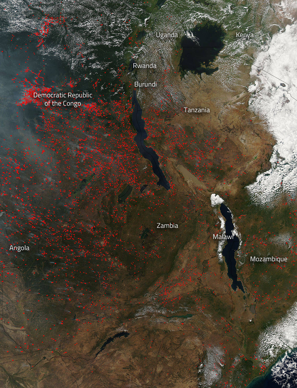
The Moderate Resolution Imaging Spectroradiometer (MODIS) on NASA’s Aqua satellite detected hundreds of fires burning in southeastern Africa on July 09, 2015. Each hot spot, which appears as a red mark, is an area where the thermal detectors on the MODIS instrument recognized temperatures higher than background. When accompanied by plumes of smoke, as in this image, such hot spots are diagnostic for fire. Most of the fires burn in grass or cropland. The location, widespread nature, and number of fires suggest that these fires were deliberately set to manage land.
Places where traditional plots of open land is not available because the vegetation in the area is dense are the places where “slash and burn” agriculture is practiced most often. These regions include parts of Africa, northern South America, and Southeast Asia, where an abundance of grasslands and rainforests are found. Slash and burn is a method of agriculture primarily used by tribal communities for subsistence farming (farming to survive). Humans have practiced this method for about 12,000 years, ever since the transition known as the Neolithic Revolution, the time when humans stopped hunting and gathering and started to stay put and grow crops. Today, between 200 and 500 million people, or up to 7% of the world’s population, uses slash and burn agriculture for field clearing. It is the most cost effective method but, not necessarily, the healthiest. All smoke is hazardous to your health. Smoke contains carbon monoxide, carbon dioxide and particulate matter than can be ingested into the lungs.
NASA image courtesy Jeff Schmaltz LANCE/EOSDIS MODIS Rapid Response Team, GSFC. Caption by Lynn Jenner/NASA