


According to a NASA story from 2009, “human activities in this area of the world have contributed to the growing fire emissions issue. Palm oil is increasingly grown for use as a cooking oil and biofuel, while also replacing trans fats in processed foods. It has become the most widely produced edible oil in the world, and production has swelled in recent years to surpass that of soybean oil. The environmental effects of such growth have been significant. Land has to be cleared to grow the crop, and the preferred method is fire. The clearing often occurs in drained peatlands that are otherwise swampy forests where the remains of past plant life have been submerged for centuries in as much as 60 feet of water. Peat material in Borneo, for example, stores the equivalent of about nine years worth of global fossil fuel emissions. Indonesia has become the third largest greenhouse gas emitter after the United States and China, due primarily to these fire emissions. With an extended dry season, the peat surface dries out, catches fire, and the lack of rainfall can keep the fires going for months.”
Also it should be noted that 2015 has been quite a severe El Nino year and that would contribute to an even greater period of drought in this area of the world and in turn, would contribute to a greater outbreak in wildfires.
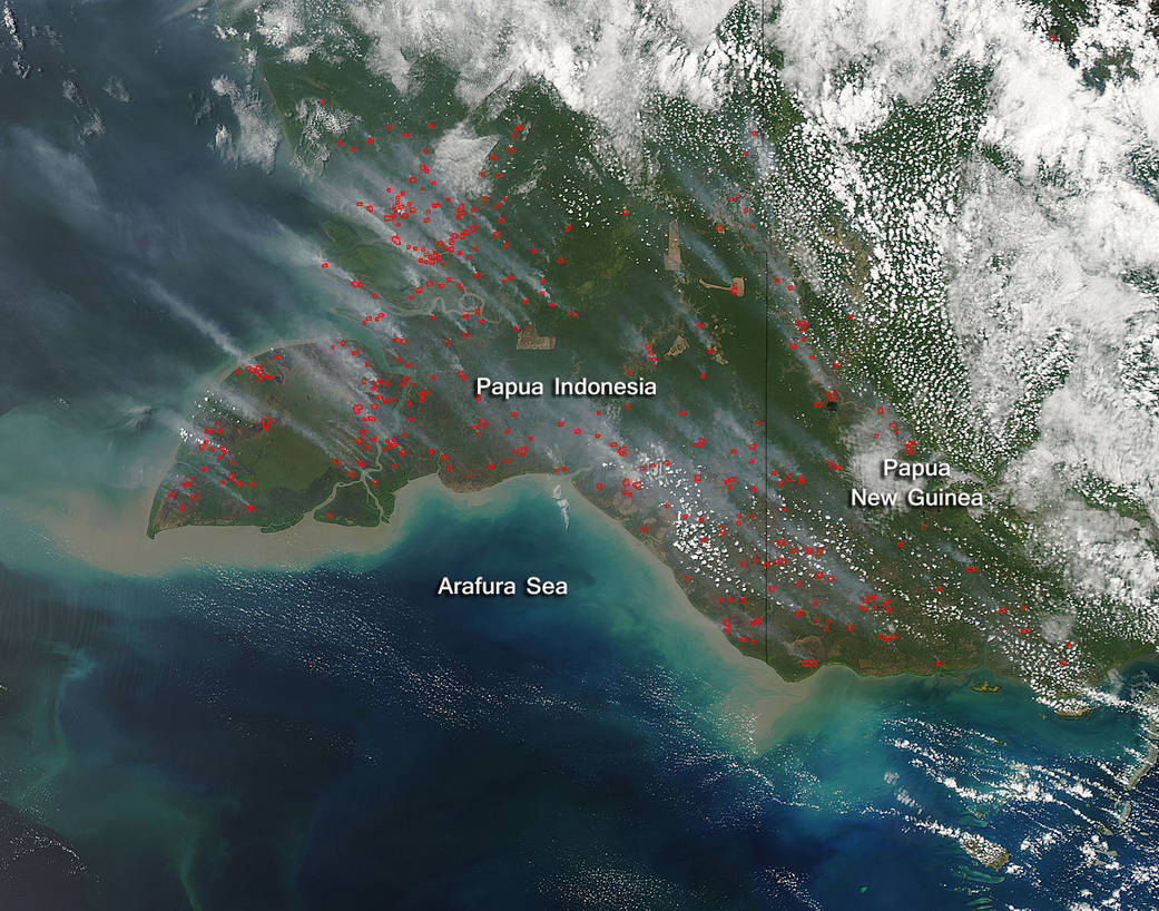
This natural-color satellite image was collected by the Moderate Resolution Imaging Spectroradiometer (MODIS) aboard the Aqua satellite on September 24, 2015. Actively burning areas, detected by MODIS’s thermal bands, are outlined in red and there is significant smoke rising from these areas and blowing northwest. NASA image courtesy Jeff Schmaltz, MODIS Rapid Response Team. Caption: NASA/Goddard, Lynn Jenner