
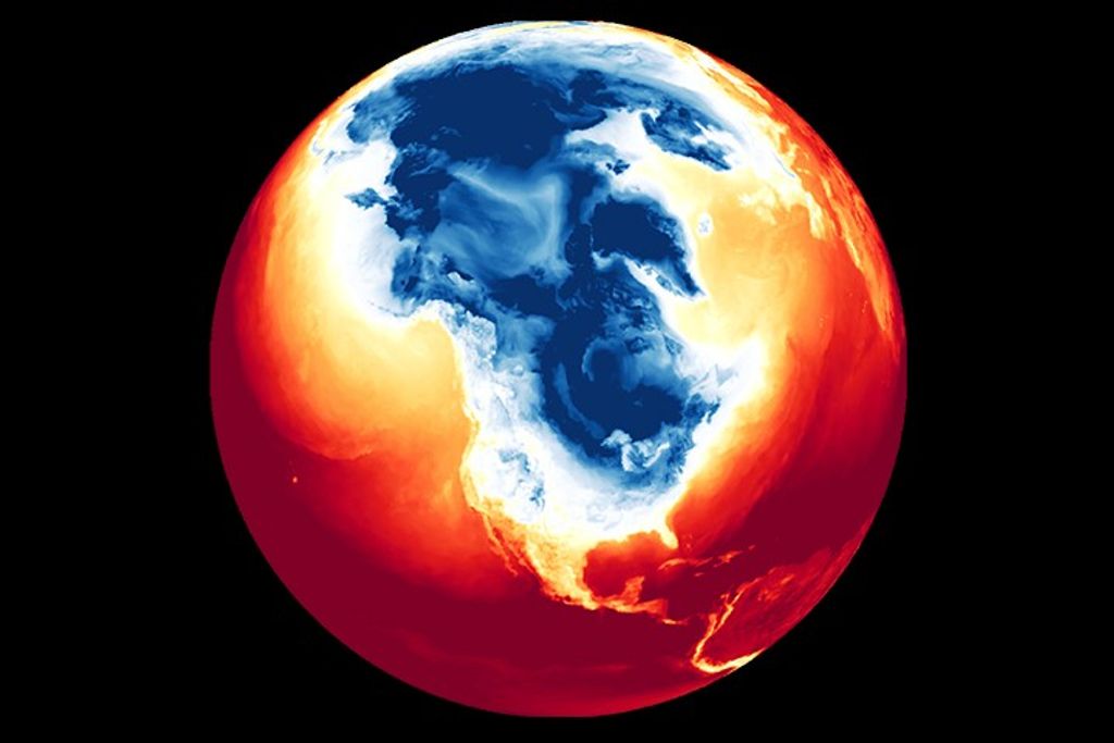


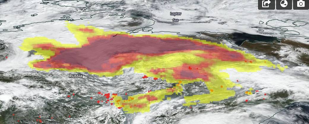
NASA/NOAA’s Suomi NPP imaged the fires and smoke across Russia’s Siberian province on Aug. 31, 2020 and found massive aerosols coming off the fires and heading high into the atmosphere. The OMPS (Ozone Mapping and Profiler Suite) Aerosol Indexer on Suomi NPP is an instrument that indicates the presence of ultraviolet-absorbing particles in the air coming from dust (desert) or soot (fires). The Aerosol Index used to measure the concentration is unitless, that is, the lowest and highest range do not scale to each other. It just indicates whether the scale is low or high. In this image of Siberia, the aerosols found were of the highest concentration (deepest red). Concentrations this high can reduce visibility and impact human health. The Aerosol index is also useful for tracking long-range transport of these aerosols that move along jet streams. Lowest concentrations come up as clear and low to mid-range concentrations are light yellow to medium yellow.
From the Worldview website: “Aerosols absorb and scatter incoming sunlight, which reduces visibility and increases the optical depth. Aerosols have an effect on human health, weather and the climate. Sources of aerosols include pollution from factories, smoke from fires, dust from dust storms, sea salts, and volcanic ash and smog. Aerosols compromise human health when inhaled by people with asthma or other respiratory illnesses. Aerosols also have an affect on the weather and climate by cooling or warming the Earth, helping or preventing clouds from forming.”
NASA’s Earth Observing System Data and Information System (EOSDIS) Worldview application provides the capability to interactively browse over 700 global, full-resolution satellite imagery layers and then download the underlying data. Many of the available imagery layers are updated within three hours of observation, essentially showing the entire Earth as it looks “right now.” Actively burning fires, detected by thermal bands, are shown as red points. Image Courtesy: NASA Worldview, Earth Observing System Data and Information System (EOSDIS). Caption: Lynn Jenner with information from Worldview.