


.png?w=1024)


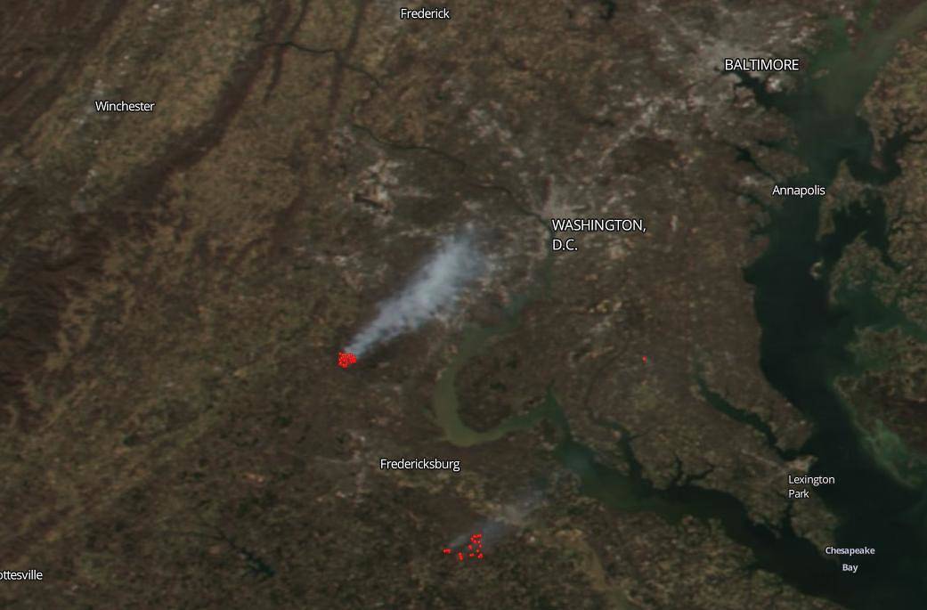
Smoke billows from a fire near the border of Prince William, Fauquier, and Stafford Counties in Virginia in this NOAA/NASA Suomi NPP satellite Worldview image from March 08, 2020. The Quantico Fire and Emergency Services in Virginia uses prescribed burns “for maintaining healthy forest lands as well as creating a fire safe forestry environment” (statement from their Facebook feed) and conducted a controlled burn of approximately 2,000 acres near Quantico on March 8, 2020. A steady breeze from the south and southwest carried the smoke plume directly over Fairfax County in Virginia, Montgomery County in Maryland and the District of Columbia. The odorous plume, which briefly reduced visibility on an otherwise clear day, could be seen on weather radar (seen in this Twitter feed) and satellite imagery as seen above.
NASA’s satellite instruments are often the first to detect wildfires burning in remote regions, and the locations of new fires are sent directly to land managers worldwide within hours of the satellite overpass. Together, NASA instruments detect actively burning fires, track the transport of smoke from fires, provide information for fire management, and map the extent of changes to ecosystems, based on the extent and severity of burn scars. NASA has a fleet of Earth-observing instruments, many of which contribute to our understanding of fire in the Earth system. Satellites in orbit around the poles provide observations of the entire planet several times per day, whereas satellites in a geostationary orbit provide coarse-resolution imagery of fires, smoke and clouds every five to 15 minutes.
NASA’s Earth Observing System Data and Information System (EOSDIS) Worldview application provides the capability to interactively browse over 700 global, full-resolution satellite imagery layers and then download the underlying data. Many of the available imagery layers are updated within three hours of observation, essentially showing the entire Earth as it looks “right now.” Actively burning fires, detected by thermal bands, are shown as red points. Image Courtesy: NASA Worldview, Earth Observing System Data and Information System (EOSDIS). Caption: Lynn Jenner with information from the Quantico Fire and Emergency Services and the National Weather Service twitter feed.