


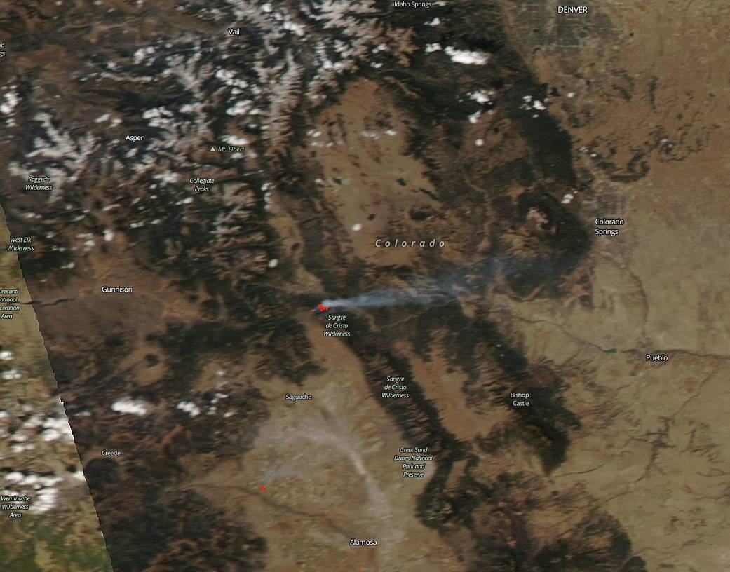
The long-lasting Decker fire which began on Sep. 08, 2019, is still continuing to burn on Oct. 16, 2019, in the Sangre de Cristo Wilderness of Colorado. The fire started as a lightning strike and has now spread to 8,464 acres and is 30% contained at present. The difficulties in fighting this fire according to Inciweb are: “Low humidity and poor overnight recoveries allowed fuels to continue to dry. Fire spread is primarily driven by wind and spotting is occurring with wind and slope alignment.” Weather is definitely one of the main reasons this fire continues to burn. Winds today are expected to gust to 20 mph which only further pushes fire constraints beyond containment lines. Winds and low relative humidity are both culprits in keeping this fire alive.
NASA’s satellite instruments are often the first to detect wildfires burning in remote regions, and the locations of new fires are sent directly to land managers worldwide within hours of the satellite overpass. Together, NASA instruments detect actively burning fires, track the transport of smoke from fires, provide information for fire management, and map the extent of changes to ecosystems, based on the extent and severity of burn scars. NASA has a fleet of Earth-observing instruments, many of which contribute to our understanding of fire in the Earth system. Satellites in orbit around the poles provide observations of the entire planet several times per day, whereas satellites in a geostationary orbit provide coarse-resolution imagery of fires, smoke and clouds every five to 15 minutes. For more information: https://www.nasa.gov/mission_pages/fires/main/missions/index.html
NASA’s Earth Observing System Data and Information System (EOSDIS) Worldview application provides the capability to interactively browse over 700 global, full-resolution satellite imagery layers and then download the underlying data. Many of the available imagery layers are updated within three hours of observation, essentially showing the entire Earth as it looks “right now.” This Terra satellite image was collected on October 14, 2019. Actively burning fires, detected by thermal bands, are shown as red points. Image Courtesy: NASA Worldview, Earth Observing System Data and Information System (EOSDIS). Caption: Lynn Jenner with information from Inciweb.