


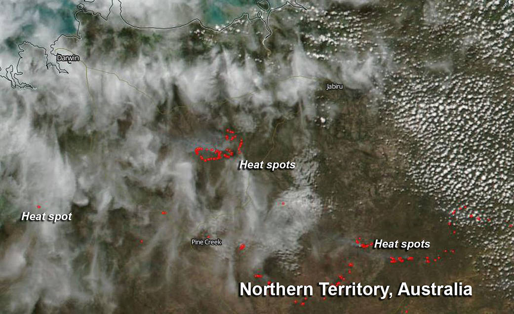
The government of Australia’s Northern Territory posted an incident map on May 7 that identified several fires burning far to the southeast of Darwin and one fire far to the south of the city. NASA-NOAA’s Suomi NPP satellite detected hot spots associated with those fires as it flew overhead early on May 7, 2019.
The Visible Infrared Imaging Radiometer Suite or VIIRS instrument aboard NOAA-NASA’s Suomi NPP satellite captured this image of the fires in the Northern Territory on May 7, 2019. Actively burning fires, detected by thermal bands, are shown as red points or heat/hot spots.
The Northern Territory Government incident map noted that the Douglas-Daly fire is an active grass and scrub fire located south of Burrundle on Route 1. Further to the southeast of the Douglas-Daly fire is the Railway TCE, Pine Creek grass and scrub fire. Just south of that fire, located between Pine Creek to the north and Nitmiluk to the south on Highway 1, is the Stuart Highway, Edith grass and scrub fire.
West of that collection of fires, and almost due south of Darwin is the Litchfield Park grass and scrub fire near route 30. Litchfield Park is a town within Litchfield National Park. The national park covers approximately 1500 square kilometers (579 square miles) and is near the township of Batchelor. The park is located 100 km (62 miles) southwest of Darwin.
NASA’s Earth Observing System Data and Information System (EOSDIS) Worldview application provides the capability to interactively browse over 700 global, full-resolution satellite imagery layers and then download the underlying data. Many of the available imagery layers are updated within three hours of observation, essentially showing the entire Earth as it looks “right now.”
Image Courtesy: NASA Worldview, Earth Observing System Data and Information System (EOSDIS)/NOAA. Caption: Rob Gutro with information from the NT Fire Incident website