


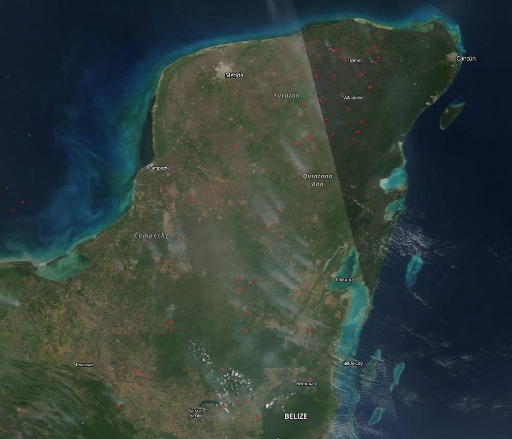
Procivy, the Civil Protection in Yucatan, is in full swing fighting fires during the fire season which runs from March 1 to May 1 when this state is at it’s hottest and driest. It is during this time that most fires in the area deliberately set for burning rubbish (a habit that is discouraged, but continues all year long) or farmers clearing fields to renew the soil grow out of control. Winds, hot conditions, and the general arid atmosphere often cause these fires to spread quickly. The fire season is then followed by a rainy season which starts in June and runs through October, overlapping with hurricane season. Most of the reports are happening in the center and west of the state, an area that is drier.
NASA’s Earth Observing System Data and Information System (EOSDIS) Worldview application provides the capability to interactively browse over 700 global, full-resolution satellite imagery layers and then download the underlying data. Many of the available imagery layers are updated within three hours of observation, essentially showing the entire Earth as it looks “right now.” This satellite image was collected by NASA-NOAA’s Suomi NPP satellite on April 11, 2019. Actively burning fires, detected by thermal bands, are shown as red points. Image Courtesy: NASA Worldview, Earth Observing System Data and Information System (EOSDIS). Caption: Lynn Jenner