


![Request for Information – Potential [Placeholder for Prize]](https://assets.science.nasa.gov/dynamicimage/assets/science/psd/solar/2023/09/s/solarsystem_0.jpg?w=1024)


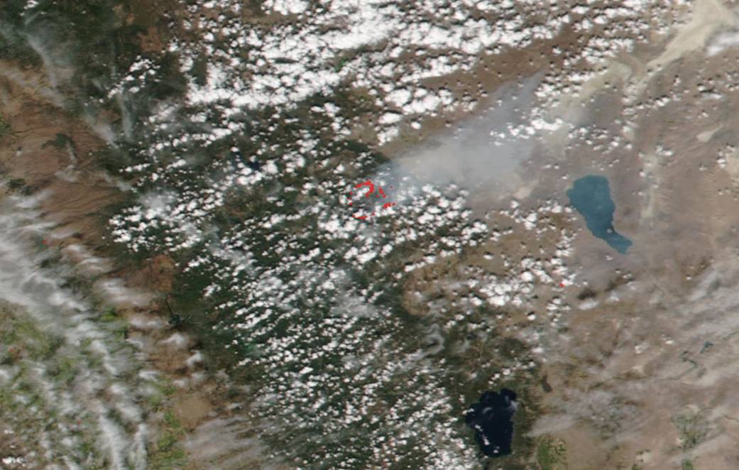
California’s Walker Fire, located within the Plumas National Forest about 11 miles east of the community of Taylorsville, California, has been burning since Sep. 04, 2019. It is currently 47,340 acres (19,157 ha) and 12% contained. The cause of the blaze is under investigation. NASA/NOAA’s Suomi NPP satellite captured this natural color image of the fire on Sep. 09, 2019 using the VIIRS instrument (Visible Infrared Imaging Radiometer Suite) onboard. Plumes of smoke rising from the “hot spots” can be seen in this image blowing eastward into Nevada and crossing Pyramid Lake. Critical fire weather continues in the area with erratic winds. There is a chance for showers and thunderstorms which will bring cooler temperatures and higher humidity levels today (Sep. 10) but dry and warmer conditions will return later in the week. Evacuations have been ordered in the area of the fire.
NASA’s Earth Observing System Data and Information System (EOSDIS) Worldview application provides the capability to interactively browse over 700 global, full-resolution satellite imagery layers and then download the underlying data. Many of the available imagery layers are updated within three hours of observation, essentially showing the entire Earth as it looks “right now.” This satellite image was collected by NASA/NOAA’s Suomi NPP satellite on Sep. 09, 2019. Actively burning fires, detected by thermal bands, are shown as red points. Image Courtesy: NASA Worldview, Earth Observing System Data and Information System (EOSDIS). Caption: Lynn Jenner with information from Inciweb.