


![Request for Information – Potential [Placeholder for Prize]](https://assets.science.nasa.gov/dynamicimage/assets/science/psd/solar/2023/09/s/solarsystem_0.jpg?w=1024)


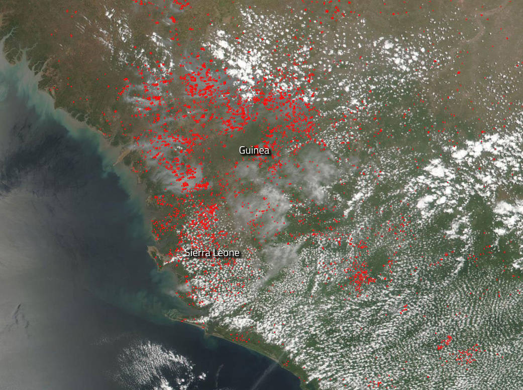
Fires dot the landscape of the countries of Guinea and Sierra Leone on the continent of Africa in this natural-color image collected by NASA/NOAA’s Suomi NPP satellite using the VIIRS (Visible Infrared Imaging Radiometer Suite) instrument on April 18, 2019. The location, widespread nature, and number of fires suggest that these fires were deliberately set to manage land. Farmers often use fire to return nutrients to the soil and to clear the ground of unwanted plants. While fire helps enhance crops and grasses for pasture, the fires also produce smoke that degrades air quality. Smoke is clearly visible in this image across much of the landscape. Actively burning areas, detected by MODIS’s thermal bands, are outlined in red.
NASA’s Earth Observing System Data and Information System (EOSDIS) Worldview application provides the capability to interactively browse over 700 global, full-resolution satellite imagery layers and then download the underlying data. Many of the available imagery layers are updated within three hours of observation, essentially showing the entire Earth as it looks “right now.” Suomi NPP is managed by NASA and NOAA. Image Courtesy: NASA Worldview, Earth Observing System Data and Information System (EOSDIS). Caption: Lynn Jenner