


![Request for Information – Potential [Placeholder for Prize]](https://assets.science.nasa.gov/dynamicimage/assets/science/missions/a-step/FFR_Earth_Background_20251120%20.png?w=1024)


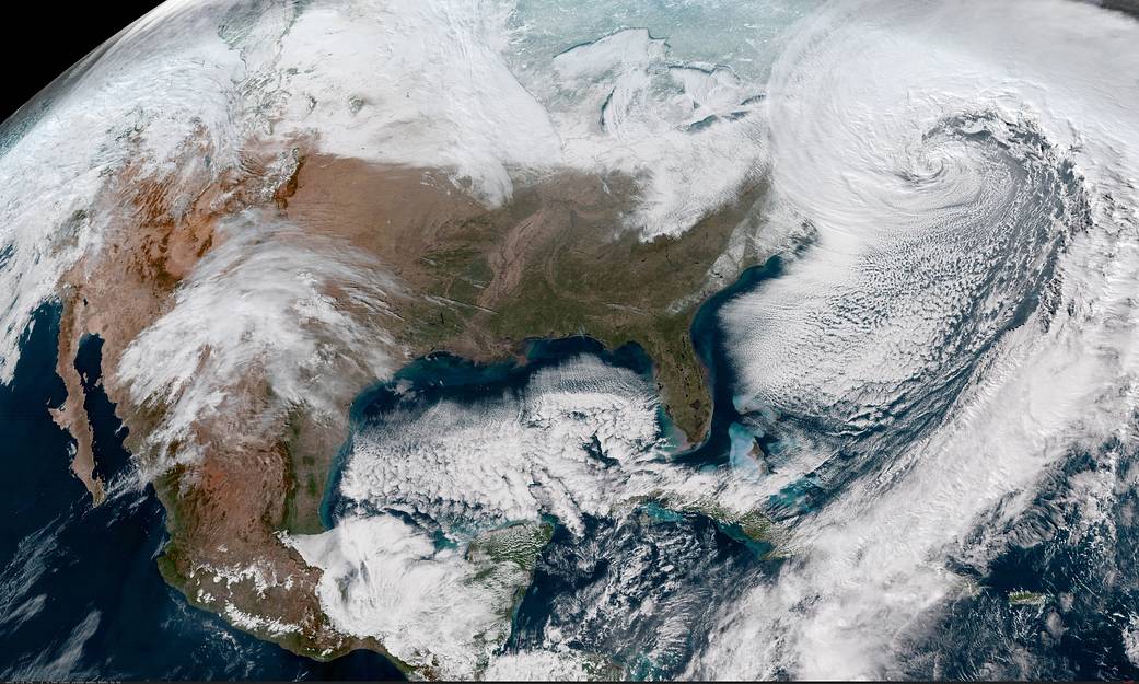
A satellite view of eastern U.S. showed the powerful winter nor’easter was moving toward New England on Jan. 4, 2018.
NOAA’s GOES-East satellite provides infrared and visible data of the eastern half of the U.S. In a visible image taken Jan. 4, 2018 at 1842 UTC (1:42 p.m. EST) from NOAA’s GOES-16 satellite, known as GOES East showed the center of the low pressure area off the coast of the northeastern U.S. and a thick band of clouds bringing snow and gusty winds from the Mid-Atlantic states to New England.
The National Weather Service (NWS) Weather Prediction Center noted “a strengthening Nor’easter will bring snow and gusty winds, with blizzard conditions along the coast and blowing snow elsewhere, along the Middle Atlantic and Northeast through Thursday. Minor to major coastal flooding and erosion will be possible, especially during high tides. Dangerous travel, scattered power outages, and bitter wind chill can be expected across the entire east coast.”
The GOES series of satellites is operated by the National Oceanic and Atmospheric Administration.
For updated forecasts, visit the NWS website: www.weather.gov
By Rob Gutro
NASA’s Goddard Space Flight Center