


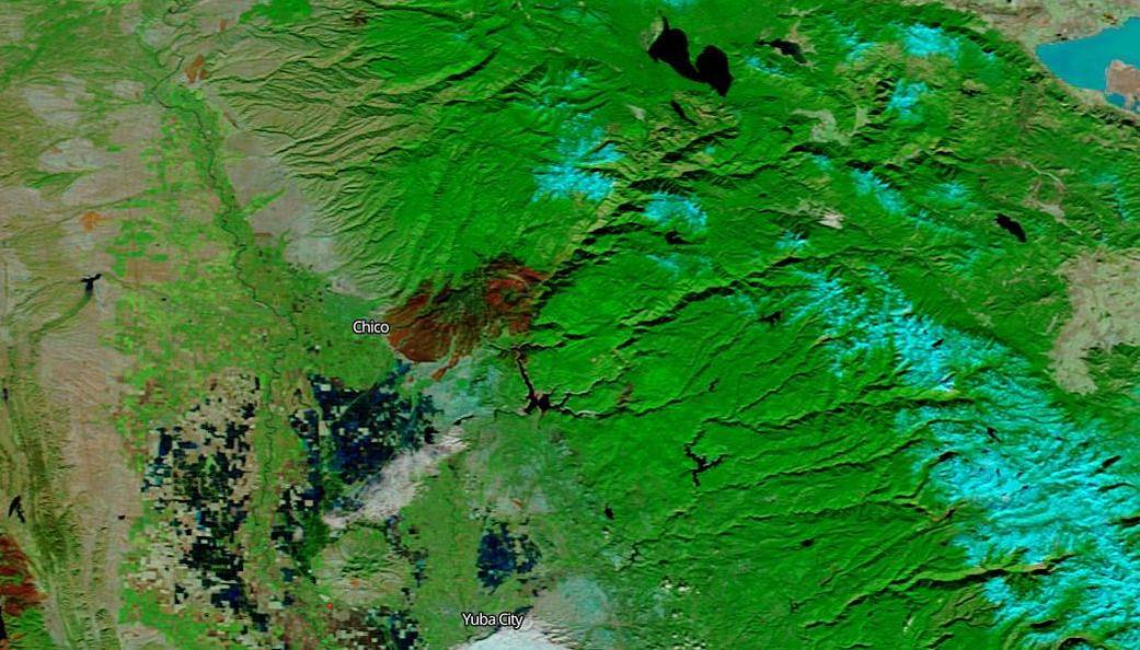
Just like the Woolsey Fire’s scar which was highlighted on the NASA Fire page on November 16, the Camp Fire scar is visible from space in this image taken by the Terra satellite on November 26, 2018. California experienced large amounts of rain during a winter storm that began on November 21, 2018. This helped to dampen the 153,336 acre fire and allowed firefighters to contain the area burning completely (100% containment at present.) This does not mean the fire is out. It means that firefighters have been able to contain the fire within a border which should allow the fire to burn out without spreading. But the damage to the interior of that containment line has already been done. The reddish-brown area on this satellite image shows the devastation from the Camp Fire. Estimates have the size of the fire to be equivalent to the size of the city of Chicago. So, too CA Fire has released an image that shows the individual structures in the area that have been damaged and/or destroyed. The CA Fire image (which can be accessed and zoomed in and out here) is below:

The red structures shown on the map are those destroyed completely; the black structures are those untouched; the other colors from green to yellow to orange refer to structures that have been damaged from 10% to 50%. There have been 13,972 residences, 528 commercial and 4,293 other buildings that have been destroyed.
The main false-color image of the area ravaged by the Camp Fire was taken by the Terra satellite using the corrected reflectance bands on the MODIS instrument to highlight the scarred areas on November 26, 2018. NASA’s Earth Observing System Data and Information System (EOSDIS) Worldview application provides the capability to interactively browse over 700 global, full-resolution satellite imagery layers and then download the underlying data. Many of the available imagery layers are updated within three hours of observation, essentially showing the entire Earth as it looks “right now.” Image Courtesy: NASA Worldview, Earth Observing System Data and Information System (EOSDIS). Caption: Lynn Jenner with information from CAFire