


Skies above California are far from sunny these days as the smoke from California fires, especially the Camp Fire, shrouds the state. The Camp Fire which began eight days ago is still an inferno having burned 140,000 acres (218 sq. miles) and is only 40 percent contained. With 56 deaths and 8,650 structures destroyed the Camp Fire stands alone as the deadliest and most destructive fire in California’s history. There are still hundreds of residents still unaccounted for.
California’s years of drought has created a tinderbox within the state. A “severe” drought began in 2012 only to grow to an “exceptional drought” by 2018. This is the third wave of multiple years of drought in the state starting in 2000 but recent years (2012 – 2018) have been the worst. Exceedingly dry conditions and the Santa Ana winds make for an incredibly unstable landscape where a single spark can grow to an inferno in seconds. With the Camp Fire, the ignition of the fire (still under investigation) was fueled by intense north winds, a dry air mass and critically dry fuels. From the Pulga area the fire quickly moved into the Feather River Canyon and into nearby communities including Paradise, Magalia and Concow, decimating them. Weather continues to be an issue for firefighters. The continued low relative humidity and dry fuel moistures combined with steep, rugged terrain will continue to challenge control operations.
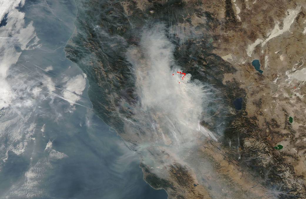
This natural-color satellite image was taken by the MODIS instrument on the Terra satellite on November 14, 2018. NASA’s Earth Observing System Data and Information System (EOSDIS) Worldview application provides the capability to interactively browse over 700 global, full-resolution satellite imagery layers and then download the underlying data. Many of the available imagery layers are updated within three hours of observation, essentially showing the entire Earth as it looks “right now.” Actively burning fires, detected by thermal bands, are shown as red points. Image Courtesy: NASA Worldview, Earth Observing System Data and Information System (EOSDIS). Caption: Lynn Jenner with information from Inciweb and the U.S. Drought Monitor.