


The lightning-caused fire located on the Georgia/Florida border was reported on April 6, 2017, approximately 2.5 miles northeast of the Eddy Fire Tower in the Okefenokee National Wildlife Refuge. Currently the fire, which is 7 miles east of Fargo, Georgia, has grown to 59,318 acres and is only 8% contained at present.
The Georgia Forestry Commission Type 2 Incident Management Team is managing the fire with U.S. Fish and Wildlife Service, Florida Forest Service, and U.S. Forest Service.
Inciweb has projected the following activity for the West Mims Fire:
“12 hours: Expect fire behavior to decrease about dark, with little growth thereafter.
24 hours: Winds shift and once again fire will change its direction of growth. South and southwest winds will begin pushing the fire to the north again. Moderate growth is projected. On the north end fire is expected to establish itself well onto Billy’s Island. On the southeast the two fire heads on the north side of Mitchell Island and Soldiers Island will progress to the north/northeast approximately a mile.
48 hours: Winds continue to push the fire to the north. Fire could be as far north as Jones Island by end of shift and on the southeast corner fire could be pushing onto Chesser Island.
72 hours: Friday is extremely hot and dry with a north wind. Weather conditions would allow for substantial fire growth, but the fire will most likely be pushed into much wetter fuels by this time and moderate fire behavior significantly.
Anticipated after 72 hours: Weather pattern starts changing over the weekend and could be setting up for another large fire growth pattern on Monday.”
Long term prognosis is not available as fire patterns shift and change with weather patterns.
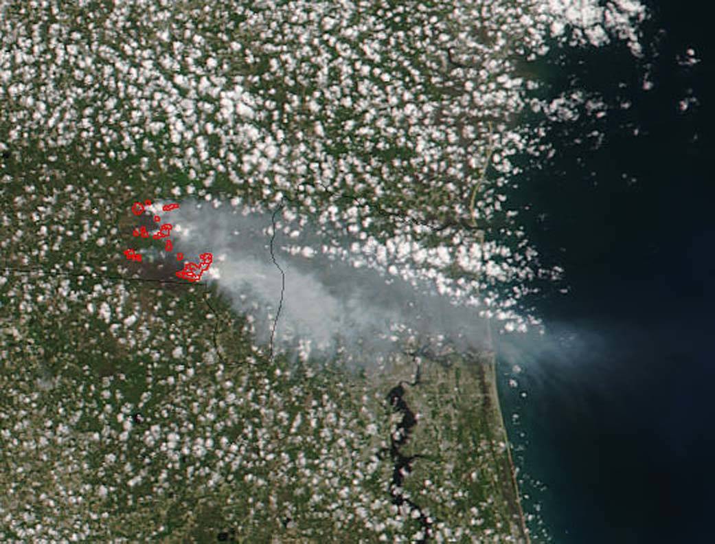
The Suomi NPP satellite’s Visible Infrared Imaging Radiometer Suite (VIIRS) instrument captured this image of the West Mims Fire on April 25, 2017. Actively burning areas, detected by VIIRS are outlined in red. Suomi is a joint mission between NASA, NOAA and the U.S. Department of Defense.
NASA image courtesy Jeff Schmaltz, MODIS Rapid Response Team. Caption: NASA/Goddard, Lynn Jenner with information from Inciweb