


Plumes of smoke were spotted by NASA’s Terra satellite as they streamed from the West Mims Fire near the Florida and Georgia border.
Inciweb, an interagency all-risk incident information management system that coordinates with federal, state and local agencies to manage wildfires reported that the West Mims Fire is located 2.5 miles north-northeast of Eddy Tower. It is burning in the northern area of Florida’s John M. Bethea State Forest and the southern part of Georgia’s Okefenokee National Wildlife Refuge.
The wildfire began from a lightning strike on April 6 and was reported at 5:00 p.m. EST.
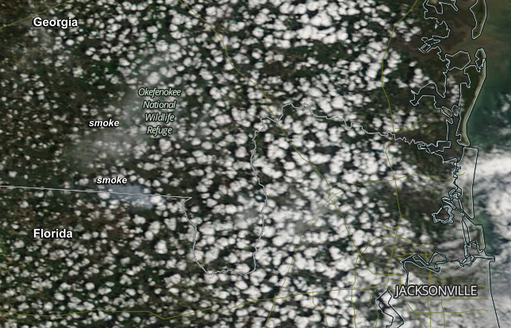
This natural-color satellite image was collected by the Moderate Resolution Imaging Spectroradiometer (MODIS) aboard the Terra satellite on April 11 at 1:30 p.m. ET. Actively burning areas, detected by MODIS’s thermal bands, are outlined in red. At the time of the image there were areas of light brown smoke near the Florida/Georgia border and over the Okefenokee National Wildlife Refuge.
On April 11 at 3:34 p.m. EST, Inciweb reported that the West Mims Fire covered 6,752 acres. The fire is being managed by the Okefenokee National Wildlife Refuge, Florida Forest Service, U.S. Forest Service, and Georgia Forestry Commission.
For more information on the West Mims Fire, visit: https://inciweb.nwcg.gov/incident/5153/
NASA image courtesy Jeff Schmaltz, MODIS Rapid Response Team. Caption: NASA/Goddard, Rob Gutro with information from Inciweb.