


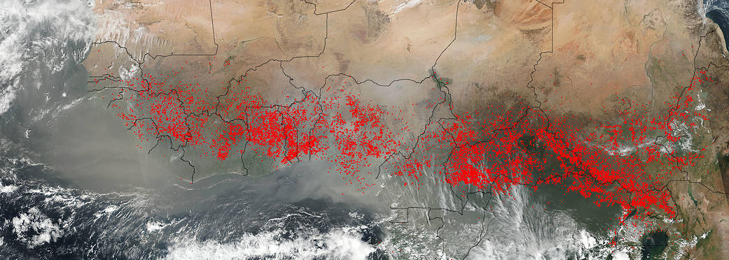
The VIIRS instrument (Visible Infrared Imaging Radiometer Suite) on NASA’s Suomi NPP satellite collected this natural-color image which detected hundreds upon hundreds of fires burning in Central Africa on December 27, 2017. Most likely these fires are agricultural in nature as farmers often use fire to return nutrients to the soil and to clear the ground of unwanted plants. While fire helps enhance crops and grasses for pasture, the fires also produce smoke that degrades air quality. Each hot spot, which appears as a red mark, is an area where the thermal detectors on the VIIRS instrument recognized temperatures higher than background. When accompanied by plumes of smoke, as in this image, such hot spots are diagnostic for fire. The fires are so copious that the smoke from them radiates across the whole continent and streams south and southeast in this image.
A study of biomass burning and the impacts of fire on vegetation in Central Africa was conducted in 2002 by Gabriela Bucini and Eric F. Lambin. The study can be viewed on ScienceDirect. What the study found and what is present in the image is that fire activity in Central Africa starts with the onset of the dry season in November and finishes with the onset of the rains in late February or early March. Fires move south during the dry season. Towards the equator, most of the fires occur from December to January, with a peak in late December as certainly evidenced here in the image provided by Suomi NPP.
NASA image courtesy Jeff Schmaltz LANCE/EOSDIS MODIS Rapid Response Team, GSFC. Caption by Lynn Jenner
Suomi NPP is managed by NASA and NOAA.