


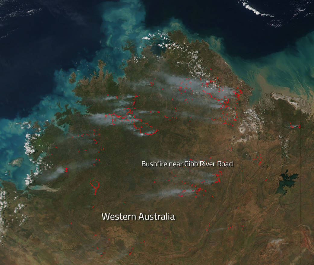
NASA’s Suomi NPP satellite collected this natural-color image using the VIIRS (Visible Infrared Imaging Radiometer Suite) instrument on April 13, 2016. Each hot spot, which appears as a red mark, is an area where the thermal detectors on the MODIS instrument recognized temperatures higher than background. When accompanied by plumes of smoke, as in this image, such hot spots are diagnostic for fire. The hotspots are most likely bushfires which plague this area of Western Australia. The Department of Fire and Emergency Services of Australia has issued a warning for the area noted on the image.
A bushfire advisement remains for people travelling on Gibb River Road between Home Valley and Ellenbrae Stations in Durack in the Shire of Wyndham-East Kimberley. There is no threat to lives or homes but there is a lot of smoke in the area. The smoke released by any type of fire (forest, brush, crop, structure, tires, waste or wood burning) is a mixture of particles and chemicals produced by incomplete burning of carbon-containing materials. All smoke contains carbon monoxide, carbon dioxide and particulate matter (PM or soot) and should be avoided. There are two fires in the area, one started on Ellenbrae Station and the other on Home Valley Station. Both are burning along Gibb River Road and are moving slowly. Both fires are out of control and unpredictable.
NASA image courtesy Jeff Schmaltz LANCE/EOSDIS MODIS Rapid Response Team, GSFC. Caption by Lynn Jenner with information from the Department of Fire and Emergency Services of Australia.