


This false-color image created from data obtained by NASA's Uninhabited Aerial Vehicle Synthetic Aperture Radar (UAVSAR) over the Napo River in Ecuador and Peru on March 17, 2013.
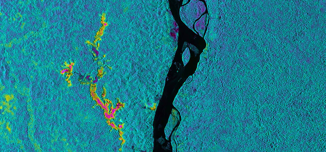
This false-color image created from data obtained by NASA’s Uninhabited Aerial Vehicle Synthetic Aperture Radar (UAVSAR) over the Napo River in Ecuador and Peru on March 17, 2013, indicated the likelihood of flooding beneath the forest canopy. Red and yellow shades indicated a high likelihood of standing water with emergent vegetation, blue and green shades were areas less likely to be inundated, and black indicated the open water areas of the Napo River. UAVSAR data like these are helping scientists assess the effectiveness of using synthetic aperture radar data to study the inundation dynamics of this and similar rivers around the world.March 17, 2013
NASA/JPL-Caltech