


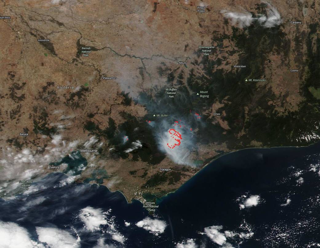
The Vic Emergency site is reporting dozens of fire incidents in the area of Licola, Dargo, and Dinner Plain in southern Victoria, Australia, and in all of the Victoria territory there are 100 incidents being tracked. Since the image of March 4, 2019, highlighting the Licola, Dargo and Dinner Plain area it appears that the bushfires in that area have grown. Australia is experiencing a particularly brutal summer season with temperatures hitting new records and creating a hotter, drier environment and a tinderbox for bushfires to start.
NASA’s Earth Observing System Data and Information System (EOSDIS) Worldview application provides the capability to interactively browse over 700 global, full-resolution satellite imagery layers and then download the underlying data. Many of the available imagery layers are updated within three hours of observation, essentially showing the entire Earth as it looks “right now.” This NOAA/NASA Suomi NPP satellite image was collected on March 07, 2019. Actively burning fires, detected by thermal bands, are shown as red points. Image Courtesy: NASA Worldview, Earth Observing System Data and Information System (EOSDIS). Caption: Lynn Jenner with information from the Vic Emergency website.