


![Request for Information – Potential [Placeholder for Prize]](https://assets.science.nasa.gov/dynamicimage/assets/science/missions/a-step/FFR_Earth_Background_20251120%20.png?w=1024)


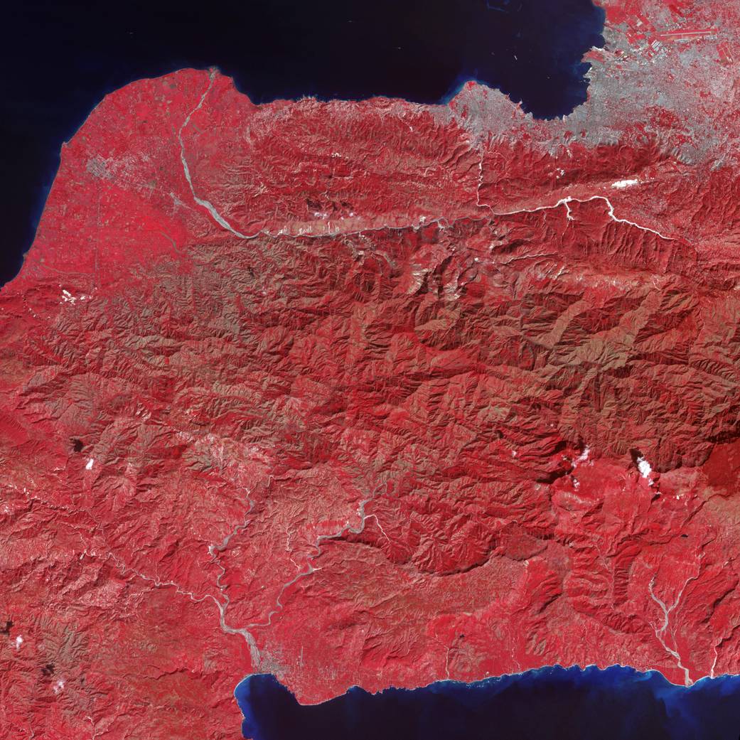
The Advanced Spaceborne Thermal Emission and Reflection Radiometer (ASTER) instrument on NASA’s Terra spacecraft captured this false-color image of Haiti on Jan. 21, 2010, nine days after a magnitude 7.0 earthquake struck the region and caused massive damage and loss of life, and one day after a large 5.9 aftershock caused additional damage.
While ASTER’s 50-foot resolution is not sufficient to see damaged buildings, it can be used to identify other results. Tiny dots of white against the plant-covered landscape (red in this image) are possible landslides, a common occurrence in mountainous terrain after large earthquakes. The possible landslides were identified by carefully comparing the new image with an image acquired one year ago.
Port-au-Prince, Haiti’s capital, is silver in the false-color image. The rivers are pale blue, while the ocean is dark blue. Exposed soil is white.Image Credit: NASA/GSFC/METI/ERSDAC/JAROS, and U.S./Japan ASTER Science Team