


InciWeb is an interagency all-risk incident information management system that coordinates with federal, state and local agencies to manage wildfires. For updates on all fires, visit the Inciweb website: http://inciweb.nwcg.gov.
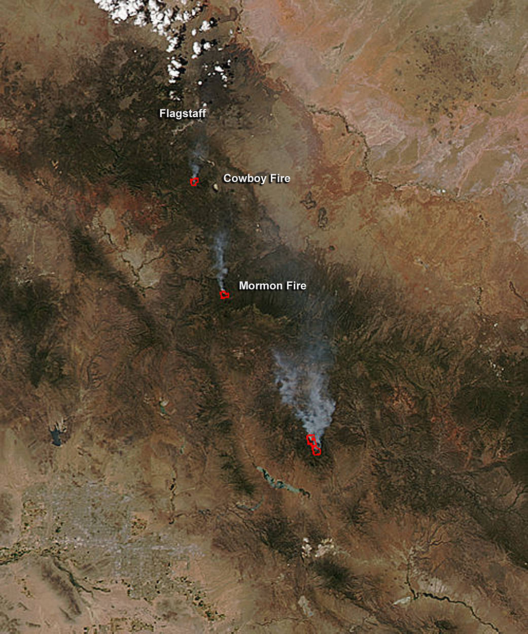
InciWeb said on June 1 that fire managers with the Coconino National Forest are utilizing two recent lightning-caused fires, the Mormon Fire and the Cowboy Fire, to benefit the landscape and maintain a healthy ecosystem by allowing fire to fulfill its natural role in the environment.
NASA’s Aqua satellite passed over the Coconino National Forest and captured a visible image of the two fires. The Mormon Fire is located south of the Cowboy Fire. The Moderate Resolution Imaging Spectroradiometer, or MODIS, instrument aboard Aqua saw the smoke and detected the heat signature (in red) of the fire on May 31 at 4:20 p.m. EDT (2020 UTC).
The Mormon fire is located approximately six miles east of Munds Park near Mormon Mountain, Arizona. Inciweb reported, “This low-intensity wildfire is being managed to achieve multiple benefits and objectives.”
The Cowboy Fire is located eight miles south of Flagstaff, immediately east of Interstate-17 near milepost 331. Motorists on I-17 can see the smoke from the Cowboy Fire.
Inciweb that these “multiple-objective fire(s) will increase in size as time goes on, and firefighters will be conducting burnout operations to facilitate where and how the fire moves through the landscape. Smoke will become more noticeable, but will still be much lighter than that of a severe wildfire. Fire managers will closely monitor smoke impacts to communities.”
For more information from InciWeb: http://inciweb.nwcg.gov.
Rob GutroNASA’s Goddard Space Flight Center, Greenbelt, Md.