


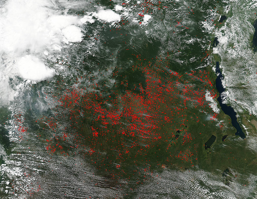
The VIIRS (Visible Infrared Imaging Radiometer Suite) instrument on the Suomi NPP satellite detected dozens of fires burning in central Africa on May 10, 2017. The fires are outlined in red. Most of the fires burn in grass or cropland, which is brownish in this image.
The location, widespread nature, and number of fires suggest that these fires were deliberately set to manage land. Farmers often use slash and burn agriculture in central Africa, northern South America, and Southeast Asia, and typically within grasslands and rainforests. In central Africa, the agricultural burning season usually runs May through August.
Slash and burn agriculture is the process of cutting down the vegetation left over from a previous growing season, setting fire to the remaining detritus, and using the ashes to provide nutrients for the soil. The cleared area following slash and burn is used for a relatively short period of time, and then left alone for a longer period of time so that vegetation can grow again. Today up to 7% of the world’s population uses slash and burn agriculture.
However, while fire helps enhance crops and grasses for pasture, the fires also produce smoke that degrades air quality. In addition to pollution produced by agricultural fires is the possibility of deforestation, erosion, nutrient loss (rather than gain), and possible extinction of species if a particular area is the only one that holds a particular species, slashing and burning could result in extinction for that species. Also the smoke (pollution) produced by the fires migrates across the world once it reaches the higher altitudes creating pollution in far reaching areas of the world.
NASA image courtesy Jeff Schmaltz LANCE/EOSDIS MODIS Rapid Response Team, GSFC. Caption by Lynn Jenner
Suomi NPP is managed by NASA and NOAA.