


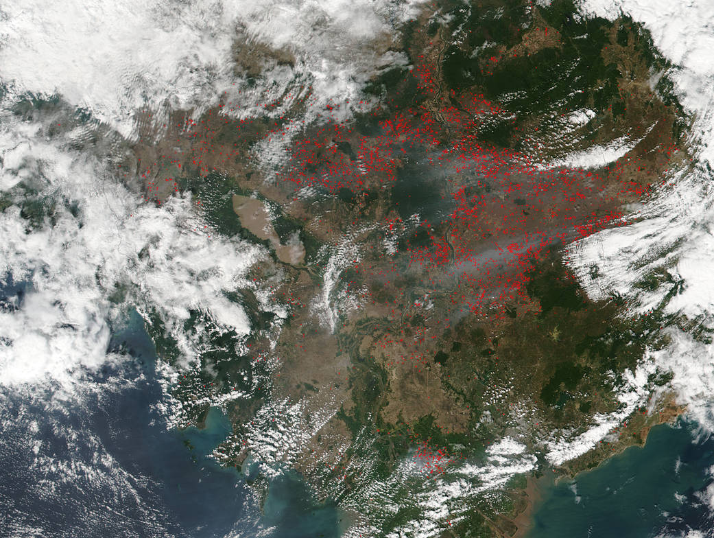
This visible-light image shows fires burning throughout Cambodia.
This visible-light image shows fires burning throughout Cambodia. Most of the fires burn in grass or cropland, which appears as a tan color in this image. The Visible Infrared Imaging Radiometer Suite (VIIRS) instrument aboard NASA-NOAA’s Suomi NPP satellite captured this visible light image on Jan. 24, 2016 at 6:15 a.m. UTC (1:15 EST). The VIIRS image showed the heat signatures from fires in red. Suomi NPP imaged the fires on Dec. 28, 2015 and they were not as widespread. For the Dec. image: https://www.nasa.gov/image-feature/goddard/satellite-detects-fires-in-cambodia.
NASA image courtesy Jeff Schmaltz. Caption: NASA/Goddard, Rob Gutro