NASA’s Science Mission Directorate seeks knowledge and answers to profound questions that impact all people. Through competitions, challenges, crowdsourcing, and citizen science activities, NASA collaborates with the public to make scientific discoveries that help us better understand our planet and the space beyond. Multiple NASA science projects were supported through public participation in Fiscal Years 2021 and 2022, spanning pursuits in astrophysics, Earth science, heliophysics,1 and more.
Astrophysics
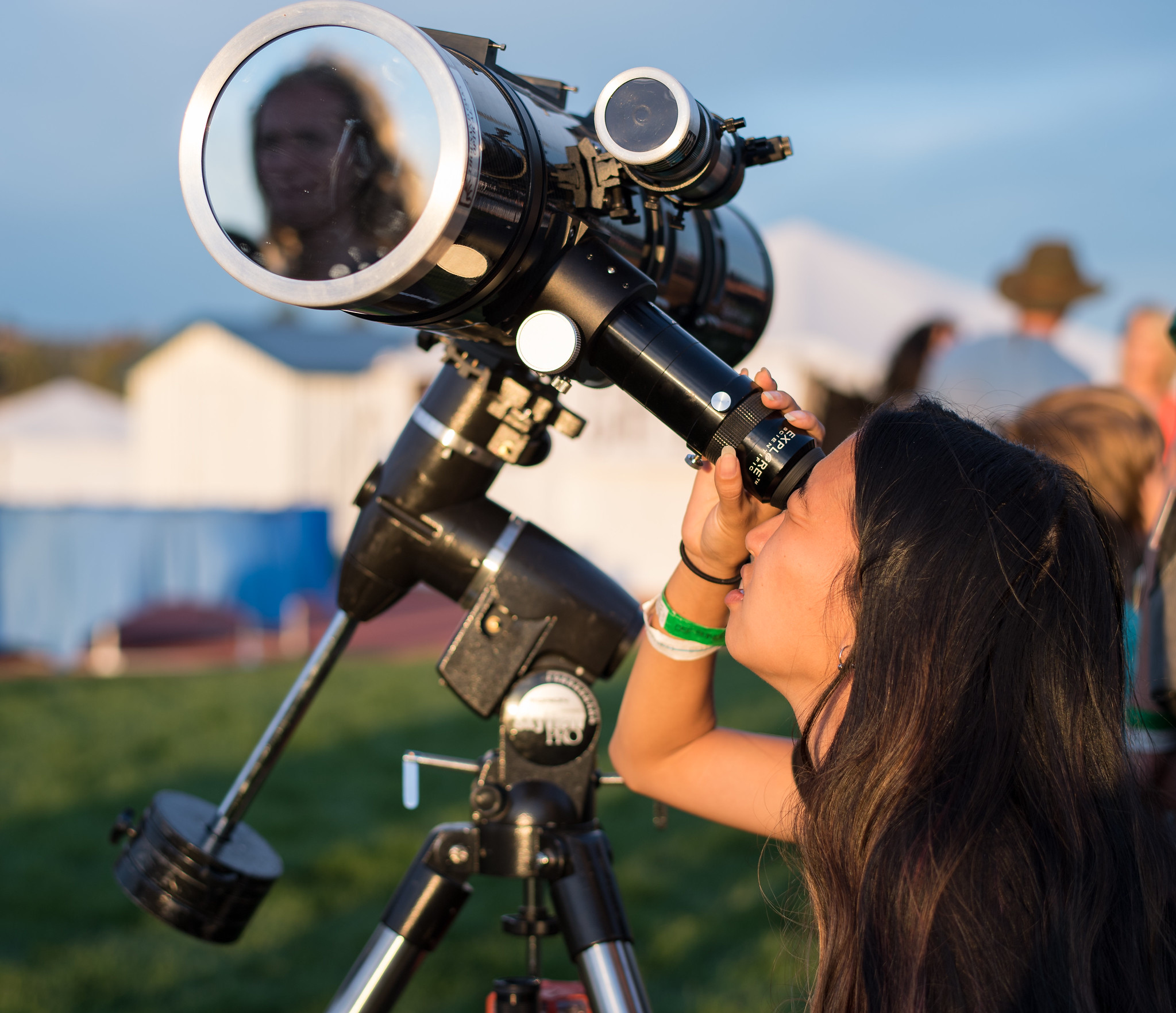
NASA challenges in astrophysics seek to uncover new information about the origin, structure, evolution, and future of the universe, as well as other worlds outside our solar system.
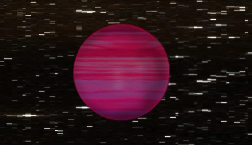
Seeking potential planets in the backyard of our solar system, NASA invited the public to examine data from the Wide-field Infrared Survey Explorer (WISE) mission to discern moving celestial bodies. Human eyes are needed for the task because anomalies in the images often fool image processing technologies. The WISE mission continues to collect data, and the Backyard Worlds: Planet 9 citizen science project is still ongoing. But the project has discovered so far more than 3500 brown dwarfs (balls of gas too small to be considered stars), and one notable citizen scientist himself found 34 ultracool brown dwarfs with companions, now published in The Astronomical Journal.
To understand stars better, a citizen science project called Disk Detective 2.0 was launched in 2020 to evaluate disks, or belts, of material around stars. The original 2014 project resulted in the discovery of the longest-lived disks that form planets—dubbed “Peter Pan” disks—as well as the discovery of the youngest nearby disk around a brown dwarf. The relaunch offered a new batch of 150,000 stars in infrared wavelengths from NASA’s WISE mission and other data. As of May 2023, more than 12,000 volunteers had contributed to the project and 14 of those co-authored scientific papers based on their findings.
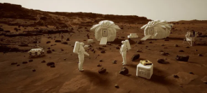
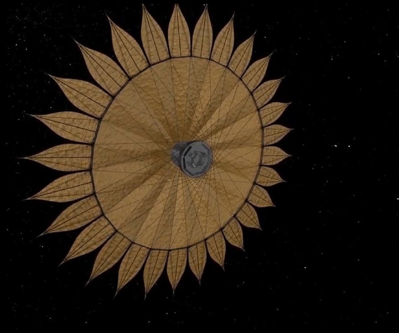
The Hybrid Observatory for Earth-like Exoplanets (HOEE) is a concept for a mission that would combine a ground-based telescope with a space-based starshade to enable better views of exoplanets from Earth. As part of early-stage study of this concept, NASA invited the public to develop 3D computer models of a lightweight starshade. Requirements for the starshade design included compact packaging, successful deployment in orbit, and a low-mass structure capable of maintaining its shape and alignment using as little spacecraft fuel as possible. The Ultralight Starshade Structural Design Challenge received 60 entries, and the top five shared a $7,000 prize. First place combined inflatable tubes for compression structures and cables for tension.
Earth Science
One goal of NASA’s Earth science pursuits is to map the connections between Earth’s vital processes and the climate effects of natural and human-caused changes. Multiple competitions are aiding our understanding of these interconnected systems.
A worldwide program called Global Learning and Observation to Benefit the Environment (GLOBE) has brought educators and students together since 1995, promoting science and learning about the environment. As one of the partner organizations for the program, NASA sponsored the NASA GLOBE Trees Challenge 2022: Trees in a Changing Climate to gather tree height observations. The data collected is compared with space-based observation systems to track tree height and growth rate as an indicator of ecosystem health. Volunteers from around the world have amassed more than 4,700 tree-height observations from over 1,500 locations in 50 countries.
A similar data-gathering effort—the Cooperative Open Online Landslide Repository (COOLR)—utilizes a web-based platform developed by NASA to share reports of landslides. The repository’s data is validating a model in development at NASA’s Goddard Space Flight Center in Greenbelt Maryland, the Landslide Hazard Assessment for Situational Awareness (LHASA), to map areas of potential landslide hazard in real-time. LHASA incorporates landslide inventories from people around the world in a machine-learning framework to estimate the relative probability of landslide occurrence.
To develop more accurate air quality data products from NASA satellite missions, a public competition called NASA Airathon: Predict Air Quality2 asked participants to develop algorithms for estimating daily levels of surface-level air pollutants on Earth. Using NASA satellite data, model outputs, and ground measurements, the public estimated daily levels of particulate matter (PM) and nitrogen dioxide (NO2) across urban areas in the U.S., India, and Taiwan—all of which have readily available satellite data. The contest generated more than 1,200 submissions from over 1,000 participants and awarded $25,000 in prizes.
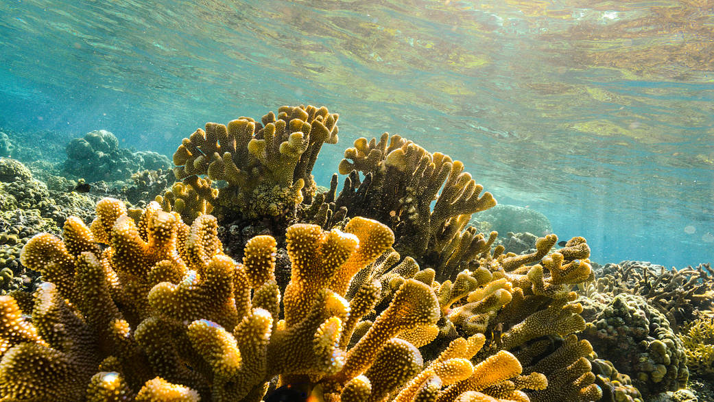
While the concept for an iPad game called NeMO-Net could be applied to the search for life across the universe, the current application is assessing the health of coral reefs. Players help NASA classify coral reefs by painting 3D and 2D images of coral captured using the NASA FluidCam instrument, the highest-resolution remote sensing benthic imaging technology capable of removing ocean wave distortion. Data from the painted images feeds into NASA NeMO-Net, the first neural multi-modal observation and training network for global coral reef assessment. With 43,000 unique downloads of the game, there have been 71,000 classifications, of which 56,400 have been reviewed and confirmed by NASA.
Planetary Science
NASA’s spacecraft, which arrived at Jupiter in 2016, continues to explore the planet and its satellites with a suite of scientific instruments and a camera called JunoCam. The camera takes visible frequency images of Jupiter’s polar regions and its moons. Via the project website, citizen scientists create images from the raw JunoCam data and post their creations on the Juno website and social media platforms. Early during the prime mission, the project engaged with the public in an online voting campaign to plan image-taking during orbital passes around Jupiter (“perijoves”), but the effort was abandoned after the transition to the 53 day–orbit mission due to unfavorable evolution of the approach geometry.
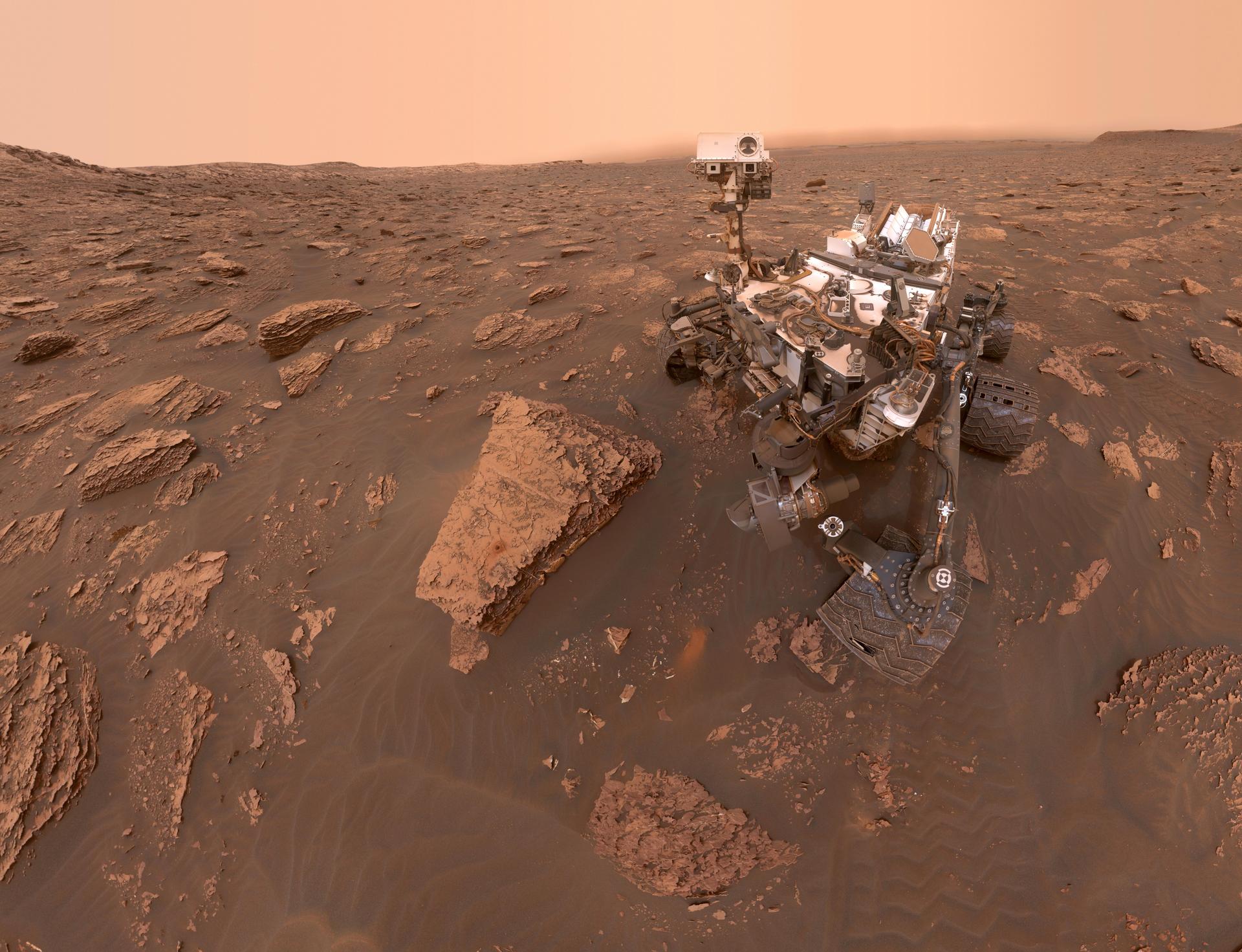
Ideally, when a space rover lands on Mars, it will know where it is safe to drive, land, sleep, and hibernate—without any guidance from a human operator. An early step in developing this capability, AI4Mars, invited the public to label images of Mars terrain taken by the Curiosity rover. The goal is to train a machine learning algorithm to improve the rover’s ability to identify and avoid hazardous terrain, which is essential for autonomous exploration. Over 16,000 volunteers completed more than 632,000 classifications, and a model developed using the data has a total accuracy of 91%.
Another ideal capability for a Mars rover is independent analysis of data to avoid the tedious process of data transmission from Mars to Earth and back. In the Mars Spectrometry: Detect Evidence for Past Habitability challenge, NASA engaged the public to build a model to automatically analyze mass spectrometry data from rock and soil samples. Out of 656 entries, a software engineer from Brisbane, Australia, won $15,000 for first place. The second-place winner from the United States received $7,500, and the third-place winner from India won $5,000.
Biological and Physical Sciences
One of the aims of biological science research at NASA is to understand how biological systems acclimate to spaceflight environments.
A unique classroom-based citizen science program called Growing Beyond Earth advances NASA’s research on growing plants in space. In its seventh year, the NASA program provides all the materials needed for the experiments. In total, more than 40,000 participating students and teachers have contributed hundreds of thousands of data points and tested 180 varieties of edible plants. As a result of their efforts, four types of vegetables were grown by NASA off-Earth, and two varieties have been successfully grown on the International Space Station.
Heliophysics
NASA studies the Sun and its effects on Earth and the solar system—or heliophysics—to increase understanding of how the universe works, how to protect technology and astronauts in space, and how stars contribute to the habitability of planets throughout the universe.
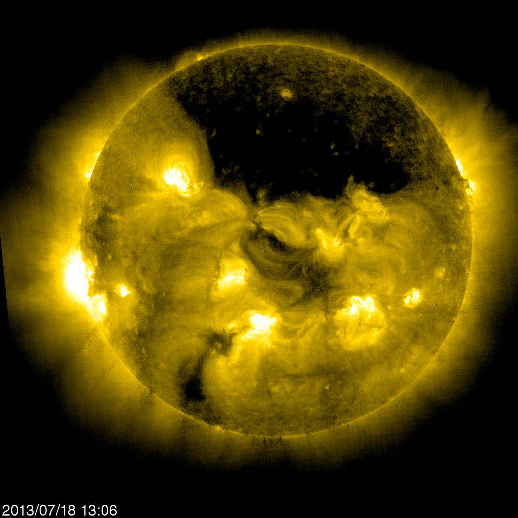
To enable better discovery and tracking of sungrazing comets—the large but faint objects made of dust and ice in close orbit of the Sun—NASA held the NASA SOHO Comet Search. Over $55,000 in prizes was awarded to solutions to reduce background noise in data recorded by the Large Angle and Spectrometric Coronagraph (LASCO), one of the instruments on the Solar and Heliospheric Observatory (SOHO) spacecraft. Hundreds of participants from around the world devised artificial intelligence and machine learning approaches, which led to the discovery of two previously unidentified comets, including a difficult-to-detect non-group comet.
The preliminary results we’re already seeing come out of this challenge highlight the value of the open science movement.

Katie Baynes
NASA's Deputy Chief Science Data Officer
Space Apps 2021
In its tenth year, NASA’s 2021 International Space Apps Challenge took place in 320 locations across 162 countries or territories. The hackathon for coders, scientists, designers, storytellers, makers, technologists, and innovators around the world offered 28 different topics to solve using open data from NASA and others. This year’s winners included an app for homeowners to simplify data from NASA’s Prediction of Worldwide Renewable Energy Resources (POWER) web services portal to help make solar panel purchasing decisions and encourage solar energy use. Another winning app detects, quantifies, follows, and projects the movement of plastic debris in the ocean with high accuracy.