


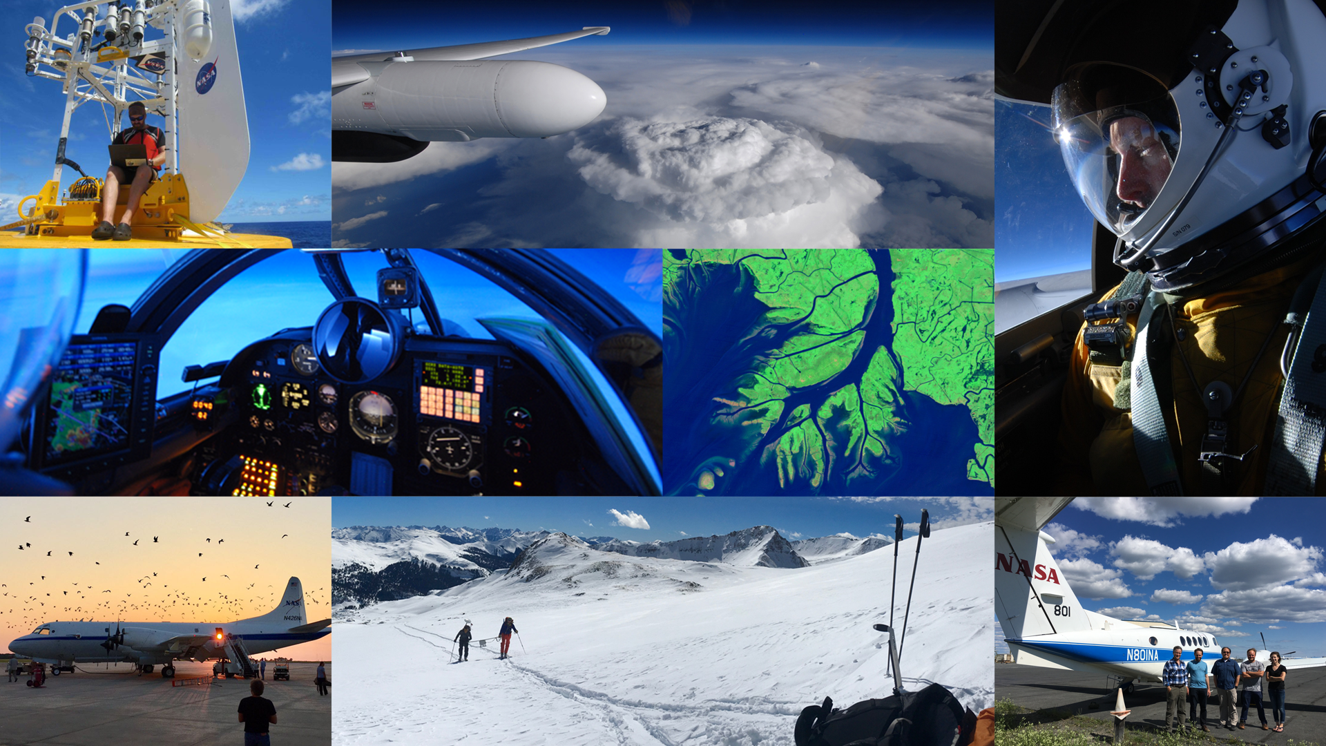
NASA is sending five airborne campaigns across the United States in 2020 to investigate fundamental processes that ultimately impact human lives and the environment, from snowstorms along the East Coast to ocean eddies off the coast of San Francisco.
Science teams will embark by land, sea and air as part of multi-year campaigns funded by NASA’s Earth Venture program. This is NASA’s third series of competitively selected Earth Venture suborbital investigations.
NASA uses the vantage point of space to increase our understanding of our home planet, improve lives and safeguard our future. To gain a more complete picture of how and why our planet is changing, the agency also sponsors intensive field campaigns targeting critical science issues that can benefit from a deeper look by taking advantage of NASA’s capabilities in airborne science.
Campaigns will conduct science on a variety of platforms. High-altitude aircraft will observe chemistry in the stratosphere, far beyond the reach of commercial planes, to study the impact of intense storms that breach the troposphere, where most weather occurs. A flotilla of autonomous gliders and floats will take to the Pacific Ocean to measure temperature and salinity at and below the water’s surface to better understand the exchange of heat between ocean and atmosphere. Researchers will descend on wetlands by foot and boat to study how sea level rise is affecting delta ecosystems.
The five new Earth Venture integrated airborne and surface field campaigns begin their first year of field work in 2020, running from January through October.
Intense Snowfall Events
On the densely populated U.S. East Coast, winter snowstorms are both frequent and disruptive. Snowstorms can shut down roads and close businesses and are hazardous for anyone caught in them. The storm and cloud processes responsible for snowstorms are often inaccurately reproduced by forecast models and are difficult to measure from space, resulting in poor snowfall predictions.
The Investigation of Microphysics and Precipitation for Atlantic Coast-Threatening Snowstorms, or IMPACTS, airborne study of these snowstorms, which heads into the field in January, aims to get a better handle on how snow is distributed in the clouds.
“People see pictures of these big swaths of clouds and think they’re snowing everywhere, but they’re not,” said IMPACTS principal investigator Lynn McMurdie at the University of Washington in Seattle. “Inside the clouds are these long narrow regions of more intense snow bands. We’re trying to understand why they form and how they evolve with the developing storm. If we can understand the processes in the clouds, we can better predict how they distribute snowfall to us on the ground.”
IMPACTS is the first major field campaign to study East Coast snowstorms in 30 years. The instrumentation that will fly on NASA’s ER-2 high-altitude aircraft and P-3 cloud-sampling aircraft is a significant advancement since then, making now an opportune time to close the knowledge gap on snowstorms and help scientists improve how they interpret satellite data and incorporate them into weather forecasting models. The ER-2 will fly out of Hunter Army Airfield in Savanna, Georgia, and the P-3 will fly out of NASA’s Wallops Flight Facility in Virginia.
Ocean-Atmosphere Heating
Circular currents of water called eddies play an important role in climate and ocean ecology, as they facilitate the exchange of heat between the ocean and the atmosphere and the vertical transport of nutrients, oxygen, and dissolved gases in the upper ocean. Some eddies are hundreds of kilometers in diameter, while others, called sub-mesoscale eddies, range in size from 1 to 10 kilometers, too small for current ocean-monitoring satellites to observe in detail.
In April, researchers with the Sub-Mesoscale Ocean Dynamics Experiment, or S-MODE, will venture 200 miles off the coast of San Francisco to make those critical observations. Three science aircraft—NASA’s King Air and Gulfstream V, in addition to a leased Twin Otter—the ocean research vessel Oceanus and an array of autonomous platforms will be fitted with instrumentation for measuring temperature, salinity, and ocean velocity across various time and spatial scales. Flights will originate from Moffett Federal Airfield at NASA’s Ames Research Center in California’s Silicon Valley.
Computer simulations indicate that these eddies have important long-term effects on the upper ocean, but their predictions are sensitive to relatively small details in how the simulations are implemented. The resolution and detail of these simulations have surpassed our ability to observe them with spaceborne or in situ sensors.
“These seemingly small factors matter when we simulate the climate system on long timescales,” said principal investigator Thomas Farrar, a physical oceanographer at Woods Hole Oceanographic Institution. “Measurements from S-MODE can help us understand how well these processes are represented in models and how to improve their representation.”
River Deltas and Sea Level Rise
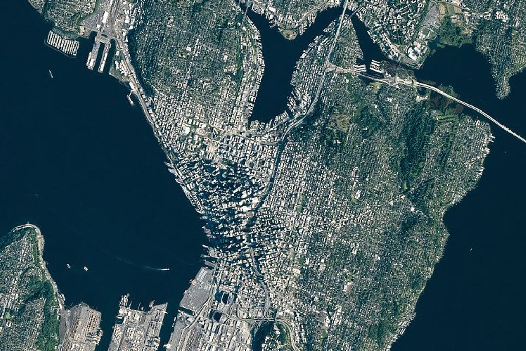
Millions of people rely on services provided by coastal deltas like the Mississippi River Delta. Those services include acting as nurseries for fish, crustaceans and other animals, in addition to protecting our infrastructure against hurricanes and tsunamis. However, most major deltas around the world are sinking under sea level rise and disappearing, taking the livelihoods and ecological services they provide with them.
The Delta-X mission will study the Mississippi River Delta to understand which parts of the region are likely to disappear and which will survive. The deltas may be able to keep up with sea level rise if enough sediment is deposited and if plants are healthy enough to grow roots. Delta-X scientists will use airborne remote sensing instruments aboard NASA’s King Air and Gulfstream aircraft, with flights originating from Lakefront Airport in New Orleans and NASA’s Johnson Space Center, and field measurements of water flow to determine where sediment transported by that water will get deposited. The scientists will also quantify how much organic soil is created from the decomposition of plants.
“These new data will help us to understand and mitigate the impact of sea level rise on the very important coastal resources found in deltas,” said Delta-X principal investigator Marc Simard from the Jet Propulsion Laboratory in Pasadena, California.
Aerosols Changing Clouds
The Aerosol Cloud Meteorology Interactions Over the Western Atlantic Experiment, or ACTIVATE, will look at the critical role marine boundary layer clouds play in Earth’s energy balance and water cycle. This type of cloud covers large stretches of the planet’s oceans. How cloud systems change continues to be one of the biggest remaining uncertainties in models that look at global warming.
The campaign, which begins in February, will focus on the western North Atlantic Ocean, where researchers will measure a broad range of aerosol, cloud and meteorological conditions. Researchers will conduct science flights on two aircraft—a NASA Falcon and King Air—that will fly in a coordinated fashion while outfitted with a host of remote sensing and in-situ instruments. Flights will originate from NASA’s Langley Research Center in Hampton, Virginia.
“Despite many prior field campaigns, we don’t have comprehensive measurements under a variety of conditions to draw definite conclusions about the effects of these interactions between aerosols, clouds and meteorology on climate,” said Armin Sorooshian, ACTIVATE principal investigator from the University of Arizona. “With this study, we intend to address that issue and provide data the international science community can use for years and decades to come.”
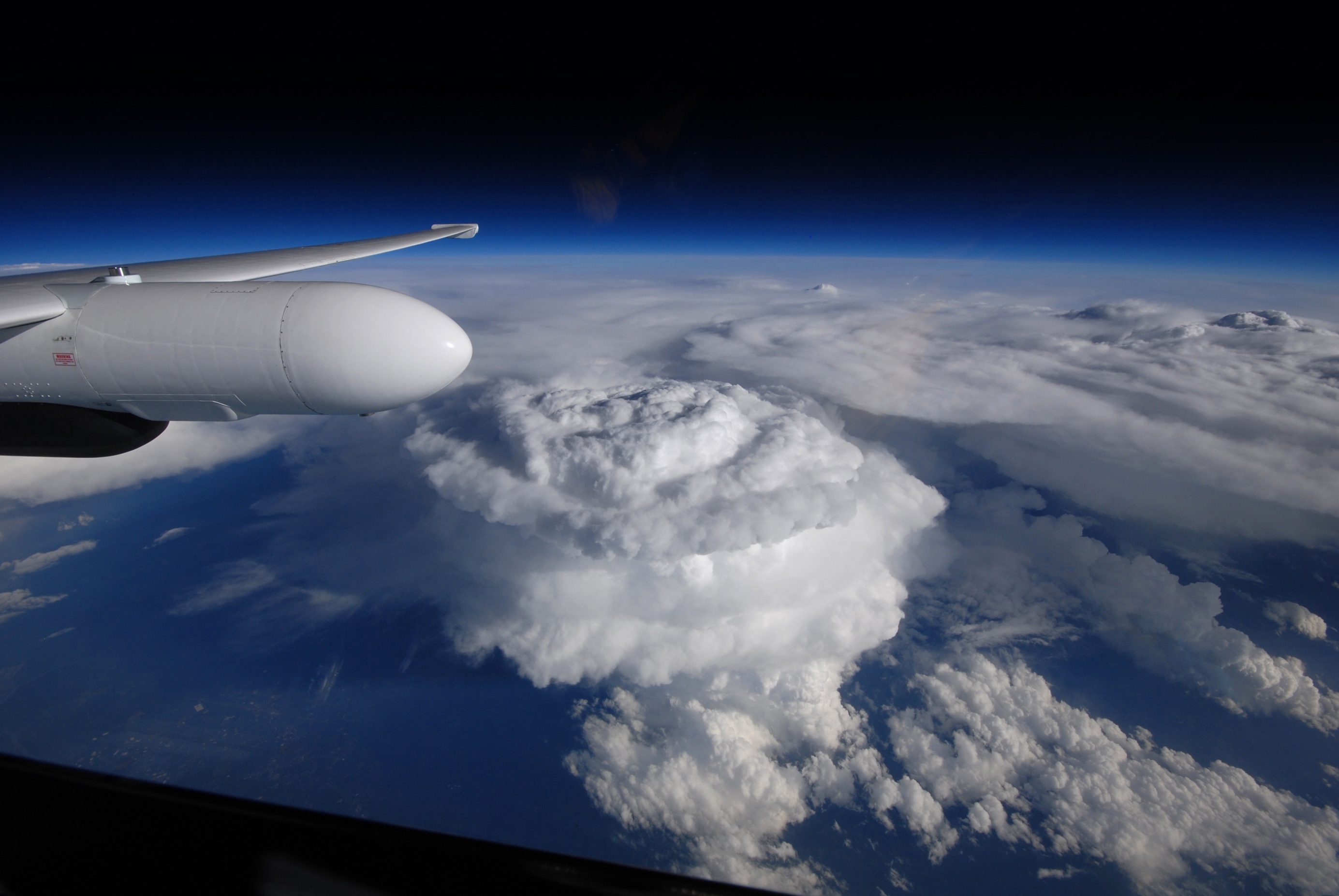
When Strong Storms Punch into the Stratosphere
In June, Dynamics and Chemistry of the Summer Stratosphere, or DCOTSS, will investigate intense storms that form over the central United States during the summer months. When these storms grow tall enough, they overshoot the troposphere, the lowest layer of Earth’s atmosphere, and can inject water vapor and pollutants into the stratosphere above, significantly altering its chemical composition. They may even negatively affect stratospheric ozone, which absorbs harmful ultraviolet light from the sun.
The scientists will target these overshooting storms using data from weather satellites and ground-based radar and will collect measurements with NASA’s ER-2 high-altitude aircraft, which will fly up to 70,000 feet, significantly higher than most research aircraft can go. Flights will originate from Salina, Kansas.
“DCOTSS is the first science mission specifically designed to observe material lifted into the stratosphere by intense thunderstorms,” said Ken Bowman, DCOTSS principal investigator from Texas A&M University. “By directly measuring storm outflow with the ER-2 aircraft, we can learn how these storms affect today’s stratosphere, and how their impacts might change as the atmosphere changes in coming decades.”
The public is invited to follow this journey of exploration online through NASA’s social media channels and the Earth Expeditions webpage, which will feature regular video, photo and blog posts from these missions.
To follow all the NASA Earth Expeditions, visit:
https://www.nasa.gov/earthexpeditions
By: Samson Reiny
NASA’s Earth Science News Team


