


The satellite was little (the size of a small refrigerator), only supposed to last one year and constructed and operated on a shoestring budget — yet it persevered. After 17 years of operation, with more than 1,500 research papers generated and more than 92,000 images captured from each of its imagers, the Earth Observing-1 (EO-1) satellite has exceeded expectations in its technology, research goals and longevity.
“The Earth Observing-1 satellite is like ‘The Little Engine That Could,’” said Betsy Middleton, project scientist for the satellite at NASA’s Goddard Space Flight Center in Greenbelt, Maryland.
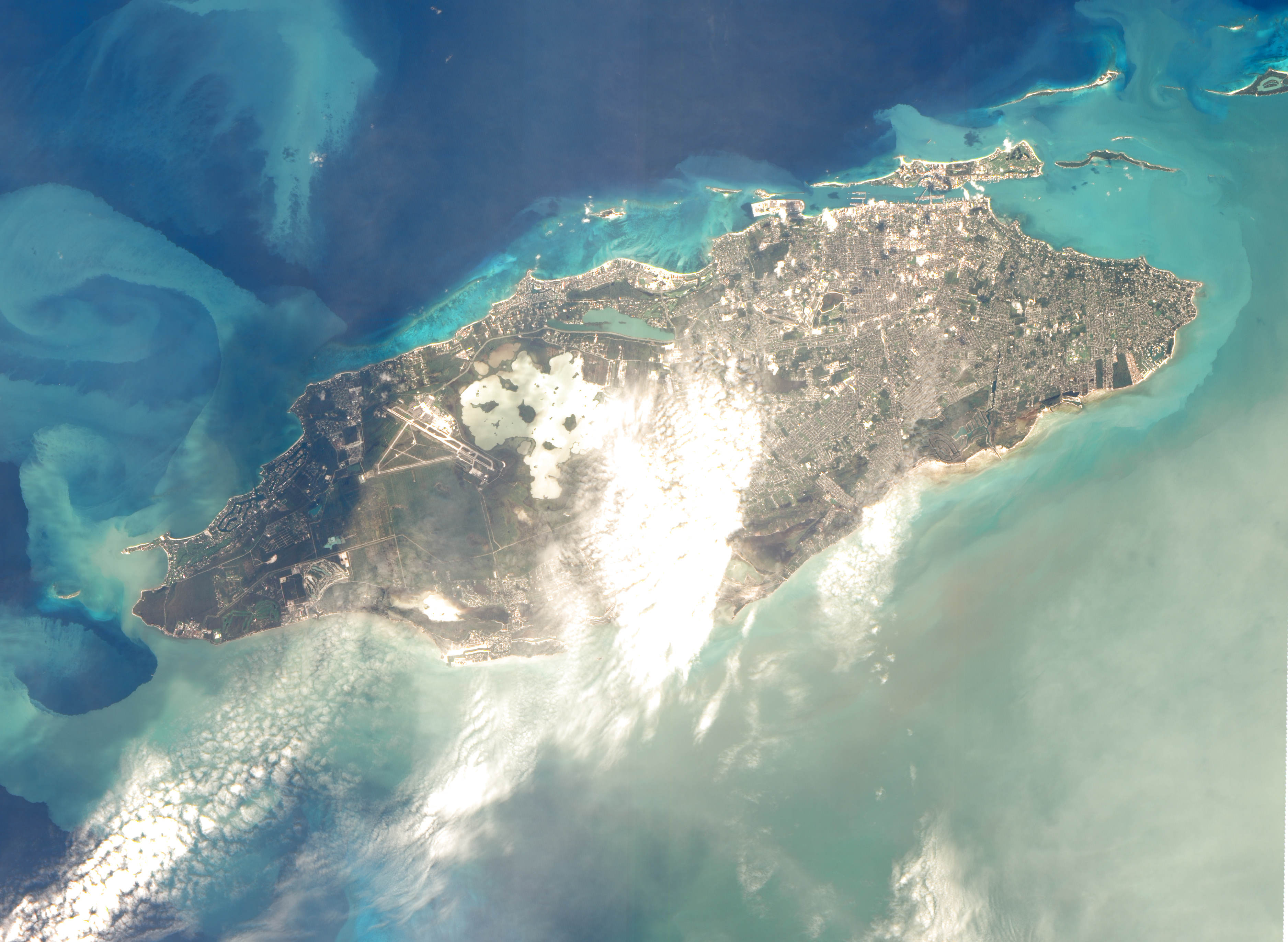
Download this video in HD formats from NASA Goddard’s Scientific Visualization Studio
EO-1 was a technology validation mission for testing cutting-edge advancements that have been and are being implemented on current and future satellite missions. The satellite launched in 2000 with 13 new technologies, including three new instruments, that had never been flown previously. Among its many accomplishments, the satellite was an innovator for detecting Earth’s biochemical constituents in unprecedented detail, a pathfinder for using artificial intelligence software for streamlined satellite communication and a precursor for extremely close flying between orbiting satellites.
On March 30, 2017, the satellite will be powered off due to a lack of fuel, not returning to Earth until 2056 as disintegrated bits. To celebrate the mission’s success, NASA highlights a few of EO-1’s notable contributions to scientific research, spaceflight advancements and society.
Scientists Learn More about Earth in Fine Detail
Just as humans have unique fingerprints to identify who they are, so do Earth’s resources such as plants and minerals. Unlike a human’s fingerprint though that can be seen with our eyes, Earth’s materials have “fingerprints,” or spectral signatures, that require special instruments to see them. EO-1 had two instruments that could identify these special, sometimes invisible, signatures in unprecedented detail that are shaping development of Earth observations.
EO-1’s Advanced Land Imager (ALI) and Hyperion imaging spectrometer looked at a scene and measured the energy that is reflected from materials on the ground. Both instruments measured energy in the form of visible and invisible electromagnetic (or light) energy, ranging from the visible blue to the invisible (to humans) infrared wavelengths.
The ALI measured energy in 10 different wavelength regions and improved observations of forest cover, crops, coastal waters and small particles in the air known as aerosols. These improvements allowed researchers to identify smaller features on a local scale such as floods and landslides, which were especially useful for disaster support. The ALI’s instrument design and onboard technology directly shaped the design of the Operational Land Imager (OLI) on Landsat 8, currently in orbit, that measures energy in nine similar wavelength regions.
EO-1’s Hyperion provided an even greater level of detail in measuring the biochemical constituents of Earth’s surface. Hyperion’s level of sophistication doesn’t just show that plants are present, but can better differentiate between corn, sorghum and many other species and ecosystems. Scientists and forest managers used these data, for instance, to explore remote terrain or to take stock of smoke and other chemical constituents during volcanic eruptions, and how they change through time.
Hyperion, classified as a hyperspectral imager, provided this detail by measuring many more wavelengths of light — akin to going from a black and white television of the 1940s to the high-definition color televisions of today. Covering the same wavelength range as ALI, Hyperion used 196 contiguous channels that can be combined to form a unique spectral signature, or “fingerprint.” Scientists can look at the “fingerprints” and can figure out what the material is. Even though Hyperion is at the end of its amazing 17 years in orbit, it remained a technology leader and could detect the reflected energy with a much higher spectral resolution than other land imaging satellite instruments.
One of Hyperion’s recent accomplishments is capturing multiple images or “time series” of research sites around the world, especially useful for studying plants. Scientists can use these longer term measurements to understand the biological processes that drive vegetation production in that area. Researchers can evaluate how multi-year external influences, such as drought, can influence species and populations on time scales longer than a few years.
“This is one of the most fruitful avenues for future hyperspectral research of the Earth’s ecosystems,” said Middleton. Other team members are working on spinoff efforts such as a smaller satellites, called CubeSats, and Unmanned Aerial Systems that employ hyperspectral instruments like Hyperion. NASA’s Hyperspectral Infrared Imager, a potential satellite mission, would also extend Hyperion’s capabilities for global ecosystem studies.
Crowdsourced Satellite Images of Disasters

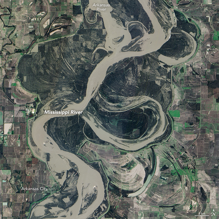
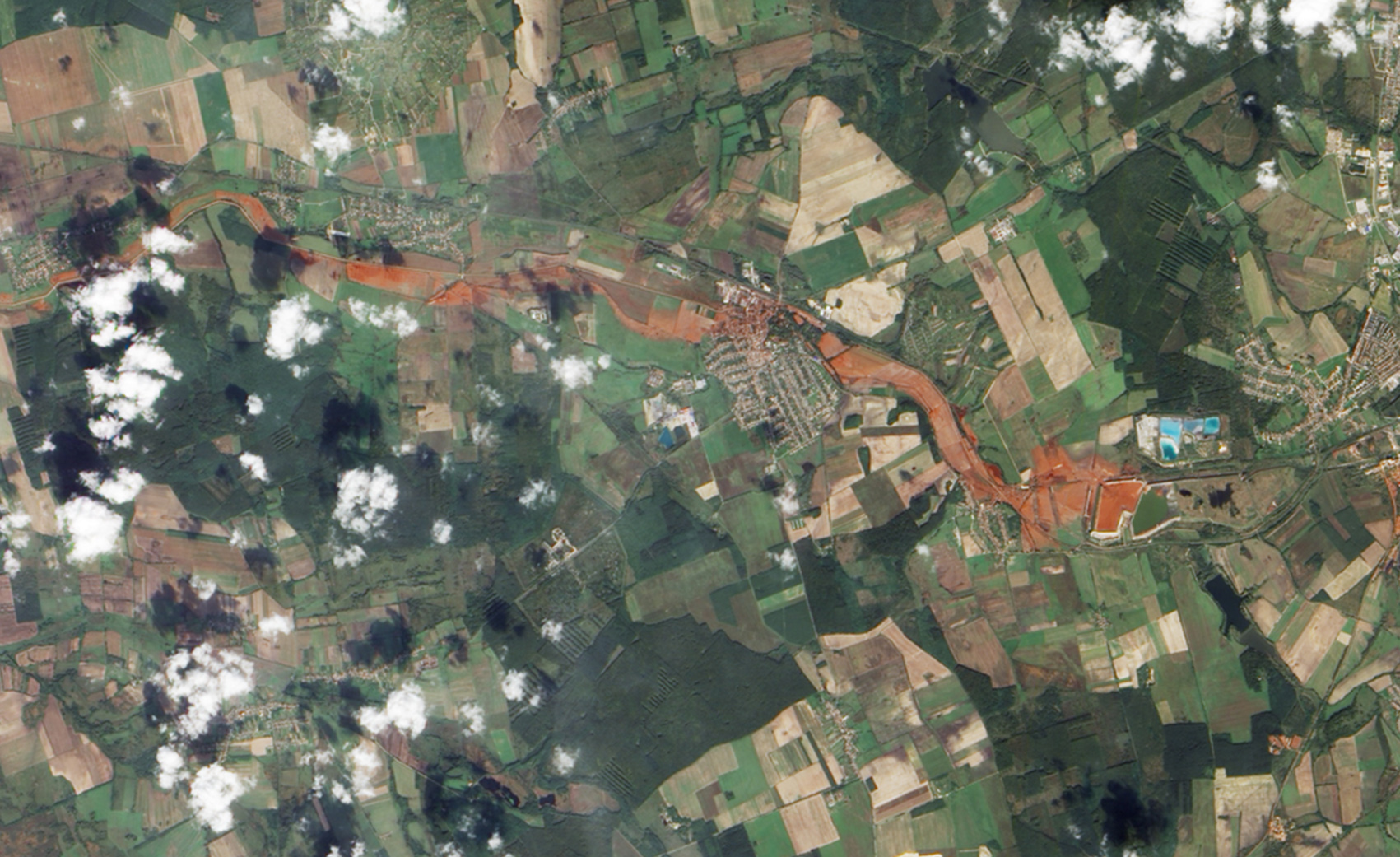
EO-1 was one of the first satellites to capture the scene after the World Trade Center attacks and the flooding in New Orleans after Hurricane Katrina. EO-1 also observed the toxic sludge in western Hungary in October 2010 and a large methane leak in southern California in October 2015. All of these scenes, which EO-1 provided quick, high-quality satellite imagery of the event, were covered in major news outlets. All of these scenes were also captured because of user requests.
EO-1 had the capability of being user-driven, meaning the public could submit a request to the team for where they wanted the satellite to gather data along its fixed orbits. From its track, EO-1 instruments could aim toward any location and capture images every two to five days of a particular spot, which was especially useful for emergency responders who wanted to keep informed of rapidly changing events. Some of EO-1’s most well-known and exclusive images and data products were taken because of user requests.
Artificial Intelligence Enables More Efficient Satellite Collaboration
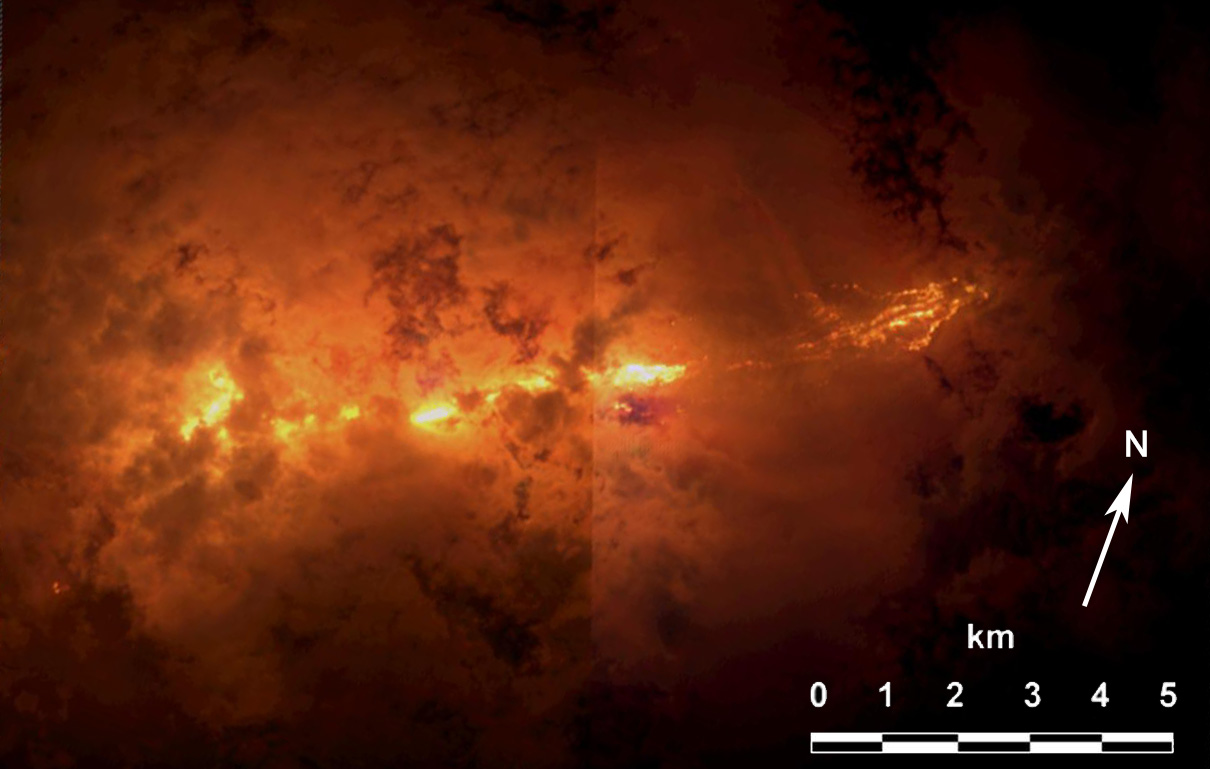
EO-1 was among the first satellites to be programmed with a form of artificial intelligence (AI) software, allowing the satellite to make decisions based on the data it collects. For instance, if a scientist commanded EO-1 to take a picture of an erupting volcano, the software could decide to automatically take a follow-up image the next time it passed overhead. The Autonomous Sciencecraft Experiment software was developed by NASA’s Jet Propulsion Laboratory in Pasadena, California, and was uploaded to EO-1 three years after it launched.
The software cut out many time-consuming manual processing steps, making the satellite smarter and more efficient at collecting the best possible images of Earth. Previously, acquiring an EO-1 image required 67 steps by flight engineers. The AI software automatically took the image with a single command tied to a goal.
AI software also allows a group of satellites and ground sensors to communicate and coordinate with one another with no manual prompting. Called a “sensor web“, if a satellite viewed an interesting scene, it could alert other satellites on the network to collect data during their passes over the same area. Together, they more quickly observe and downlink data from the scene than waiting for human orders. NASA’s SensorWeb software reduces the wait time for data from weeks to days or hours, which is especially helpful for emergency responders.
With SensorWeb, the EO-1 team became an early player in coordinating data collection through international collaborations. The team supported NASA’s effort as a member of the Committee on Earth Observation Satellites (CEOS) and the Group on Earth Observations (GEO), two large international coalitions of nations striving to help society through the collective use of the Earth’s satellites.
EO-1 participated mainly in the disaster subgroups to improve emergency responses through synchronizing multiple satellites from different countries. For example, several CEOS members took images in October 2016 of Hurricane Matthew that were then used to make flood maps for disaster management agencies.
Laying the Foundation for ‘Formation Flying’
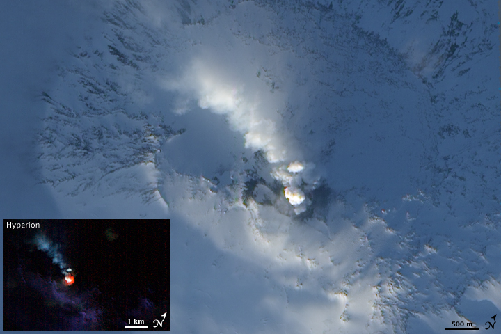
EO-1 was a pioneer in precision “formation flying” that kept it orbiting Earth exactly one minute behind the Landsat 7 satellite, already in orbit. Before EO-1, no satellite had flown that close to another satellite in the same orbit. EO-1 used formation flying to do a side-by-side comparison of its onboard ALI with Landsat 7’s operational imager to compare the products from the two imagers.
This close satellite formation flying concept is now widely implemented in spaceflight and opens new scientific possibilities that are difficult to achieve with a lone satellite in orbit. Today, many satellites that measure different characteristics of Earth, including the five satellites in NASA’s A Train, are positioned within seconds to minutes of one another to make observations on the surface near-simultaneously.
The technologies and concepts listed here are only a few of EO-1’s accomplishments in its lifetime, but a more comprehensive list can be found at EO-1’s project website. EO-1 was supported by NASA, the U.S. Geological Survey, the National Oceanic and Atmospheric Administration, National Reconnaissance Office and Naval Research Laboratory. Orbital ATK, previously Swales Aerospace in 2000, served as the prime contractor, satellite mission integrator and bus developer for the EO-1 mission.
Even though EO-1 is no longer operating, scientists still have plenty of work. NASA scientists are embarking on a new effort to study and archive more than 200 terabytes of imagery collected across the world from the Hyperion instrument during its flight. Researchers acquired images for more than 20,000 places that will be precisely mapped to a grid in order to offer an open and public data record of land-based and coastal changes that may have occurred over the last 17 years. This image archive will also support the calibration of instruments and science studies of upcoming NASA missions.
Even after its decommission, NASA’s “little Earth satellite that could” continues to help tell the story of our changing Earth.
Related Links
- EO-1 website
- 17 Years of Earth Observing-1 Image Gallery on NASA’s Earth Observatory
- NASA Says Goodbye to Pathfinder Earth Satellite After 17 Years
- List of EO-1 technologies
- Earth Observing-1: Ten Years of Innovation
- More information about NASA’s SensorWeb experiments
- How A.I. Captured a Volcano’s Changing Lava Lake
- A First: NASA Spots Single Methane Leak from Space
- More information on the Hyperspectral Cubesat Constellation for Natural Hazard Response (Follow-on)
By Kasha Patel
NASA’s Goddard Space Flight Center, Greenbelt, Md.