![Request for Information – Potential [Placeholder for Prize]](https://assets.science.nasa.gov/dynamicimage/assets/science/psd/solar/2023/09/s/solarsystem_0.jpg?w=1024)


The cutting-edge science and technology that NASA develops to study Earth and space often spurs new applications through NASA’s Technology Transfer program. Everything from satellite-assisted search-and-rescue missions, to a drill developed for the Mars Perseverance rover that’s now aiding geologists on Earth shows that the sky is far from the limit when innovators and entrepreneurs take NASA technologies for a spin.
Below are some examples of these Earth-focused technologies featured in the 2021 NASA Spinoffs publication.
5G: Putting networks to the test
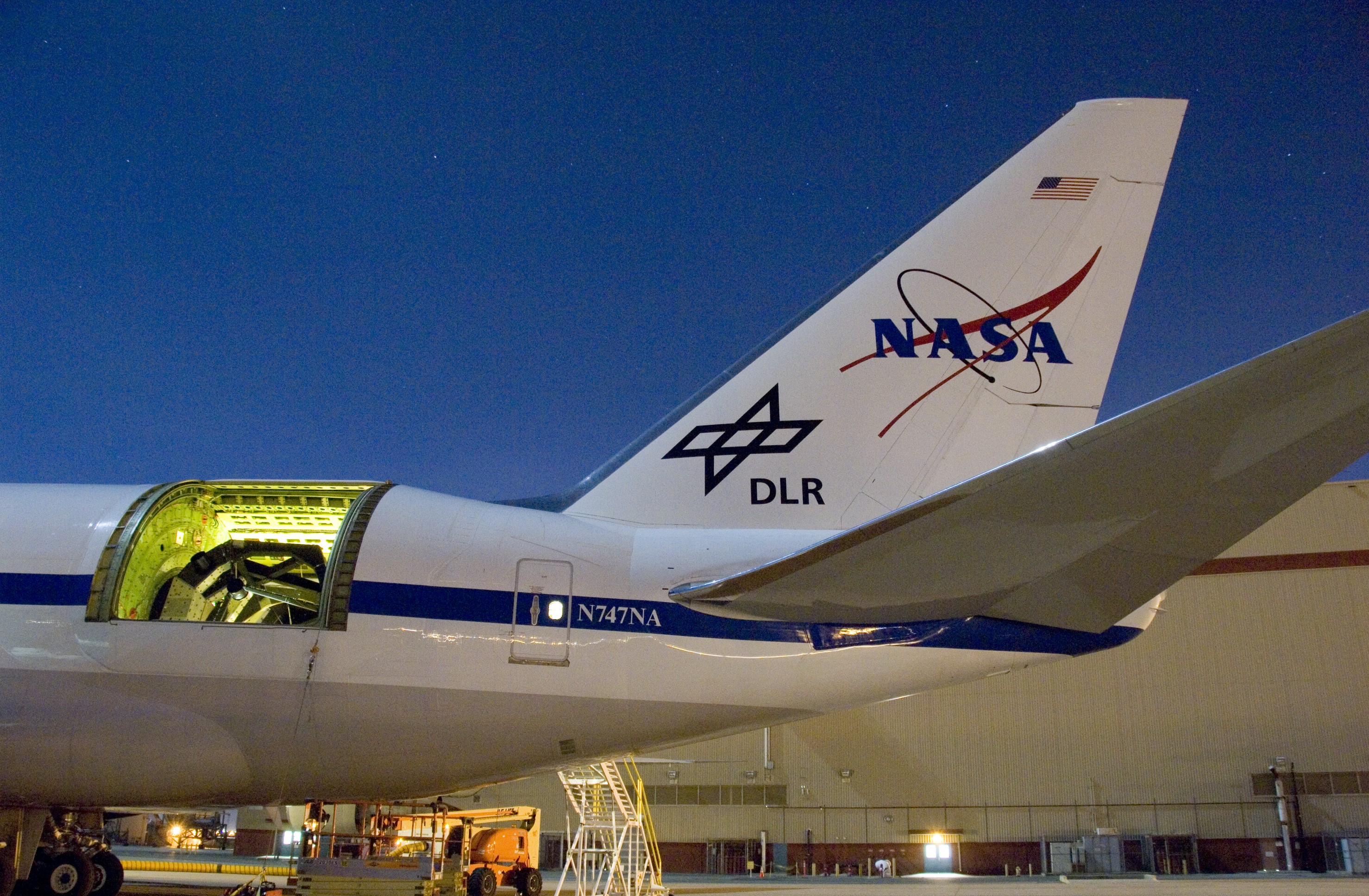
Satellites have orbited Earth since the late 1950s, providing new data and insights into the natural systems and processes of our planet. Satellite technology has numerous commercial applications, with profound success advancing communications such as radio, television, GPS, wifi and cellular networks, which now includes 5G.
NASA satellites and 5G cell networks both utilize isolators – devices that protect microwave or radio receivers from interfering waves. For NASA, spectrometers aboard Earth-observing aircrafts and satellites need isolators to measure small-scale wavelengths and assess properties of light, but the existing isolator designs caused high levels of signal loss. So, researchers from NASA’s Jet Propulsion Laboratory in Southern California and the company Micro Harmonics based in Fincastle, Virginia, developed a new low-loss isolator that could work at much higher frequencies and higher power levels.
High-speed cell phone bandwidths operate within the newly widened range of these isolators, and telecommunications labs can now utilize them to test the viability of 5G frequencies in various environments. The current isolators are equipped to handle the heat, but NASA’s Goddard Space Flight Center in Greenbelt, Maryland, is working with Micro Harmonics to develop complementary isolators that can operate in extremely cold temperatures.
SARSAT and Earthrise: Saving lives and livelihoods
Satellites can also aid in matters of life and death. This is true for the Geostationary Orbiting Environmental Satellites (GOES), which are operated by the National Oceanic and Atmospheric Association (NOAA), and developed and launched by NASA. Two GOES series satellites are among those that support the U.S. Search and Rescue Satellite Aided Tracking (SARSAT) system and its global counterpart COSPAS-SARSAT. While they collect data on Earth’s environment and atmosphere, the satellites are also outfitted with equipment to detect and pinpoint distress signals from emergency beacons, which has led to the rescue of more than 48,000 people worldwide.
In the last 10 years, the world’s navigational satellites, including ones designed by NASA for use with the GPS system, have also been added to the network, along with new ground stations to improve detection and location times. With the large quantity of satellites and ground stations now at their disposal, NOAA turned to Greenbelt, Maryland-based Orbit Logic Inc.’s STK Scheduler software, which was developed by former NASA contractors thanks to their long experience planning missions for the space agency. The software prioritizes which satellites to track for the highest accuracy when locating distress signals.
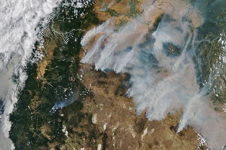
Many Earth-orbiting satellites are also capable of producing beautiful and informative imagery. These pictures from above can provide valuable observation of a specific location, including the local weather and how the land is being used, which NASA makes available to the public. Earthrise Alliance and Digital Earth Africa are two organizations taking advantage of the imagery to identify illegal gold mines in the Amazon and across the African continent.
Additionally, the Portland-based organization Mercy Corps and NASA are collaborating to provide farmers in Africa with satellite-derived weather and agronomic information to better inform their practices. Repurposing the environmental data collected by NASA missions allows farmers and policy-makers alike to apply the knowledge in ways that can impact their lives and livelihoods.
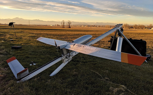
S2 Drone: A hardy aircraft for risky data collection
Although NASA technology applications can benefit a wide range of people, many are designed and used for scientific research. For example, scientists studying extreme weather events or natural disasters often struggle to collect data near the source. Thanks to multiple NASA-supported Small Business Innovation Research (SBIR) projects with Boulder, Colorado-based Black Swift Technologies, the S2 fixed-wing aircraft is a drone designed to get reliable aerial data even in tough conditions.
The University of Colorado’s Institute of Arctic and Alpine Research has already put the S2 to the test, performing atmospheric sampling in -20 degrees Fahrenheit (-28.9 degrees Celsius) and heights up to 14,000 feet (4,267 meters) in Greenland. The drone may yet be used for sampling in the high winds of whirling tornados or the toxic plumes of erupting volcanos. Until then, it has several commercial applications for farmers, surveyors, and oil and gas industries collecting data over their lands.
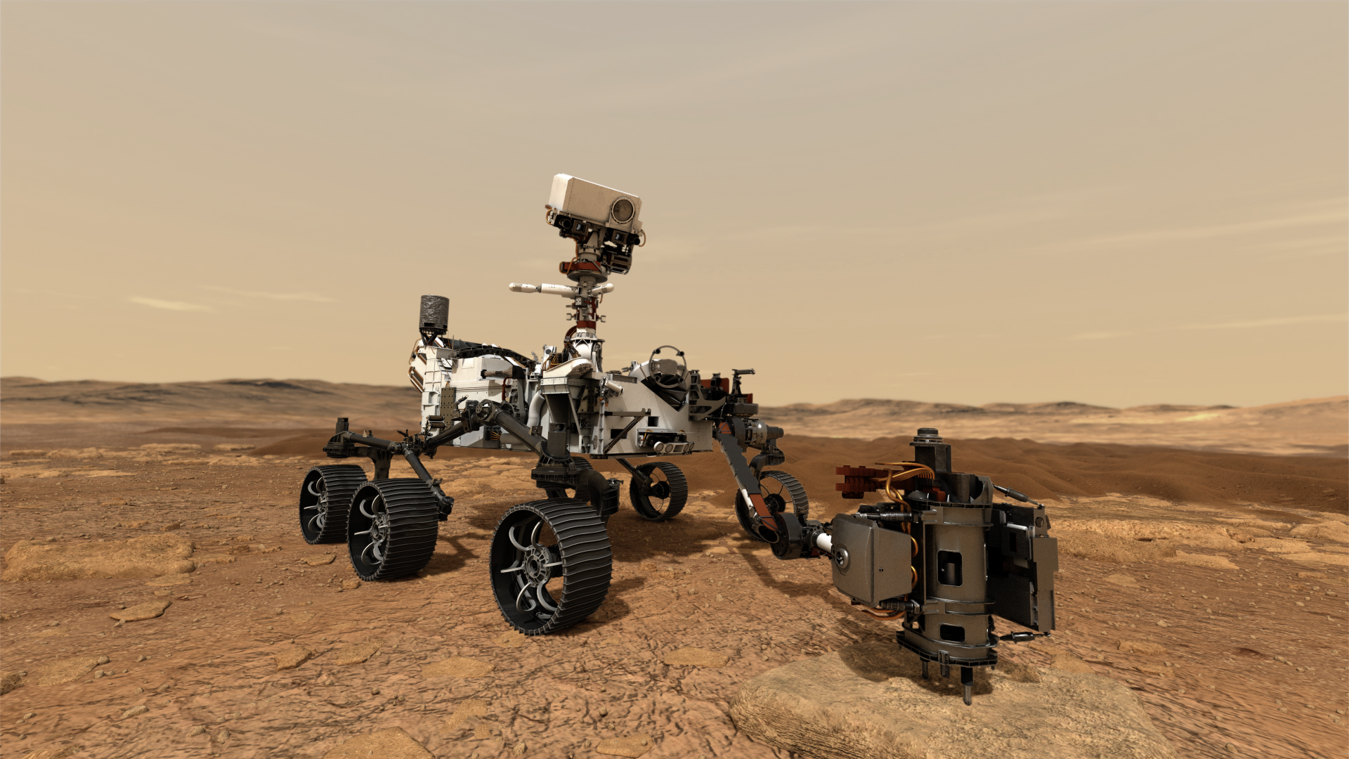
Honeybee: If it can drill on Mars, it can drill on Earth
While satellites and aircraft offer many opportunities for Earth science and Earth-bound technology applications, some spinoff technologies are born of missions even farther removed. Perseverance, the latest Mars rover set to land on the Red Planet in early 2021, takes with it a specialized drill bit to collect the first sediment samples from the Martian surface. These will eventually come back to Earth for study.
On Earth, rock samples drilled by a hollow bit can often become fragmented or contaminated in the process of removal. With the extreme lengths it takes to retrieve samples from Mars, NASA needed a better solution for Perseverance’s sample return mission.
Honeybee Robotics, funded by NASA Small Business Innovation Research (SBIR) contracts from JPL, designed a tube nested within the coring bit to combat the fragmentation issue. Now a drilled sample is contained within the bit and more secure for retrieval. In addition to sending this drill bit to Mars, Honeybee Robotics has patented the design, which is compatible with a standard drill for use here on Earth.
There are numerous NASA technologies with almost infinite possible applications. These are just a few tangential to Earth science highlighted in NASA’s 2021 Spinoff publication.
By Lara Streiff
NASA’s Earth Science News Team