


Indirect evidence of the Earth’s spherical shape has existed for a long time, but the photographic proof was lacking until well into the 20th century. The ancient Greeks believed the Earth was round and calculated its circumference with remarkable accuracy, while observers inferred our planet’s spherical shape as it cast a curved shadow on the Moon during lunar eclipses. With the advent of aviation, photographers could reach altitudes from which they could record the Earth’s curvature. With sounding rockets and then spacecraft returning photographs from ever-greater distances from the planet, we could begin to see the Earth first as a full disk, then as a smaller and smaller blue oasis against the emptiness of space. Through these images, we gained a better understanding of Earth’s, and therefore of our own, place in the universe.
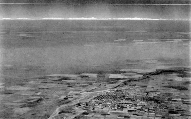
“The first photograph ever made showing laterally the curvature of the Earth,” read the original caption in the May 1931 issue of The National Geographic Magazine. The photograph, taken 21,000 feet above Villa Mercedes, Argentina, showed the Andes Mountains 287 miles away and well below the expected
horizon if the Earth were flat. Credits: The National Geographic Society.
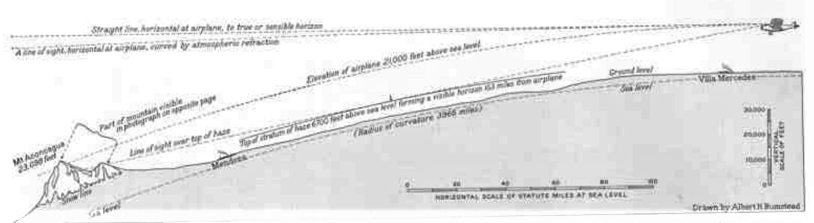
“A diagram illustrating the curvature of the Earth, as shown in the [accompanying] photograph,” read the original caption in the May 1931 issue of The National Geographic Magazine. The diagram describes that the Andes Mountains are visible below the expected horizon due to the Earth’s curvature.
Credits: The National Geographic Society.
An article in the May 1931 issue of The National Geographic Magazine described how a photograph taken from an airplane east of the Andes mountain range in South America provided evidence for the Earth’s curvature. Capt. Albert W. Stevens, an officer in the U.S. Army Air Corps and an aerial photographer, took the image on Dec. 30, 1930, while flying at an altitude of 21,000 feet over Villa Mercedes, Argentina. The Andes Mountains, 287 miles away, and although taller than the plane’s altitude, lay below the sensible horizon, marked by the white horizontal line in the photograph. The Earth’s curvature explains this phenomenon, as described in the diagram accompanying the photograph. The Earth’s curvature is also visible laterally in the photograph, although the effect is subtle as the image encompasses only 1/360 of the Earth’s circumference.
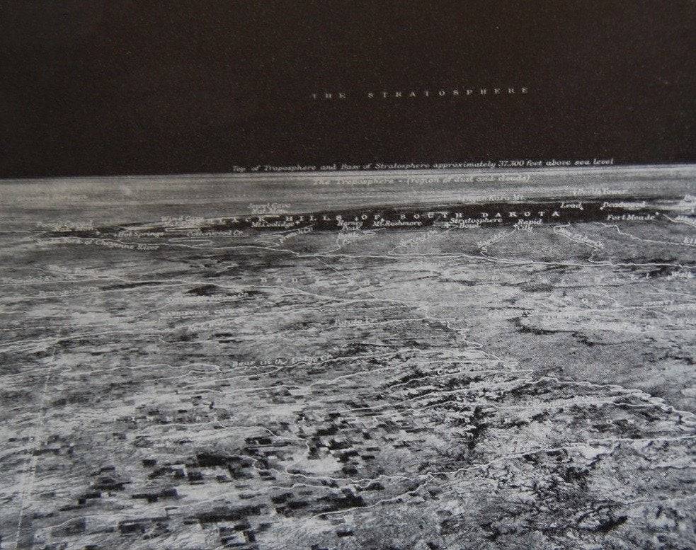
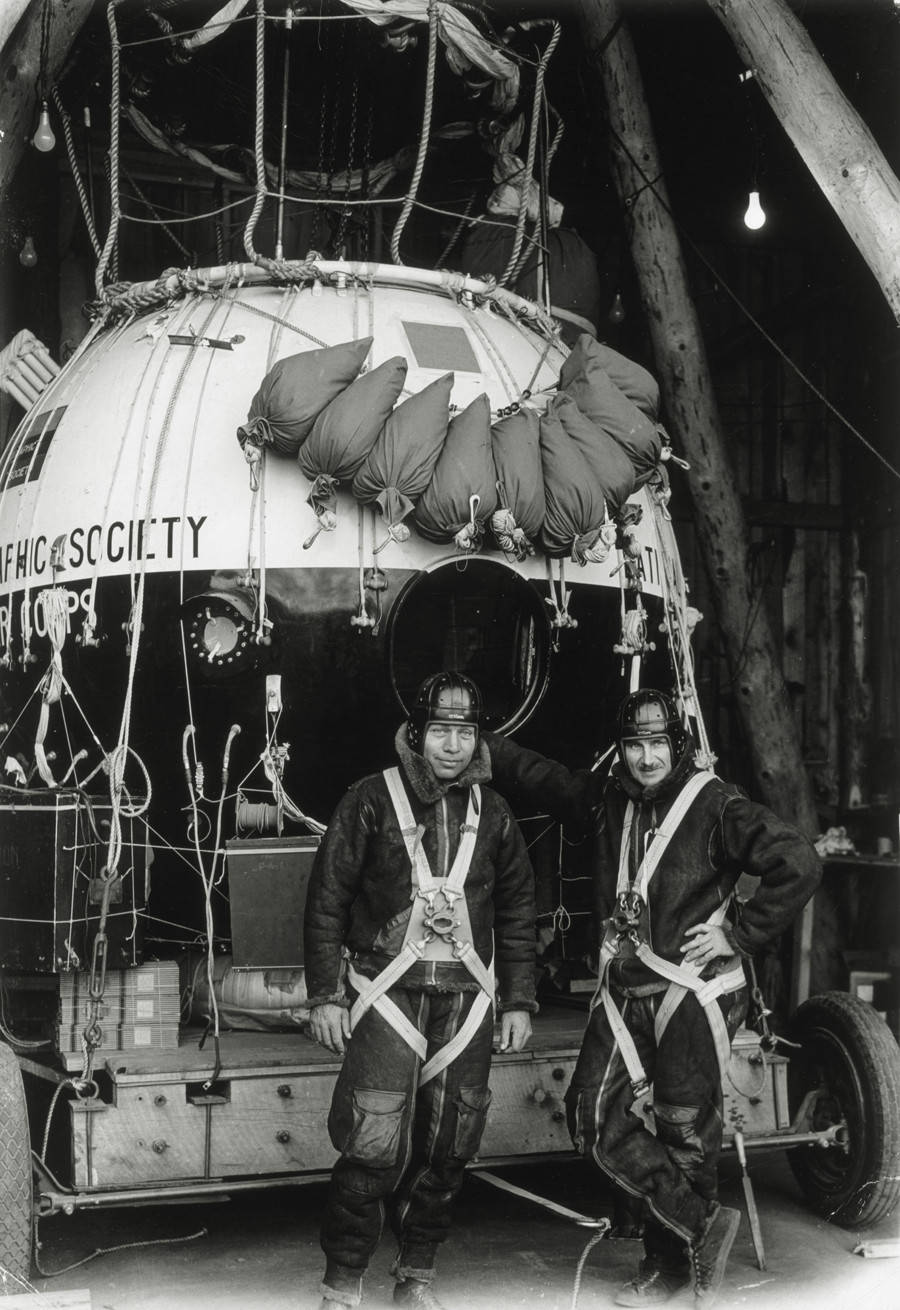
Left: Photograph of South Dakota taken during the record-setting Explorer II balloon flight, showing the curvature of the Earth. Right: Capt. Orvil A. Anderson, left, and Capt. Albert W. Stevens
stand in front of the Explorer II balloon gondola.
Credits: National Geographic Society.
In a joint program between the U.S. Army Air Corps and the National Geographic Society, Capt. Stevens, joined by Capt. Orvil A. Anderson, took the first photograph from a high-altitude balloon, clearly showing the Earth’s curvature. On Nov. 11, 1935, the pair took off from the Stratobowl near Rapid City, South Dakota, aboard the helium-filled Explorer II balloon, and ascended to a then world record altitude of 72,395 feet. The photograph showed the troposphere-stratosphere boundary and the actual curvature of the Earth and demonstrated the potential for long-range reconnaissance from high-altitude balloons.
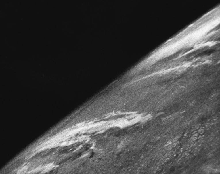
Left: The first image of Earth taken from space by a suborbital rocket, from an altitude of 65 miles.
Credits: White Sands Missile Range/Applied Physics Laboratory.
On Oct. 24, 1946, more than 10 years before the launch of the first artificial satellite Sputnik, scientists at the White Sands Missile Range in New Mexico placed a camera on top of a captured German V-2 ballistic missile. As the rocket flew to an altitude of about 65 miles – just above the generally recognized border of outer space – the 35 mm motion picture camera snapped a frame every one and a half seconds. Minutes later, the missile came crashing back down and slammed into the ground at more than 340 mph, but the film survived and gave us our first glimpse of Earth from space. On Aug. 14, 1959, the Explorer 6 satellite took the first photograph of Earth from orbit, but the image lacked detail. On April 1, 1960, the TIROS-1 weather satellite returned the first of its 23,000 television images of the Earth, most of them of sufficient quality for weather forecasting.
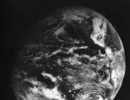
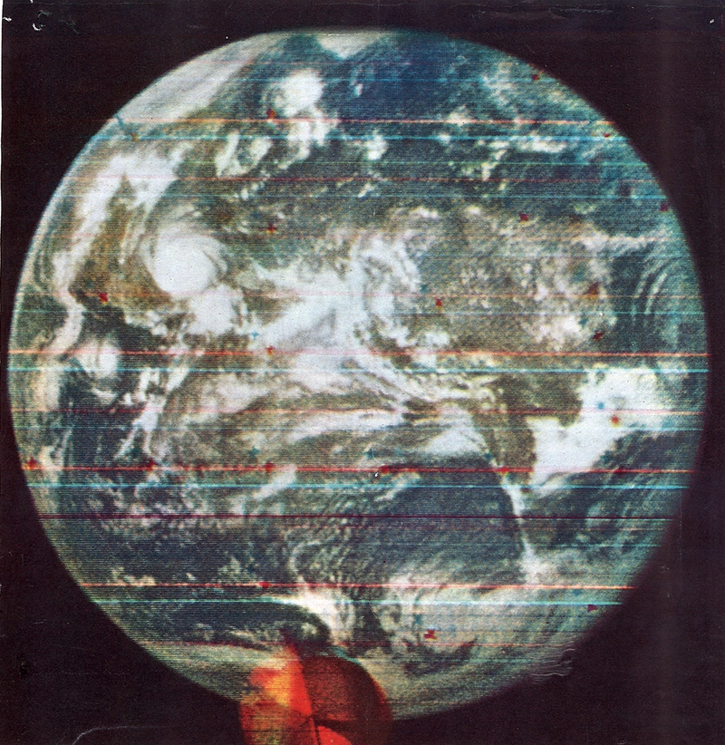
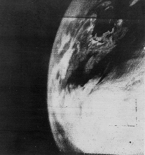
Left: The first full-disk photograph of Earth, taken by the Soviet Molniya 1-3 communications satellite. Middle: The first image of Earth taken from geostationary orbit, by the ATS-1 satellite. Right: The first color image of the full Earth from the DODGE (Department of Defense Gravity Experiment) satellite.
The Soviet Molniya 1-3 communications satellite took the first photograph showing the Earth as a full-disk on May 30, 1966, although the image quality was somewhat poor. On Dec. 11, 1966, the ATS-1 advanced technology satellite beamed back the first photograph of Earth from geostationary orbit 22,300 miles above Ecuador. The Department of Defense Gravity Experiment (DODGE) satellite returned the first color image of the full Earth in August 1967.
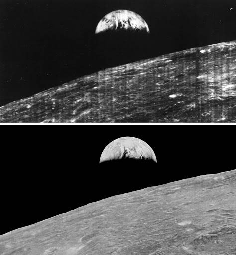
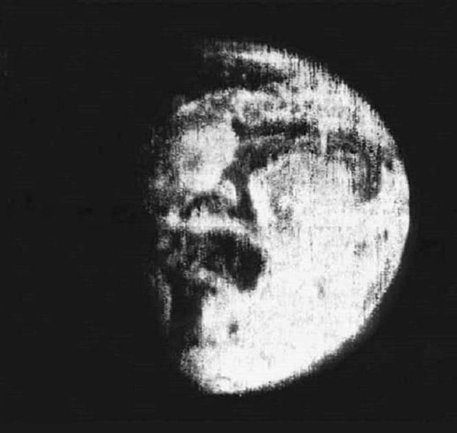
Left: The original photo, top, of Earth taken from lunar orbit by the Lunar Orbiter 1 spacecraft in 1966, and a 2008 digitized version by the Lunar Orbiter Image Recovery Project (LOIRP). Right: The first color image of Earth taken from the surface of the Moon by the Surveyor 3 spacecraft.
Credits: LOIRP.
The primary purpose of early robotic spacecraft to the Moon was to prepare for the crewed Apollo missions that followed, including extensive photography of the lunar terrain from orbit and from the surface. The first of five Lunar Orbiter spacecraft designed to map the Moon’s surface from orbit took the first photograph of the Earth from lunar distances on Aug. 23, 1966. A digital reconstruction of the original frame in 2008 as part of the Lunar Orbiter Image Recovery Project removed the scan lines and other imperfections. The Surveyor 3 robotic lander, later visited by the Apollo 12 astronauts, took the first photograph of the Earth from the lunar surface on April 30, 1967.
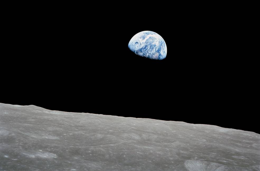
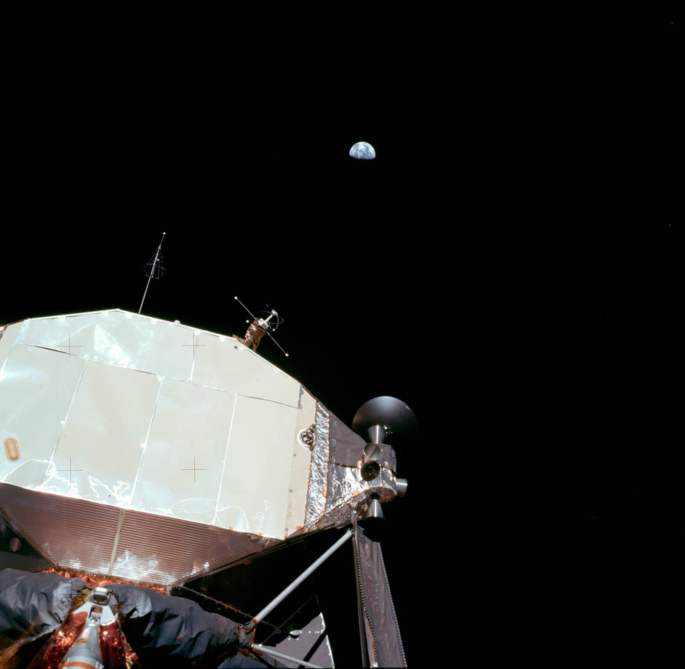

Left: The famous Earthrise photograph taken by Apollo 8 during the crew’s first orbit around the Moon. Middle: The first photograph of the Earth taken by an astronaut standing on the lunar surface, taken during the Apollo 11 Moon landing. Right: The Blue Marble image taken by the Apollo 17 astronauts on
their way to the Moon.
The Apollo missions of the late 1960s and early 1970s returned thousands of stunning and memorable images of humanity’s first exploration of another world. Among them are photographs of the Earth taken by the astronauts that show how small and fragile our planet can appear against the blackness and vastness of space. Arguably, the most famous is the Earthrise photos taken during Apollo 8, the first crewed mission to orbit the Moon. The image of the smooth blue ball of Earth appearing suspended over the battered gray lunar terrain provided inspiration for the ecology movement of the time. The first human lunar landing mission, Apollo 11, returned many iconic photographs of Neil A. Armstrong and Edwin E. “Buzz” Aldrin on the surface, and also included the first image of the Earth taken by an astronaut on the Moon. Astronauts on the final Apollo lunar landing mission, Apollo 17, took the famous Blue Marble image of the Earth from 72,000 miles away on their way to the Moon.
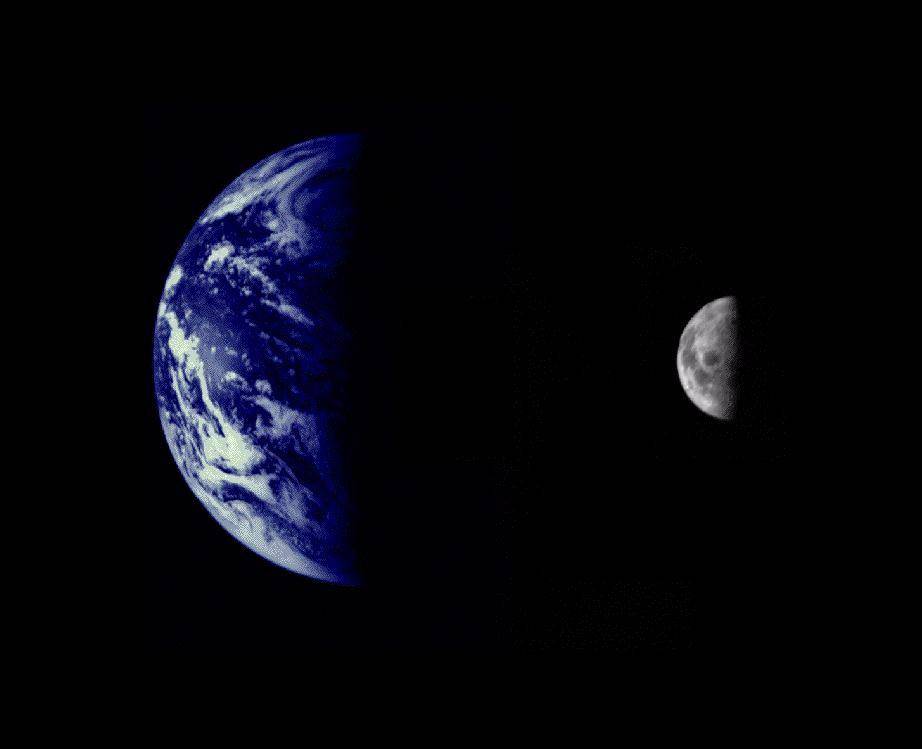

Left: A composite of two separate images of the Earth and Moon, taken by Mariner 10 as the spacecraft
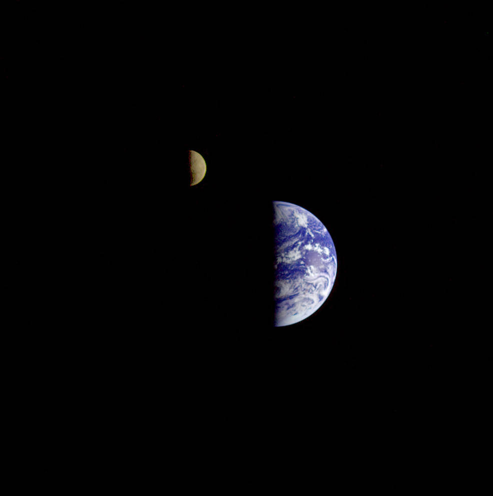
headed toward encounters with Venus and Mercury. Right: The first image of the Earth-Moon system in a single photographic frame taken by Voyager 1 as it departed on its journey to explore Jupiter and Saturn. Right: The first image of Earth taken by a planetary spacecraft, Galileo, as it made a return encounter with its home planet for a gravity assist.
As planetary spacecraft became more sophisticated in the 1970s, some turned their cameras toward the Earth as they departed on their long voyages of exploration. In November 1973, a few days after Mariner 10 launched on its mission to explore Venus and Mercury, it snapped separate photographs of both the Earth and the Moon, which technicians combined into a composite photo. On Sept. 18, 1977, at a distance of 7.25 million miles, the Jupiter-bound Voyager 1 snapped the first photograph of the Earth-Moon system in a single frame, providing an impression of what the view might be for a spacecraft approaching our home planet. The Galileo spacecraft did exactly that – on Dec. 8, 1990, more than two years after its launch, it passed within 600 miles of Earth, using the planet for a gravity assist to get it to Jupiter. During the fly-by, Galileo used its sophisticated instruments and cameras to study Earth as if it were an unexplored planet and detected chemical signatures in atmospheric trace elements associated with life-form activity.
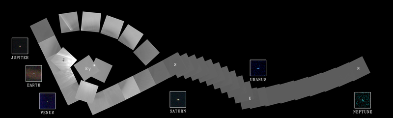
Voyager 1’s family portrait of six planets, when the spacecraft was 3.7 billion miles from Earth.
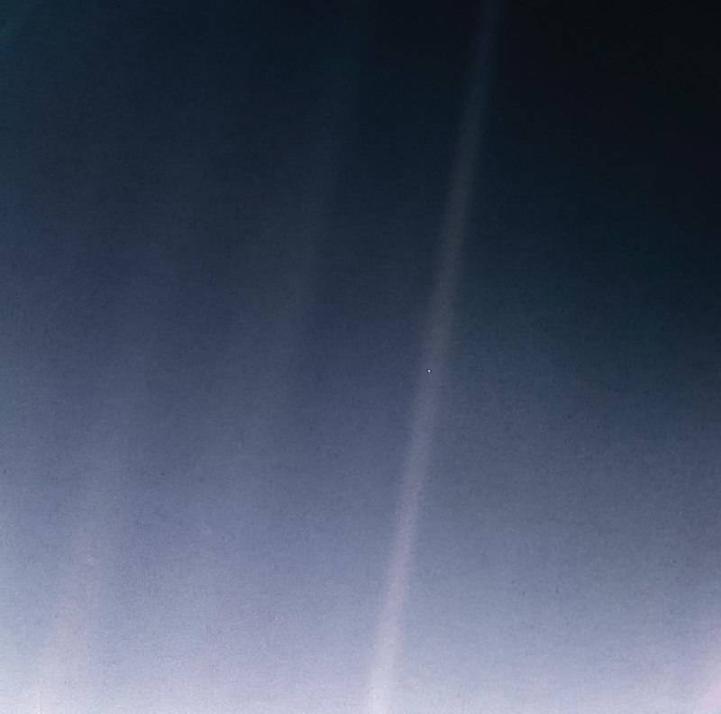
Pale Blue Dot Revisited, NASA’s remastered version of the Voyager 1 image of Earth.
On Feb. 14, 1990, more than 12 years after it began its journey from Earth and shortly before its cameras were permanently turned off to conserve power, Voyager 1 spun around and pointed them back into the solar system. In a mosaic of 60 images, it captured a “family portrait” of six of the solar system’s planets, including a pale blue dot called Earth more than 3.7 billion miles away. In February 2020, to commemorate the photograph’s 30th anniversary, NASA released a remastered version of the image of Earth as Pale Blue Dot Revisited.
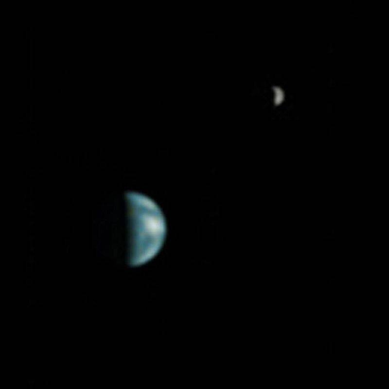
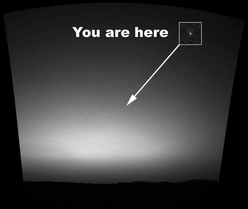
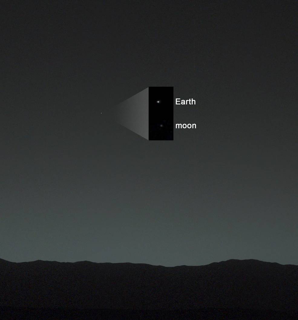
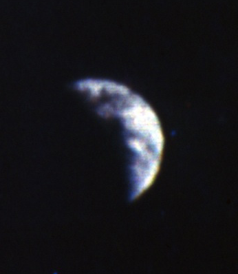
Left: The Earth and Moon photographed by the Mars Global Surveyor spacecraft in orbit around Mars. Middle: The Earth photographed from the surface of Mars by the Mars Exploration Rover Spirit. Right: The Earth and Moon photographed by the Mars Science Laboratory Curiosity rover.
If you ever wondered what Earth will look like to future Martian explorers, imagery returned by several spacecraft in orbit around and on the surface of Mars will give you a good idea. The Mars Global Surveyor spacecraft took the first photograph of the Earth-Moon system from its orbit around Mars, from a distance of 86 million miles. Because the Earth and Moon are closer to the Sun than Mars, they exhibit phases, much as Venus and Mercury do as viewed from Earth. The image taken on May 8, 2003, shows the Earth and Moon in roughly one-quarter phase. The Mars Exploration Rover Spirit took the first photograph of the Earth from the surface of Mars on March 11, 2004, the Earth appearing as a bright star. An image taken by the Mars Science Laboratory Curiosity rover on Jan. 31, 2014, from a distance of 99 million miles, shows the Earth and Moon as separate objects.
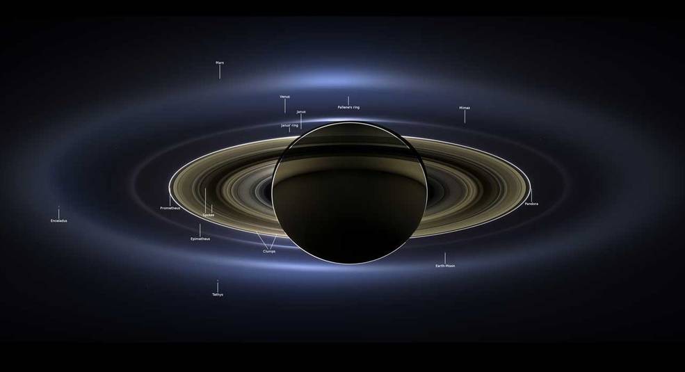
The Earth-Moon system as seen from the Cassini spacecraft in orbit around Saturn.
On July 19, 2013, the Cassini spacecraft in orbit around Saturn took a series of images from a distance of about 750,000 miles as the planet eclipsed the Sun. In the event dubbed The Day the Earth Smiled, people on Earth received notification in advance that Cassini would be taking their picture, and were encouraged to smile at its camera. In addition to the Earth and the Moon, Venus, Mars, and seven of Saturn’s satellites are visible in the photograph.
We hope you enjoyed this review of how photographs of Earth over the past 90 years have changed our perspectives of our home planet, and also of our own place in the universe. Future human space explorers, whatever their destinations, will always look back and try to find their home planet in whatever sky it may shine, and hopefully share their experiences with us through photographs we can only dream about today.