


Its launchmate, Lunar Crater Observation and Sensing Satellite, confirmed the existence of water ice reserves in the lunar soil.
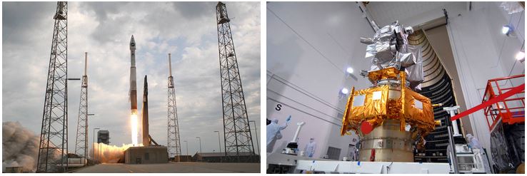
The primary mission of the Lunar Reconnaissance Orbiter, or LRO, managed by NASA’s Goddard Space Flight Center, located in Greenbelt, Maryland, was to measure the entire lunar surface to create a high-resolution 3-D map of the Moon with ~50-centimeter resolution images to aid in the planning of future robotic and crewed missions. In addition, LRO would map the polar regions and search for the presence of water ice. Its primary mission was to last only one year. LRO was launched from Cape Canaveral Air Force Station on June 18, 2009, atop an Atlas V launch vehicle.
Launched with LRO was the Lunar Crater Observation and Sensing Satellite, or LCROSS, a satellite managed by NASA’s Ames Research Center in California’s Silicon Valley designed to further explore the presence of water ice in permanently shaded areas of the Moon’s polar regions. The two components of LCROSS, the Centaur upper stage of the launch vehicle and the Shepherding Satellite, were intended to deliberately crash into the Moon. Instruments on Earth and aboard LRO and the LCROSS Shepherding Satellite would observe the resulting plumes and analyze them for the presence of water.
The LRO spacecraft carries seven scientific instruments:
- the Cosmic Ray Telescope for the Effects of Radiation (CRaTER) to characterize the lunar radiation environment;
- the Diviner Lunar Radiometer Experiment (DLRE) to identify areas cold enough to trap ice;
- the Lyman-Alpha Mapping Project (LMAP) to search for ice in the lunar polar regions;
- the Lunar Exploration Neutron Detector (LEND) to create a map of hydrogen distribution and to determine the neutron component of the lunar radiation environment;
- the Lunar Orbiter Laser Altimeter (LOLA) to measure slopes and roughness of potential landing sites;
- the Lunar Reconnaissance Orbiter Camera (LROC) consisting of two-narrow angle and one wide-angle camera to take high-resolution images of the lunar surface; and
- the Mini Radio-Frequency (Mini-RF) experiment, an advanced radar system to image the polar regions and search for water ice.
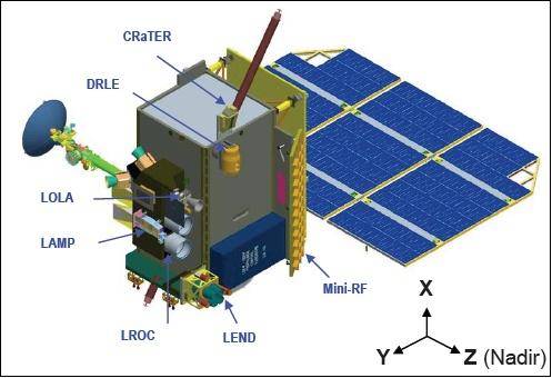
Left: Illustration of LRO and its scientific instruments. Right: Illustration of LCROSS and its scientific instruments on panel at left.
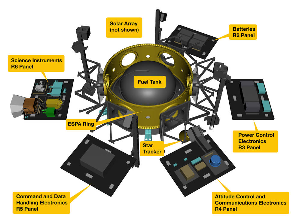
The LCROSS Shepherding Satellite carried nine instruments – five cameras (one visible, two near-infrared, and two mid-infrared); three spectrometers (one visible and two near-infrared); and a photometer. They were used to monitor the plume sent up by the impact of the Centaur upper stage.
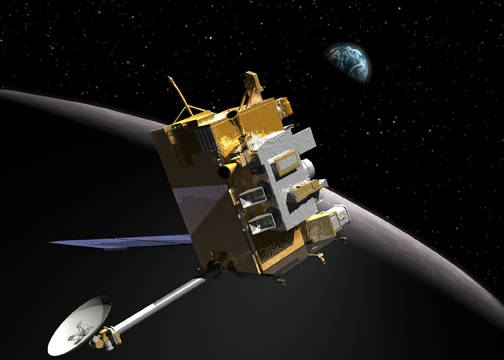
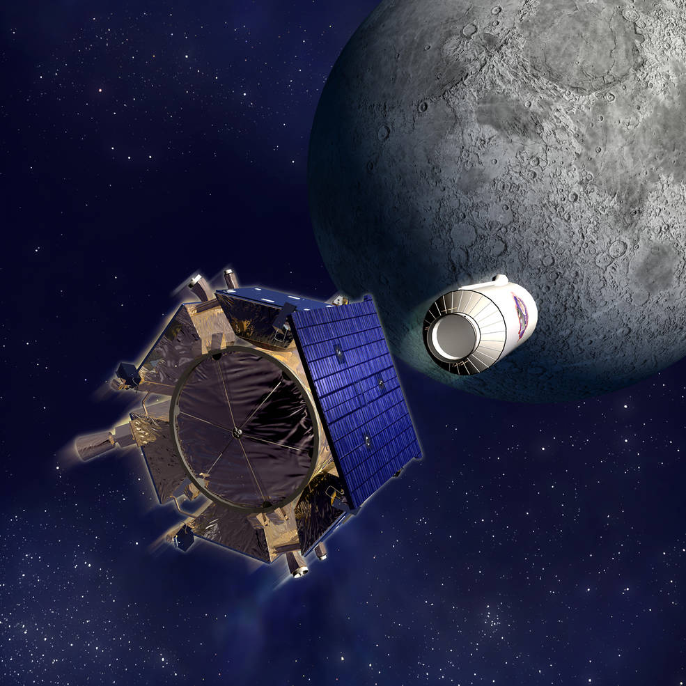
Left: Illustration of LRO in lunar orbit. Right: Illustration of LCROSS Shepherding Satellite at left and Centaur upper stage at right prior to lunar impact.
After a four-and-a-half-day journey from Earth, on June 23, 2009, LRO entered into an elliptical polar orbit around the Moon. Over the next four days, four engine burns refined the spacecraft’s orbit and engineers on the ground began commissioning its instruments. The LROC returned its first image of the Moon on June 30 of an area near the Mare Nubium. On Sept. 15, 2009, LRO began its primary one-year mission to map the lunar surface from its science orbit 31 miles above the Moon.
On Oct. 9, 2009, first the Centaur upper stage followed five minutes later by the LCROSS Shepherding Satellite crashed into the Moon’s Cabeus Crater near the lunar south pole. Although the plumes created were smaller than anticipated, instruments were able to detect signs of water in the ejected debris.
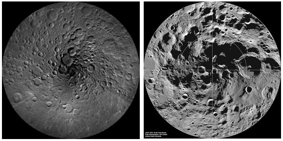
In September 2010, LRO completed its primary mapping mission and began an extended science mission around the Moon. On Dec. 17, NASA released the most detailed topographic map covering more than 98 percent of the Moon’s surface based on data from LRO’s LOLA instrument. The map continues to be updated as new data are received from the spacecraft. On March 15, 2011, LRO had made available more than 192 terabytes of data from LRO’s primary mission to its Planetary Data System, or PDS, to make the information available to researchers, students, media, and the general public. LRO continues to this day to deliver data to the PDS, having generated the largest volume of data from a NASA planetary science mission ever.
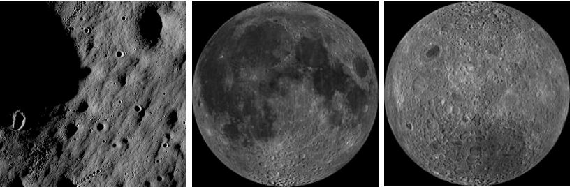
Right: Mosaic of images of the Moon’s far side.
The LCROSS data showed that the lunar soil within shadowy craters is rich in useful materials, such as hydrogen gas, ammonia and methane, which could be used to produce fuel for space missions. Large amounts of light metals, such as sodium, mercury and silver, were discovered. The data revealed that there is perhaps as much as hundreds of millions of tons of frozen water on the Moon, enough to make it an effective oasis for future explorers.
Thanks to its unique vantage point in a low altitude lunar orbit, LRO’s camera has been able to take remarkably detailed images of all six Apollo landing sites. The detail is such that not only can the Lunar Module (LM) descent stages be clearly identified, but disturbances of the lunar soil by the astronauts’ boots, the shadows of the American flag are visible at five of the landing sites, and the Lunar Rovers from the last three missions are even visible. The scientific instruments, and in at least three of the landing sites, the U.S. flag left by the astronauts can be discerned. The flag at the Apollo 11 site cannot be seen because it most likely was blown over by the exhaust of the LM’s ascent stage engine when the astronauts lifted off. In addition to the Apollo landing sites, LRO has also imaged crash and softlanding sites of other American, Soviet, Chinese, and Israeli spacecraft, including craters left by the deliberate impacts of the Apollo S-IVB upper stages. LRO also turned its camera Earthward to catch stunning Earthrise views, one image with Mars in the background, and the Moon’s shadow on the Earth during the total solar eclipse on Aug. 21, 2017.
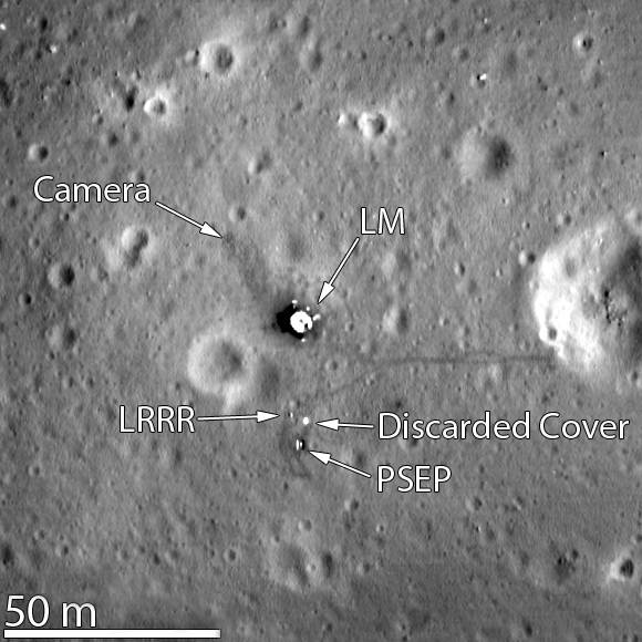
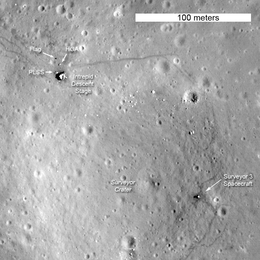
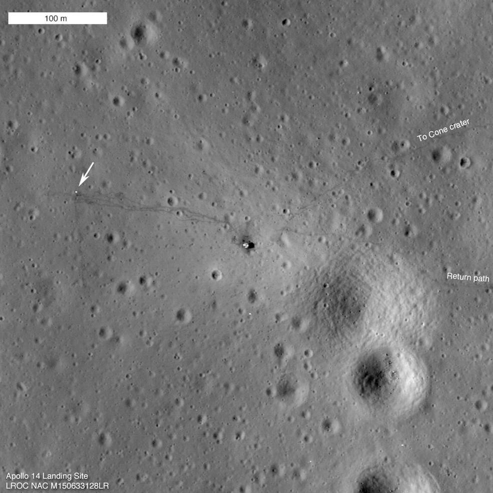
LRO images (left to right) of the Apollo 11, 12, and 14 landing sites.
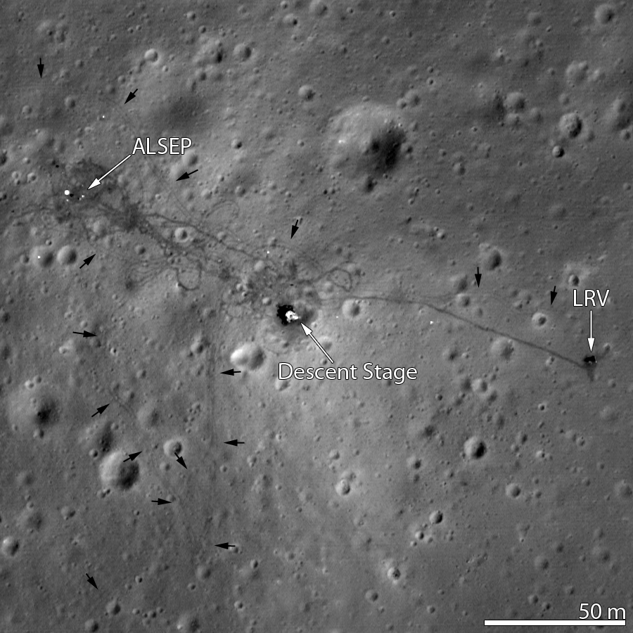
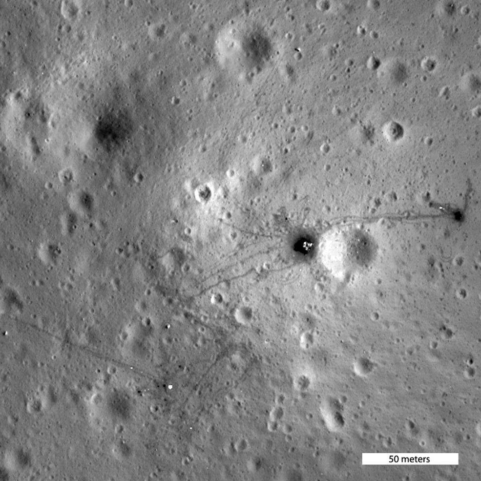
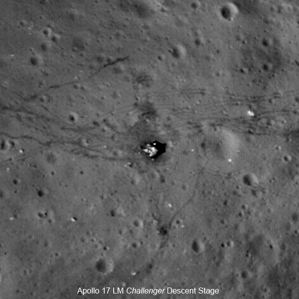
LRO images (left to right) of the Apollo 15, 16, and 17 landing sites.

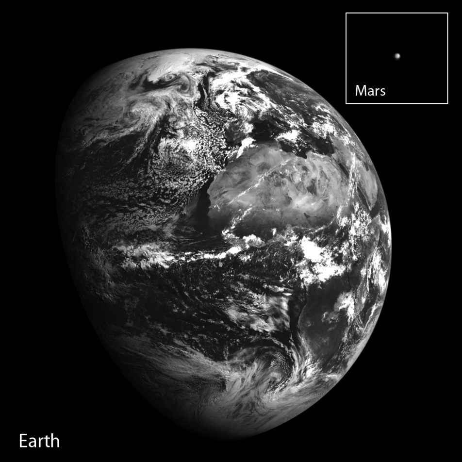
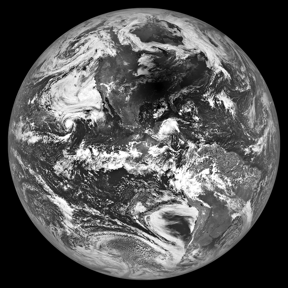
Left: LRO image of Earthirse over Compton Crater taken Oct. 12, 2015. Middle: LRO image of Earth and Mars taken Oct. 2, 2014. Right: LRO image of the total solar eclipse taken on Aug. 29, 2017.
The LRO mission continues with the spacecraft returning images and data from its instruments. It is estimated that at least six years’ worth of fuel remain on board LRO. The spacecraft could be in position to support new commercial lunar activities and possibly even the return of humans to the lunar surface.