CASA Work on Gulf Coast
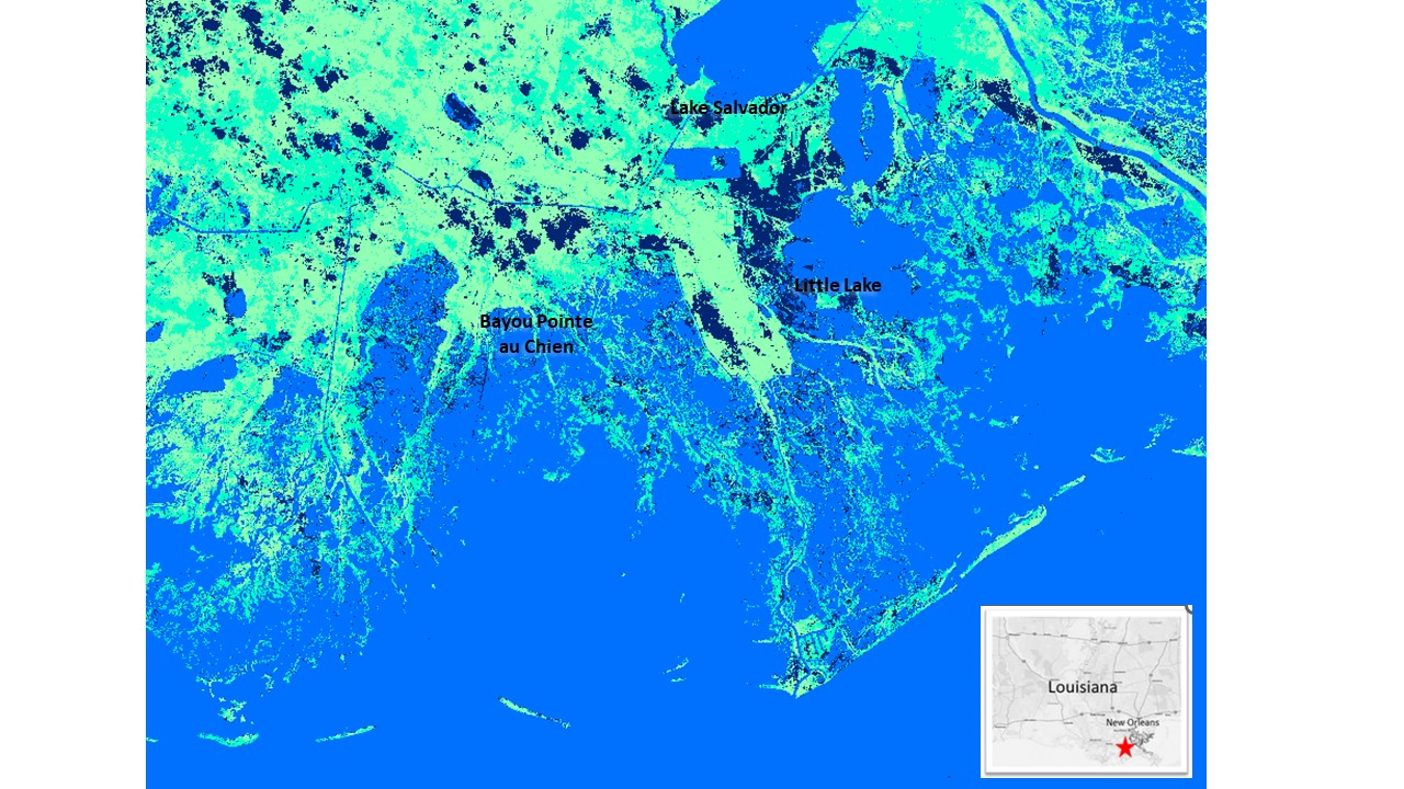
Map of wetland loss (dark blue pixels) across Barataria and Terrebonne Basins of coastal Louisiana detected by comparison of Landsat 8 NDWI images before and after the destructive storm surge of Hurricane Ida in August 2021. A total of 686 km² of wetland area was transformed to open water cover, more than twice the wetland area lost from Hurricane Katrina in 2005.
Potter, C. and Sukanna, T., 2023. Remote sensing of damage inflicted on coastal wetlands of southern Louisiana from tropical storms. Journal of Coastal Research,
(External Link): Remote Sensing of Damage Inflicted on Coastal Wetlands of Southern Louisiana from Tropical Storms (bioone.org)
Potter, C. and Amer, R., 2020. Mapping 30 years of change in the marshlands of Breton Sound basin (southeastern Louisiana, U.S.A.): Coastal land area and vegetation green cover. Journal of Coastal Research, 36(3), 437–450.
CASA Work in Alaska
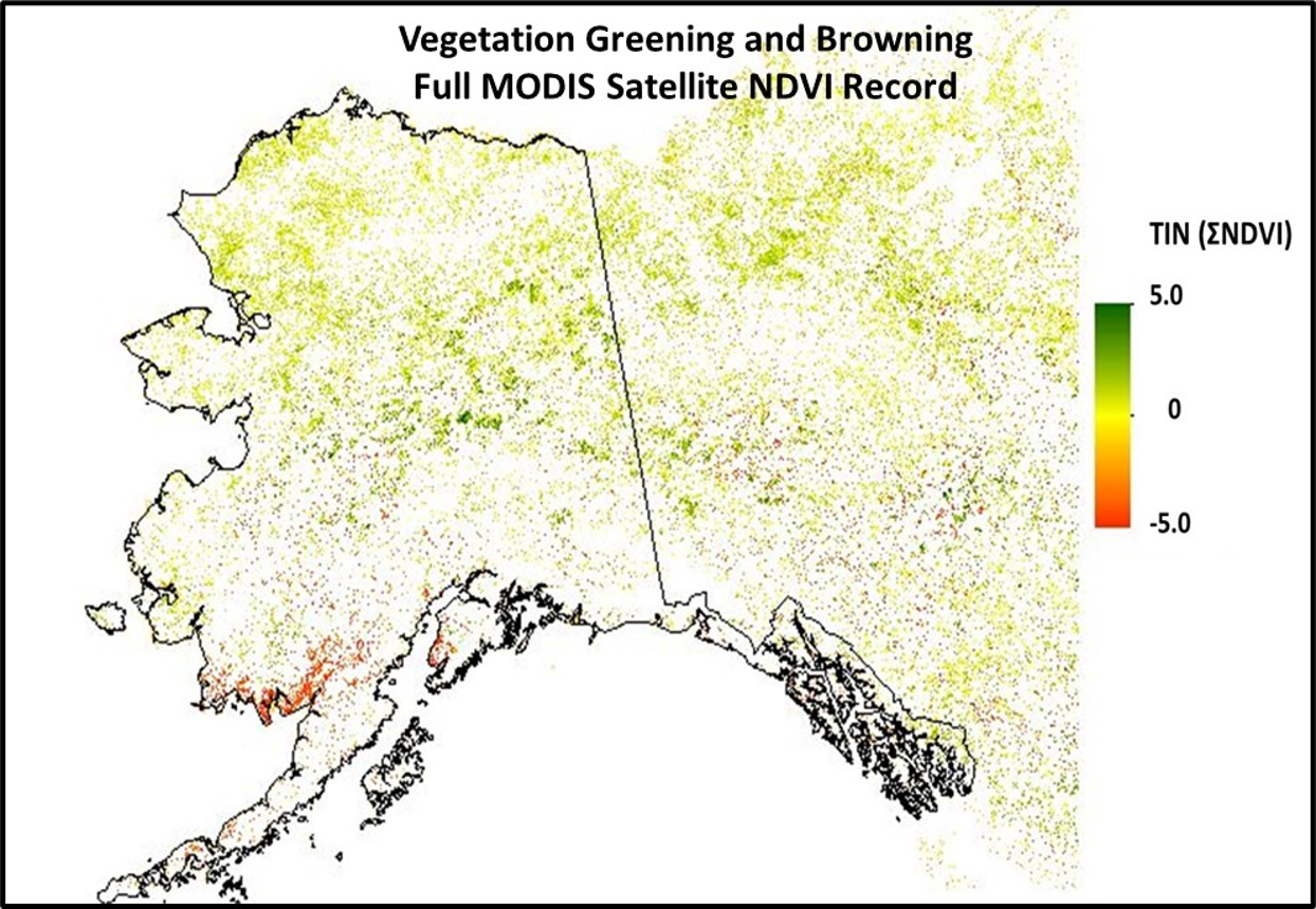
Over the past two decades, vegetation across Alaska has displayed many dramatic changes. But these patterns of greening and forest damage are complex, with plants and trees thriving in many parts of the state, while degenerating rapidly in others. The NASA-CASA team has been tracking these changes in all Alaskan ecosystems using NASA satellite imagery (e.g., Landsat), including the impacts of wildfires on carbon emissions.
Potter, C. and Alexander, O., 2020, Changes in Vegetation Phenology and Productivity in Alaska Over the Past Two Decades. Remote Sensing,12, 1546.
(External link): Remote Sensing | Free Full-Text | Changes in Vegetation Phenology and Productivity in Alaska Over the Past Two Decades (mdpi.com)
Potter, C.S., 2019, Changes in vegetation cover of the Arctic National Wildlife Refuge estimated from MODIS greenness trends. Earth Interactions, 23, 1–18.

