


![Request for Information – Potential [Placeholder for Prize]](https://assets.science.nasa.gov/dynamicimage/assets/science/psd/solar/2023/09/s/solarsystem_0.jpg?w=1024)


2020 Ames Earth Science Highlights
January 2020
| January 1 |
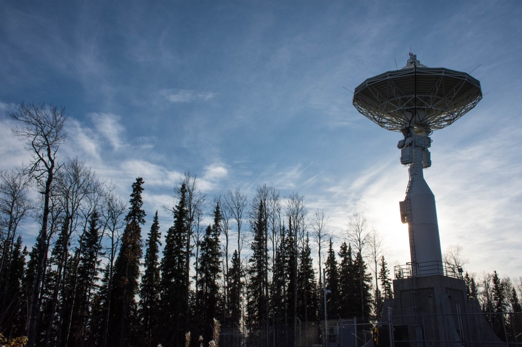
| S-MODE (Sub-Mesoscale Ocean Dynamics Experiment) – For this Earth-Venture Suborbital-3 (EVS-3) investigation managed by ESPO, four flights were successfully conducted with the NASA JPL (Jet Propulsion Laboratory) DopplerScatt payload on the AFRC B200 research aircraft during 2-13 December 2019 operating out of both ARC and AFRC. S-MODE examines the finer-scale variability in ocean-atmosphere exchange over the Pacific Ocean off the coast of Northern California important for weather and climate. |
| IMPACTS (Investigation of Microphysics and Precipitation for Atlantic Coast-Threatening Snowstorms) – The IMPACTS team is preparing the NASA P-3B and NASA ER-2 aircrafts for the first field campaign. The ER-2 is scheduled to transit to the deployment site on 15 January 2020. The ESPO team managing IMPACTS has deployed for pre-flight preparation at the two field sites. The chief objective of IMPACTS is to improve predictive capability for East Coast snowstorms. |
| CPEX-AW (Convective Processes EXperiment – Aerosols & Water) – ESPO completed a site visit during December 2019 to Cabo Verde in the Cape Verde Islands in support of CPEX-AW. As an update, due to an ongoing maintenance issue with the NASA DC-8 aircraft, the CPEX-AW field campaign will be performed using the NASA P-3B research aircraft. |
| ACCLIP (Asian Summer Monsoon Chemical and Climate Impact Project) – ESPO will conduct a site visit in January 2020 to Naha, Japan in support of the ACCLIP field study, planned for summer 2020 using the NASA WB-57 research aircraft. ACCLIP is a joint campaign with the NSF/NCAR Gulfstream-V to investigate the impacts of Asian pollution on global chemistry and climate associated with the Asian summer monsoon circulation. |
| January 15 |
| NASA HQ has approved a precursor activity for the Surface Biology and Geology (SBG) hyperspectral observing system to provide the scientific community with SBG-like data products from airborne and space-borne imaging spectroscopy missions, e.g., the HyspIRI airborne campaigns, DESIS, HISUI, and Hyperion. NASA Ames Research Center will play a foundational role in this effort by adapting its automated science processing operations developed for the Kepler and TESS exoplanet missions for the SBG precursor activity. This is a 5-7 year JPL-led effort with additional participation from Goddard Space Flight Center. SBG is a hyperspectral (VSWIR/NIR) observing system recommended in 2017 Earth Science Decadal Survey. It entered a two-year pre-phase A study in late 2018 and has an anticipated launch date in 2026-2027. |
| Earth Venture Suborbital 3 conducted a Media event at AFRC. All 5 EVS-3 projects were highlighted. The 3 ESPO managed projects are Investigation of Microphysics and Precipitation for Atlantic Coast-Threatening Snowstorms Science (IMPACTS), Sub-Mesoscale Ocean Dynamics Experiment (S-MODE) and Dynamics and Chemistry of the Summer Stratosphere Science (DCOTSS). The interviews can be seen at: https://www.youtube.com/watch?v=beeD3GRTkpQ&feature=share |
| IMPACTS (Investigation of Microphysics and Precipitation for Atlantic Coast-Threatening Snowstorms) – The P-3 is conducting the final test fights for science flights to begin January 17. The ER-2 has transited to Hunter AAF in Savannah Georgia and is preparing for science flights January 17. The ESPO teams have deployed to both sites and labs and offices are ready. The team successfully completed their Mission Readiness Review. The chief objective of IMPACTS is to improve predictive capability for East Coast snowstorms. |
| ACCLIP (Asian Summer Monsoon Chemical and Climate Impact Project) – Jhony Zavaleta and Erin Czech will conduct a site visit next week to Naha, Japan in support of the ACCLIP mission, planned for summer 2020 using the NASA WB-57. ACCLIP is a joint mission with the NSF/NCAR GV. ACCLIP is a joint campaign with the NSF/NCAR Gulfstream-V to investigate the impacts of Asian pollution on global chemistry and climate associated with the Asian summer monsoon circulation. |
| January 22 |
| Symposium on Earth Science and Applications from Space – Ryan Spackman represented Ames at the symposium in Washington, D.C. on 21 January 2020.The symposium will be held at the National Academy of Sciences Building Kavli Auditorium, 2101 Constitution Avenue NW, Washington, DC, from 8am to 7:30pm. Speakers include Marcia McNutt, Thomas Zurbuchen, Sandra Cauffman, Maurice Borgeaud, Chu Ishida, leading scientists, early career cutting-edge scientists, and more. |
| IMPACTS (Investigation of Microphysics and Precipitation for Atlantic Coast-Threatening Snowstorms) – The ER-2 transited to Hunter on 15 January 2020 and the P-3 completed its first science flight on Saturday, 18 January 2020 in a winter storm forecasted to impact the northeastern US. This week, IMPACTS is gearing up for a second science mission with the possibility of back to back flights in a forecasted storm to hit the Northeastern US on 25-26 January 2020. Both aircraft and teams are ready for operations. |
| ACCLIP (Asian Summer Monsoon Chemical and Climate Impact Project) – Jhony Zavaleta and Erin Czech will conduct a site visit next week to Naha, Japan in support of the ACCLIP mission, planned for summer 2020 using the NASA WB-57. ACCLIP is a joint mission with the NSF/NCAR GV. ACCLIP is a joint campaign with the NSF/NCAR Gulfstream-V to investigate the impacts of Asian pollution on global chemistry and climate associated with the Asian summer monsoon circulation. |
| FELDSPAR (Field Exploration and Life Detection Sampling for Planetary Analogue Research) project has been featured on the AGU GeoSpace. This project is studying the distribution of life in these harsh Icelandic environments to inform the search for hidden life signs on planets like Mars. Diana Gentry and the team presented their results last month at AGU’s Fall Meeting 2019 in San Francisco. |
| January 29 |
| IMPACTS (Investigation of Microphysics and Precipitation for Atlantic Coast-Threatening Snowstorms) – The NASA P-3 and ER-2 aircrafts have each flown 2 flights. They flew the first coordinated flight on 25 January 2020 over a storm in the Northeastern US. Scientists were able to collect a combined 13.4 hours of flight data in a bow tie pattern over the busy airspace in NY and Vermont. The chief objective of this Earth Venture Suborbital-3 (EVS-3) investigation managed by ESPO is to improve predictive capability for East Coast snowstorms. |
| ACCLIP (Asian Summer Monsoon Chemical and Climate Impact Project) – ESPO Project Managers Jhony Zavaleta and Erin Czech returned from a site visit to Okinawa, Japan in preparation for the ACCLIP field campaign in summer 2020. ACCLIP is a joint NASA/NSF campaign with the NASA WB-57F and NSF/NCAR Gulfstream-V aircrafts to investigate the impacts of Asian pollution on global chemistry and climate associated with the Asian summer monsoon circulation. |
February 2020
| February 1 |
| The NEX (NASA Earth Exchange) web portal has been replaced with a new web page. The old URL https://nex.nasa.gov automatically redirects to the new material at https://www.nasa.gov/nex. |
| ACCLIP (Asian Summer Monsoon Chemical and Climate Impact Project), 4-6 February 2020 – Rei Ueyama (meteorological forecasting), Jim Podolske and Laura Iraci (COMA instrument), Paul Bui (MMS), Jhony Zavaleta (ESPO), and Ryan Spackman (Division Chief) returned from a very productive ACCLIP Science Team meeting in Boulder last week. Ames has several important roles in this mission including meteorological forecasting for daily flight planning, in situ trace gas and meteorological measurements on board the NASA WB-57F aircraft, and campaign project management. ACCLIP is a joint NASA/NSF campaign with the NASA WB-57F and NSF/NCAR Gulfstream-V aircrafts to investigate the impacts of Asian pollution on global chemistry and climate associated with the Asian summer monsoon circulation to be based from Okinawa, Japan in August 2020. |
| IMPACTS (Investigation of Microphysics and Precipitation for Atlantic Coast-Threatening Snowstorms) – IMPACTS logged an additional 27.1 flight hours this week. The P-3 and ER-2 flew IMPACTS flight #4 over a winter storm system in the Midwest (Indiana, Illinois, Ohio) on 5 February 2020. They flew again the morning of 7 February 2020 over the state of New York. The chief objective of this Earth Venture Suborbital-3 (EVS-3) investigation managed by ESPO is to improve predictive capability for East Coast snowstorms. |
| ORACLES (ObseRvations of Aerosols above CLouds and their intEractionS) Science Team Meeting – Kristina Pistone, Samuel LeBlanc, Yohei Shinozuka, Stephen Broccardo, Michal Segal-Rosenheimer, Meloë Kacenelenbogen, James Podolske, Rei Ueyama and Ju-Mee Ryoo participated in the virtual ORACLES Science Team meeting on 12-14 May 2020. ORACLES is a five-year Earth Venture Suborbital-2 investigation (2015-2020) with three field campaigns with science and project management leadership at Ames. The science objective of ORACLES is to study key processes that determine the climate impacts of African biomass-burning aerosols. This is the last ORACLES Science Team meeting and addresses the outstanding investigation science questions and discusses future directions. |
| February 5 |
| ACCLIP (Asian Summer Monsoon Chemical and Climate Impact Project) – Rei Ueyama (meteorological forecasting), Jim Podolske and Laura Iraci (COMA instrument), Paul Bui (MMS), Jhony Zavaleta (ESPO), and Ryan Spackman (Division Chief) are attending the science team meeting at National Center for Atmospheric Research (NCAR) in Boulder, CO. Ames has several important roles in this mission including meteorological forecasting for daily flight planning, in situ trace gas and meteorological measurements on board the NASA WB-57F aircraft, and campaign project management. ACCLIP is a joint NASA/NSF campaign with the NASA WB-57F and NSF/NCAR Gulfstream-V aircrafts to investigate the impacts of Asian pollution on global chemistry and climate associated with the Asian summer monsoon circulation to be based from Okinawa, Japan in August 2020. |
| IMPACTS (Investigation of Microphysics and Precipitation for Atlantic Coast-Threatening Snowstorms) – The NOAA P-3 and ER-2 flew IMPACTS flight #3 in the early morning of 1 February 2020 over a developing low pressure system off the coast of North Carolina. The project achieved an underflight of the GPM (Global Precipitation Measurement) satellite, with GOES-16 Mesoscale-2 Sector images available. Later this week, the project may fly science flights over northern Pennsylvania and southern New York, across an elongated trough and precipitation region. The chief objective of this Earth Venture Suborbital-3 (EVS-3) investigation managed by ESPO is to improve predictive capability for East Coast snowstorms. |
| February 19 |
| IMPACTS (Investigation of Microphysics and Precipitation for Atlantic Coast-Threatening Snowstorms) – The P-3 flew an additional two flights this week for IMPACTS. The first flight took place very early on February 13 over the state of New York and lasted 6.7 hours. The second, over New England, was flown on February 18 and lasted 5 hours. The P-3 is prepping today, February 20, to fly a winter storm system over North Carolina and southern Virginia. |
| Don Sullivan appointed as Chairman of INCITS/L1, Geographic Information Systems (GIS) Donald Sullivan was appointed for his first term as Chairman of INCITS/L1, GIS, by majority vote of INCITS. Donald Sullivan’s first term begins immediately and will expire in February 2023. INCITS is the InterNational Committee for Information Technology Standards. The work of L1, GIS consists of adopting or adapting information technology standards and developing digital geographic data standards. This technical committee is the U.S. Technical Advisory Group (TAG) to the International Organization for Standardization (ISO) Technical Committee (TC) 211 (ISO/TC 211). ISO/TC 211 – Geographic information/Geomatics aims to establish a structured set of standards for information concerning objects or phenomena that are directly or indirectly associated with a location relative to the Earth. Donald Sullivan will be the head of the U.S. Delegation to ISO/TC 211 meetings. |
| NASA Earth Observatory features Ames’ NASA Earth Exchange review paper in Nature. A recent review paper in Nature Reviews which including Ames Earth Science authors Rama Nemani and Taejin Park from the NASA Earth Exchange (NEX) has been featured on NASA’s Earth Observatory. |
| February 26 |
| IMPACTS (Investigation of Microphysics and Precipitation for Atlantic Coast-Threatening Snowstorms) – The chief objective of this Earth Venture Suborbital-3 (EVS-3) investigation managed by ESPO is to improve predictive capability for East Coast snowstorms. IMPACTS completed two more flights this week using the NASA P-3. These flights sampled the warm sector of a low-pressure system over the North Atlantic coast, and a strong system with elevated convection and wave features over North Carolina. This second system dropped 1-5 inches in the study area. On 25 February 2020 both the ER-2 and P-3 will be sampling a developing system over the Northern Illinois area. The P-3 flew to Wright-Patterson AFB on Monday to be better positioned to sample this storm. |
| Designated Observables Down-select Strategy Meeting – Ryan Spackman, Ian Brosnan, and Anh Nguyen attended the Designated Observables Down-select Strategy Meeting at NASA Headquarters on February 26th. The purpose of the meeting was for HQ to define for the study teams how the architectures presented to HQ would be winnowed to a final selection and discuss what products the teams should prepare for HQ. The first team to submit architectures will be The Surface Biology and Geology team at the end of FY20. |
March 2020
| March 1 |
| NeMO-NET (The Neural Multi-Modal Observation & Training Network for Global Coral Reef Assessment) – Last week, the NeMO-Net team hosted renowned oceanographer Dr Sylvia Earle at the NASA Ames Research Center. Dr. Earle was named “Hero of the Planet” in 1998 by Time Magazine former NOAA Chief Scientist and has been a very strong advocate for the conservation of the oceans worldwide. Through her NGO, Mission Blue, Dr. Earle has been collaborating with NeMO-Net and past projects. This time she was updated on the progress of the project and also recorded a series of educational video clips that will be part of NeMO-Net’s app field guide for coral identification and reefs characterization. |
| IMPACTS (Investigation of Microphysics and Precipitation for Atlantic Coast-Threatening Snowstorms) – The deployment was successfully completed at the end of February. The instrument de-integration and equipment return to AFRC was completed this week. The IMPACTS team is scheduled to hold a science meeting in late July at the University of Washington in Seattle. The team reconvenes in ~ 9 months for deployment #2 in winter 2020-21. The chief objective of this Earth Venture Suborbital-3 (EVS-3) investigation managed by ESPO is to improve predictive capability for East Coast snowstorms. |
| EXPORTS (the EXport Processes in the Ocean from RemoTe Sensing) – This ocean-borne field campaign has been deemed mission critical so ESPO is at the Woods Hole Oceanographic Institute (WHOI) shipping critical equipment for the two research vessels to sail in the North Atlantic in April. EXPORTS is a large-scale NASA-led field campaign that will provide critical information for quantifying the export and fate of upper ocean net primary productivity using satellite observations and state-of-the-art ocean technologies. |
| March 4 |
| IMPACTS (Investigation of Microphysics and Precipitation for Atlantic Coast-Threatening Snowstorms) – The chief objective of this Earth Venture Suborbital-3 (EVS-3) investigation managed by ESPO is to improve predictive capability for East Coast snowstorms. The IMPACTS 2020 deployment was completed on 29 February 2020 and the ER-2 returned to Palmdale on 2 March 2020. The team flew 61.3 hours on the P-3 and 62.6 hours with the ER-2, over storms in the Midwest, the Northeast, and the South. It was a very successful deployment, even with a low number of suitable winter storms. The team achieved coordinated P-3/ER-2 flights in the congested airspace of the Eastern US. The IMPACTS team is scheduled to hold a science meeting in late July at the University of Washington in Seattle. The team reconvenes in ~ 9 months for deployment #2 in winter 2020-21. |
| Surface Deformation and Change (SDC) Study – As a part of the SDC Study, Ames Research Center (ARC) recently completed a flight dynamics cross-calibration study with Langley Research Center (LaRC). The purpose of this study was to determine the coverage and revisit rate of several potential SDC architectures while ensuring that LaRC and ARC converged on identical assumptions and definitions for future independent flight dynamics studies. This ensures a consistent approach to future studies that the SDC team will request from ARC or LaRC. SDC is a space-based synthetic aperture radars observing system identified in the 2017 Earth Science Decadal Survey. It entered a multi-Center, JPL-led five-year pre-phase A study in late 2018. |
| March 18 |
| Satellite Observations Aid Bison Management – The Earth Observatory at the EOS Project Science Office (GSFC) has posted a feature story on the new publication by Christopher Potter (SGE) in the journal Landscape Ecology that has shown a strong linkage between the effects of climate change, the productivity of grasslands, and the proliferation of bison in Yellowstone National Park. This study, using two decades of MODIS satellite data, showed that the annual period of vegetation growth has been getting longer on the winter range of Yellowstone National Park, likely due to the decreasing severity of winters and warming average temperatures. (NASA Earth Observatory image by Joshua Stevens, using data from Potter, C. (2020). |
| March 25 |
| NASA Science – As an outcome from Applied Science initiatives at Ames, a feature article was posted to the NASA Science website on 20 March 2020 highlighting the project partner, Carlee McClellan, from the Western Water Applications Office (WWAO) Navajo Drought project. This human-interest piece chronicles Carlee’s life and career path alongside the current partnerships with NASA (PI Amber McCullum) and the Desert Research Institute (collaborators Justin Huntington and Britta Daudert). The article was also featured on NASAEarth’s Twitter page for World Water Day (22 March 2020). |
April 2020
| April 1 |
| NeMO-Net, the award-winning benthic habitat mapping citizen science virtual game environment, is scheduled for public launch on Earth Day, April 22, 2020. NeMO-Net is a product of Ved Chirayath’s group in the Ames Earth Science Division, and will be covered by NASA Science Live TV on launch day. A special feature by NASA Ames will be released April 9, followed by an interview with Science Magazine. |
| April 8 |
| Introductory Webinar: Using the UN Biodiversity Lab to Support National Conservation and Sustainable Development Goals – Applied Remote Sensing Training (ARSET), an Applied Sciences program in Earth Science, held the webinar on 24 March, 31 March, and 7 April 2020. Live sessions with Q&A were offered in English, Spanish, and for the first time French. These sessions combined netted a record-breaking 1,700 online participants from over 125 countries and 1,000 unique organizations. This introductory-level training came as the result of a collaboration between ARSET and the UN Development Programme (UNDP) and trains participants on the use of the new UN Biodiversity Lab (https://www.unbiodiversitylab.org/) interface in relation to conservation goals. The training was led by Amber McCullum (ARC) and Juan Torres-Pérez (ARC), and was supported by Brock Blevins (GSFC), Selwyn Hudson-Odoi (GSFC), Ana Prados (GSFC), David Barbato (GSFC), and Jonathan O’Brien (GSFC). |
| The Swift Engineering Ultra Long Endurance UAS (SULE) is ready to fly. SULE is a prototype high-altitude long-endurance aircraft funded by NASA SBIR and managed at Ames, has conducted final ground check-outs and is ready to fly at the New Mexico Space Port as soon as travel restrictions are lifted. The first test will be a low-altitude check-out flight below 5000 ft. The second flight will demonstrate high-altitude operations with a 2-U cubesat developed at Ames. This vehicle will enable 30+ day earth observing missions to complement geostationary imagers while also enabling atmospheric sampling. POC: Matt Fladeland. |
| An April 9, 2020 NASA press release on NeMO-Net calls on “Gamers, Citizen Scientists to Help Map World’s Corals”. NeMO-Net is scheduled for public launch on Earth Day, April 22, 2020. In this award-winning benthic habitat mapping citizen science virtual game environment, NASA invites the public to embark on virtual ocean research expeditions to help map coral reefs around the world to better understand these threatened ecosystems. NASA has 3D images of the ocean floor, including corals, algae and seagrass, but the data alone do not tell the whole story of what’s happening to the corals beneath the waves. NASA asks the players to virtually “dive” to the Earth’s coral reefs within NeMO-Net, to help train NASA’s Pleiades supercomputer at Ames to recognize corals from any image of the ocean floor based on coral classifications players make by hand. NeMO-Net is a product of Ved Chirayath’s group in the Ames Earth Science Division and will be covered by NASA Science Live TV on launch day, and an interview with Science Magazine is scheduled. NeMO-Net is funded by the AIST program, and will be available for multiple platforms. |
| April 15 |
| NeMO-Net calls on “Gamers, Citizen Scientists to Help Map World’s Corals” – and thousands respond around the globe. The April 9, 2020 NASA press release resulted in intense media coverage world-wide (over 30 articles in ~20 languages), ~9,500 app downloads, and over 10,000 transects have already been classified in this first week alone. In this award-winning benthic habitat mapping citizen science virtual game environment, NASA invites the public to embark on virtual ocean research expeditions to help map coral reefs around the world to better understand these threatened ecosystems. NASA has 3D images of the ocean floor, including corals, algae and seagrass, but the data alone do not tell the whole story of what’s happening to the corals beneath the waves. NASA asks the players to virtually “dive” to the Earth’s coral reefs within NeMO-Net, to help train NASA’s Pleiades supercomputer at Ames to recognize corals from any image of the ocean floor based on coral classifications players make by hand. NeMO-Net is a product of Ved Chirayath’s group in the Ames Earth Science Division NeMO-Net is funded by the AIST program and is available for multiple platforms. NeMO-Net is scheduled for public launch on Earth Day, April 22, 2020. It will be covered by NASA Science Live TV on launch day, and an interview with Science Magazine is scheduled. |
| April 22 |
| NASA Live coverage: Earth Day (50th anniversary) on 22 April 2020: NeMO-Net Launch. NASA Administrator Jim Bridenstine was joined by Ames Earth Science Division’s Ved Chirayath for the official Launch of NeMO-Net. NeMO-Net Is an award-winning benthic habitat mapping citizen science virtual game environment, NASA invites the public to embark on virtual ocean research expeditions to help map coral reefs around the world to better understand these threatened ecosystems. NASA has 3D images of the ocean floor, including corals, algae and seagrass, but the data alone do not tell the whole story of what’s happening to the corals beneath the waves. NASA asks the players to virtually “dive” to the Earth’s coral reefs within NeMO-Net, to help train NASA’s Pleiades supercomputer at Ames to recognize corals from any image of the ocean floor based on coral classifications players make by hand. NeMO-Net is a product of Ved Chirayath’s group in the Ames Earth Science Division. NeMO-Net is funded by the AIST program and is available for multiple platforms. |
| The Western Water Applications Office (WWAO) Navajo Drought project was featured as the image of the day on the Earth Observatory website on Monday 4/20/2020. This includes multiple images and a brief story about the project and relevance to Applied Sciences. |
| April 29 |
| NASA NeMO-Net called on Citizen Scientists around the world to help map the world’s corals – thousands responded. NeMO-Net, launched on 22 April 2020 for the 50th anniversary of Earth Day, is an award-winning benthic habitat mapping citizen science virtual game environment, NASA invites the public to embark on virtual ocean research expeditions to help map coral reefs around the world to better understand these threatened ecosystems. NASA has 3D images of the ocean floor, including corals, algae and seagrass, but the data alone do not tell the whole story of what’s happening to the corals beneath the waves. NASA asks the players to virtually “dive” to the Earth’s coral reefs within NeMO-Net, to help train NASA’s Pleiades supercomputer at Ames to recognize corals from any image of the ocean floor based on coral classifications players make by hand. NeMO-Net is a product of Ved Chirayath’s group in the Ames Earth Science Division. NeMO-Net is funded by the AIST program and is available for multiple platforms. The initial release saw almost 30,000 segments classified by almost 21,000 users, followed by an additional 12,500 on Earth Day alone by almost 4,000 users. Users are dominantly from the U.S., Canada, the U.K., Singapore, and Germany. |
| Joint NASA/USGS Postdoctoral fellows Drs. Liz Carter and Dan Griffith presented their work to a combined NASA and USGS Headquarters audience during a virtual ‘brown-bag’ held on 21 April 2020 – More than fifty people attended, including USGS’ Senior Science Advisor Dr. Geoff Plumlee, NASA SMD’s Assistant Deputy Associate Administrator for Management Dan Woods, and NASA Earth Science Acting Division Director Sandra Cauffman. Several science program managers have subsequently reached out to Dan and Liz to learn more about their work and discuss future opportunities. The titles of their talks were Advancing Ecosystem Science with Phylogeny and Remote Sensing of Functional Diversity (Dr. Dan Griffith), and Automatic Satellite-Based Flood Detection (Dr. Liz Carter). |
May 2020
| May 1 |
| Forest Mapping and Monitoring with SAR Data – The ARSET webinar series began this week. This four-part training, with sessions on 12, 14, 19 and 21 May is being offered by Amber McCullum and Juan Torres-Perez in collaboration with Erika Podest (JPL) and Sean McCartney (GSFC). This is the first training offered by our Land Management team focused on SAR data and will highlight the advantages of SAR data, especially in cloud-prone tropical forests. This advanced webinar series will introduce participants to 1) SAR time series analysis of forest change using Google Earth Engine (GEE), 2) land cover classification with radar and optical data with GEE, 3) mapping mangroves with SAR, and 4) forest stand height estimation with SAR. Each session includes a background presentation and a hands-on guided exercise for accessing and analyzing Sentinel-1 and Landsat data. The training will be presented live in both English and Spanish and has over 1,900 participants registered globally. |
| USGS/NASA mission passes AFSRB – The USGS volcano monitoring sUAS gas sensing flight mission at Makushin Volcan (Amaknak Island, Alaska) using a Black Swift Technologies LLC (Boulder CO) SBIR sUAS product, with airborne operations managed at NASA Ames (Matt Fladeland), has passed its AFSRB (Airworthiness and Flight Safety Review Board) review with flying colors on May 7th, 2020. The next step will be a site visit, before the FRR (Flight Readiness Review). The Blackswift S2 was developed by Black Swift as an SBIR investment with JPL supervision, and was reconfigured to accommodate gas payloads on volcanoes and renamed during an EVS-3 preparatory flight under scientific leadership by Ames Earth Science division deputy and volcanologist Florian Schwandner while he was still at JPL, and ecologist Josh Fisher (JPL). |
| Pandora is now streaming live data – A new Pandora instrument, #34 of the Pandora Project, was installed a few months ago on the roof of building N245 as part of our existing live automated atmospheric measurement instrument suite. Our Pandora instrument now has an active live stream into the international Pandora data network, called Pandonia Global Network (PNG)– both raw and processed data are available with a one-day processing lag. Pandora is a compact, modestly-priced sun/sky/lunar passive UV/Visible grating spectrometer system similar to the older and simpler NOVAC network of instruments. The Pandora initiative started in 2005 and is a NASA-ESA collaboration for Satellite validation of atmospheric gas measurements. Earth Venture Instruments (EVI) and Earth Venture Suborbitals (EVS) have made use of the the Pandora instrument network for the purposes of validation and verification, including DISCOVER-AQ. |
| May 6 |
| ORACLES (ObseRvations of Aerosols above CLouds and their intEractionS) Science Team Meeting – Kristina Pistone, Samuel LeBlanc, Yohei Shinozuka, Stephen Broccardo, Michal Segal-Rosenheimer, Meloë Kacenelenbogen, James Podolske, Rei Ueyama and Ju-Mee Ryoo will be participating in the virtual ORACLES Science Team meeting on 12-14 May 2020. ORACLES is a five-year investigation (2015-2020) with three Intensive Observation Periods (IOP) designed to study key processes that determine the climate impacts of African biomass-burning aerosols. This will be the last ORACLES Science Team meeting. |
| May 20 |
| ORACLES (ObseRvations of Aerosols above CLouds and their intEractionS) Science Team Meeting – Earth Science Project Office (ESPO) hosted the ORACLES Science Team Meeting / Southeast Atlantic Workshop last week, 12 – 14 May. 122 participants met via Webex from locations ranging from Hawaii to Israel, a 13-hour time zone span. ORACLES is a five-year Earth Venture Suborbital-2 investigation (2015-2020) with three field campaigns with science and project management leadership at Ames. The science objective of ORACLES is to study key processes that determine the climate impacts of African biomass-burning aerosols. This was the last ORACLES Science Team meeting and addressed the outstanding investigation science questions and discusses future directions. Content included results from several projects based in the southeast Atlantic Ocean: ORACLES, CLARIFY, AEROCLO-sA and LASIC. Participants connected from Europe, Africa, and the US. The meeting was originally planned for a venue at the University of Miami but was changed to remote format due to COVID19 restrictions. The agenda was very compressed to accommodate the variety of time zones, but the meeting was completed successfully and materials have been shared among participants. |
| May 27 |
| The Earth Science Project Office (ESPO) has published a video to illustrate their essential contributions to airborne science at NASA. ESPO manages Earth science field campaigns for the agency at deployment sites around the globe. They provide planning, implementation and post-mission support for large, complex, multi-agency, national and international field campaigns, with over 50 missions under their belt to date, since 1987. |
| NASA Western Water Applications Office (WWAO) – Amber McCullum appointed WWAO Impact and Transition Lead – Dr. Mccullum has been appointed to this new role, significantly adding to the Ames footprint in the WWAO leadership team (F. Melton, L. Johnson, F. Schwandner, M. Fladeland). As the WWAO Impact and Transition Lead, she will coordinate with project leads and the WWAO program office to assess, characterize, and communicate the benefits of project outcomes to people and the environment. This will include facilitating a community of practice around research to operations through a series of workshops and strategies for the successful transition of project applications to the public or private sector. This role will also engage more broadly with the Applied Sciences and Capacity Building Programs to facilitate collaboration and to connect research with the stakeholder community. |
| Aquatics Cross Mission Coordination Team for PACE, GLIMR, and SBG – Liane Guild was invited to join this newly formed team supporting cross-mission synergies and benefits for the planned NASA Plankton, Aerosol, Cloud and ocean Ecosystem (PACE), Geostationary Littoral Imaging and Monitoring Radiometer (GLIMR), and Surface Biology and Geology (SBG) missions. She is representing the aquatics efforts of SBG with Kevin Turpie (GSFC) and as co-chair of the international Aquatics Study Group that supports SBG and that previously supported the Hyperspectral Infrared Imager (HyspIRI) mission study. The charter of the Coordination Team is to identify shareable resources, mutually beneficial opportunities, overlapping activities and find ways to synergize efforts across aquatic missions in order to reduce risk, save cost and better our support of the research and applications needs of the aquatic remote sensing communities. |
June 2020
| June 1 |
| Florian Schwandner was featured in an article on interdisciplinary science in the Washington Post on 8 June 2020. The article describes a field experiment at Rincón de la Vieja volcano in Costa Rica as part of a multi-year cross-disciplinary initiative originally conceived by Schwandner in 2016, and co-led by him together with JPL PI Josh Fisher. This multi-center initiative with US and international partners in Costa Rica and Canada explores how climate change, tropical ecology and volcanology can come together to solve some of the most pressing scientific challenges of our time, including how the tropical terrestrial biomass will respond to more intense CO2 exposure 50-200 years from now. This proposed natural experiment dubbed ELEVATE (Enhanced Levels of Emissions in Volcanically Active Tropical Ecosystems) provides a window into the future by making use of natural and continuous cold volcanic CO2 gas seeps flooding the forests on the slopes of tropical volcanoes to simulate future conditions. |
| June 4 |
| 2020 Interns are arriving virtually – Intern onboarding is in full swing; examples of the exciting projects commencing include: The 2020 Summer DEVELOP team at Ames starts their 10-week term on 1 June; they are partnering with the Nature Conservancy’s Washington State Chapter and the Puget Sound Clean Air Agency to assess impacts of wildfire smoke on surrounding air quality in the Pacific Northwest over the last two decades. This project will integrate MODIS, VIIRS, CALIPSO, and Sentinel-5P data to map wildfire emissions over time and create a web-based tool to visualize air quality data across the study area, where on-the-ground sensors can be geographically sparse. The Center for Applied Atmospheric Research and Education (CAARE) summer internships kicked off this week with six interns starting on 1 June and with four to start on 15 June. These interns are working in an all virtual environment with many SG researchers on projects related to science communication, methane emissions, coral reef health, air quality, atmospheric rivers, snowpack and drought monitoring. These students are mentored by scientists across the Earth Science Division. |
| The Earth Science Project Office (ESPO) hosted the virtual meetings for the PBL (Planetary Boundary Layer) Decadal Workshop on the mornings of 19, 20, 26 and 27 May by using Webex Events. The meeting was initially planned to be held in Maryland but due to travel restrictions was converted to a 100% remote meeting. The workshop garnered interest from over 270 people and had up to 195 concurrent attendees, spanning 9 time zones. The workshop included 30 invited talks, 49 lightning talks as well as lively question and answer sessions with raised hands for audio in addition to online questions/answers. |
| Applied Sciences – Forrest Melton is presenting on remote sensing of cover crops to program officers of the Walton Family Foundation on 4 June. |
| June 17 |
| High-Altitude Long-Endurance UAS Partnership with US Forest Service through NASA SBIR Phase IIE – The Ames Office of Airborne Science within the Earth Science Division supports the Airborne Science Program (ASP) with new technology infusion to enable new observations. The High-Altitude Long-Endurance (HALE) UAS capability assessment project (PI: Matt Fladeland) has just secured a $1M+ partnership with the USFS to demonstrate the capability of the newly developed Swift Ultra Long Endurance UAS, a NASA Small Business Innovative Research Phase II project to build and demonstrate a 30+ day endurance aircraft. The USFS plans to deploy a variety of cameras in the visible, shortwave, and longwave infrared coupled with onboard processing and high-speed telemetry to demonstrate real-time fire observations. Swift Engineering (PI: Andrew Streett) has submitted a Phase IIE proposal to NASA that might provide up to $375K in matching funding for this effort. NASA matching funding will explore integration of payloads to support radiation measurements, magnetic fields, and imaging spectroscopy, in coordination with several NASA, DOE, and USGS teams. NASA Earth Science has worked closely with Mike Stewart to develop an Interagency Agreement to enable his office to support USFS with Airworthiness and Flight Safety Reviews, as well as Certificate of Authorization (COA) development. The flights are scheduled to take place in June 2021. |
| June 24 |
| 2020 Ames NASA Honor Awards – Ten awards were received across the Earth Science Division and its collaborative organizations, testifying to the outstanding achievements and hard work our staff is doing to advance NASA’s mission. An awards ceremony is being planned; it may be virtual given COVID-19 related constraints. |
July 2020
| July 1 |
| OpenET Briefings to Congressional Staff – Forrest Melton provided briefings on OpenET for the offices of Sen. Feinstein (8 June) and Sen. Harris (16 June). The one hour briefings were organized by the Desert Research Institute. Briefings covered uses of OpenET data, NASA contributions to scientific and technical advances, the need for a shared basis for decision making, and collaboration between OpenET and the USGS Water Availability and Use Science Program. These briefings could potentially generate congressional interest and support to sustain these programs. |
| The ARSET (Applied Remote SEnsing Training) webinar series, Understanding Phenology with Remote Sensing, began this week on 30 June 2020 – This three-part training, with sessions on 30 June, 7 and 14 July, is offered by Amber McCullum and Juan Torres-Pérez. The training has over 1,700 participants registered globally. Phenological patterns and processes can vary greatly across a range of spatial and temporal scales and can provide insights about ecological processes like invasive species encroachment, drought, wildlife habitat, and wildfire potential. This training will highlight NASA-funded tools to observe and study phenology across a range of scales. Attendees will be exposed to the latest in phenological observatory networks and science, and how these observations relate to ecosystem services, the carbon cycle, biodiversity, and conservation. |
| July 8 |
| SBIR-funded Swift HALE (high-altitude long-endurance) UAS takes to the skies for the first time – The Swift Engineering solar-electric UAS, designed to fly for 30+ days at 65,000 ft altitude, conducted its first, low-altitude flight test at SpacePort America in New Mexico on 7 July 2020. This is the first in a series of tests to validate the aircraft design and operational envelope. This effort, funded by a NASA SBIR Phase II grant, is part of a HALE capability demonstration project supported by the SMD Airborne Science Program (PI Matt Fladeland). The project team is grateful for support from the NASA Ames Flight Operations Division and Safety and Mission Assurance Directorate whose staff provided oversight through Airworthiness and Flight Safety Review and Flight Readiness Review. The Ames Spectrum Office also assisted with frequency approvals. |
| National Academies Consensus Study on the Future Use of Airborne Platforms to Advance Earth Science Priorities – The Ames Airborne Science Program Office and Earth Science Project Office assisted in responding to a data-call from the ongoing study. Ames responded with reports and analyses of past airborne science missions as well as flight tracks and statistics from the Science Operations Flight Request system (SOFRS) as well as the Mission Tools Suite (MTS). Both software systems were developed and are operated by Ames in the Earth Science and Intelligent Systems Divisions, respectively. |
| All three S1.08 2020 Phase I SBIR proposals assigned to Ames Earth Science were selected for funding. S1.08-4948: Angstrom: An Imaging Star Photometer. Company: Innovative Imaging and Research Corporation (Stennis Space Center, MS). S1.08-5149: Two-Channel, Fast Time-Response CAPS NOx Monitor. Company: Aerodyne Research, Inc. (Billerica, MA). S1.08-6396: Return Glider for High Altitude Sampling Systems. Company: Delta Zee Solutions (Tucson, AZ). |
| July 15 |
| Amber McCullum participated as a panel speaker and representative for NASA’s Indigenous Peoples Capacity Building Program at the United Nations High-level Political Forum on Sustainable Development side event—Indigenous Peoples-led Use of Earth Observations—held virtually on 9 July 2020. During this event, a panel of experts discussed key challenges and opportunities for inclusive engagement of indigenous peoples to advance the use, application, and co-development of tools that use Earth Observations for conservation, land management, and sustainable development. Contributors to this event included indigenous leaders from around the world, the Group on Earth Observations (GEO) Secretariat, members of the GEO Indigenous Alliance, and international non-governmental organizations such as Conservation International. |
| COVID-19 Response – Chris Potter (SGE) was funded by SMD’s ESD to investigate Impacts of Bay Area Shelter-in-Place during COVID-19 on urban surface heat fluxes – Chris Potter leads this study with collaborator Glynn Hulley (JPL) to investigate how the absence of worker activities during shelter-in-place has altered the infrared heat flux from parking lots, highways, and large industrial buildings. The lead hypothesis is that this may be caused mainly by quantitative changes in the surface reflective properties (including brightness) in these different classes of non-vegetated urban features. Two more proposal teams from the division are still pending. The division had actively responded to this short-fuse Announcement of Opportunity– Rapid Response to the COVID-19 Pandemic (ROSES2020, A.28). Several submitted concepts had received a go-ahead from HQ for a full proposal, and three full proposals have been submitted. The Biospheric Science Branch (Code SGE) together with Codes TI, D, and the GeneLab project (Code SCR) are also exploring analytical capabilities of environmental factors in collaboration with the NASA Earth Exchange (NEX). |
| July 22 |
| During late June and early July, Forrest Melton provided briefings on OpenET (etdata.org) for the offices of Sen. Harris, Sen. Feinstein, the Director of the Western Governors’ Association, and staff for the House Natural Resources Subcommittee on Water, Oceans and Wildlife – Briefings were organized by the Desert Research Institute and the Environmental Defense Fund, and focused on the development of a new, operational system for satellite mapping evapotranspiration and consumptive use across the western U.S. All staff spent at least one hour with the team and provided positive feedback and clear statements of support for the effort and the proposed partnership with USGS for long-term support. The OpenET platform was released to 140 water management partners on July 10 for testing and review. The public launch is scheduled in early 2021. |
| July 29 |
| Jim Bridenstine: NASA Weekly Update from the Administrator (27 July 2020) – “Recently, I enjoyed learning how NASA’s Indigenous Peoples Capacity Building Initiative, which is a program first conceptualized by Ames research scientist Dr. Cindy Schmidt, is helping Indigenous communities manage their natural and cultural resources through access to our agency’s satellite assets. I am a big believer that our work developing technology to further understand our world and explore our solar system also has significant indirect impacts on improving human life.” |
| Dialogues on Diversity and Inclusion – Ames Earth Science Division staff have participated in D&I dialogues held at the branch level initially, and continuing division-wide. Ames ODEO staff and the NASA Special Emphasis Program Manager LGBT have helped facilitate. |
August 2020
| August 1 |
| The Airborne Science Program Mission Tools Suite (MTS) was put to the test during recent NOAA reconnaissance flights for Hurricane Isaias – MTS is a real-time mission monitoring tool for the planning, operations, and overall management of airborne missions. The MTS team is making progress on developing its new public tracker (see attached screenshots). The new tracker will include integrated 3D models and an AR (augmented reality) view. It is currently designed for a smartphone and can be viewed at: https://mts2.nasa.gov/tracker |
| August 5 |
| IMPACTS (Investigation of Microphysics and Precipitation for Atlantic Coast-Threatening Snowstorms) Virtual Science Team Meeting. The chief objective of this Earth Venture Suborbital-3 (EVS-3) investigation managed by ESPO is to improve predictive capability for East Coast snowstorms. IMPACTS successfully conducted their first virtual science team meeting using the WebEx Training platform on 27-29 July 2020 – With over 75 participants in virtual attendance, the team shared preliminary data from the first deployment and covered planning for the upcoming 2nd deployment, scheduled for the mid-January to February time frame. The team discussed and will continue to evaluate the ramifications of COVID-19 on the deployment. |
| Cindy Schmidt (SGE) co-led a virtual workshop on Remote Sensing Tools for Conservation on 30 and 31 July 2020, as part of the Society for Conservation Geographic Information Systems (GIS) virtual conference – The workshop focused on the use of open source tools for basic land cover analysis and change detection. Presenters included Schmidt and Nancy Thomas, the director of the Geospatial Innovation Lab at UC Berkeley. There were 35 attendees working primarily for Conservation Non-Governmental Organizations (NGOs) from the US, Europe and South and Central America. This workshop provided participants with tools for monitoring and managing wildlife habitat. |
| NASA’s SpaceTech website features the SBIR UAS partnership with SWIFT and the US Forest Service, preparing a high-altitude long-endurance UAS for 30-day science flights. The Ames Office of Airborne Science within the Earth Science Division supports the Airborne Science Program (ASP) with new technology infusion to enable new observations. The High-Altitude Long-Endurance (HALE) UAS capability assessment project (PI: Matt Fladeland) secured a $1M+ partnership with the USFS to demonstrate the capability of the newly developed Swift Ultra Long Endurance UAS, a NASA Small Business Innovative Research Phase II project to build and demonstrate a 30+ day endurance aircraft. The USFS plans to deploy a variety of cameras in the visible, shortwave, and longwave infrared coupled with onboard processing and high-speed telemetry to demonstrate real-time fire observations. |
| A first 2-hour test flight from the Spaceport America in New Mexico was successfully completed on July 7th. For the test flight, the Swift HALE took NASA’s FluidCam, a high-frame-rate video camera coupled with artificial intelligence processing capable of providing unprecedented observations of the coastal ocean seafloor. The flight test with FluidCam has implications for extensive scientific and environmental research of coral reefs. FluidCAM is a product of the Earth Science Division’s Laboratory for Advanced Sensing (PI: Ved Chirayath), with funding from ESTO. |
| August 19 |
| Tropospheric Emissions: Monitoring of Pollution (TEMPO) held their Science Team Meeting on 13 & 14 August 2020 – TEMPO was selected in 2012 by NASA as the first Earth Venture Instrument, for launch in 2022 into geostationary orbit 22,236 miles above Earth’s equator as a payload on Intelsat 40e. It will measure atmospheric pollution for greater North America in unprecedented detail during daylight hours. Laura Iraci, Matthew Johnson, and Robert Chatfield participated and the Earth Science Project Office (ESPO) hosted this virtual meeting with 209 participants from across the US as well as from Canada, Mexico, Europe, and Korea. There were 12-15 breakout rooms used for virtual poster sessions each day. The science team considered the meeting well organized and a great success. |
| The Navajo Drought Severity Evaluation Tool (DSET) was featured on Twitter by NASA Earth. NASA Earth used DSET to highlight the Space for US series on 8 August 2020. This series highlights a NASA Earth Science project from each state, with DSET being the highlight for Utah. Amber McCullum leads the Navajo Nation Drought Project, with funding from NASA’s Western Water Applications Office. |
| August 26 |
| Juan L. Torres-Pérez will be conducting the ARSET webinar “Remote Sensing of Coastal Ecosystems” on 25 August, 1 and 8 September 2020 – This is an introductory webinar aimed at presenting an overview of major temperate and tropical coastal ecosystems, the satellite/sensors typically used to retrieve information from these systems, how light interacts with the water column and how it affects the characterization of benthic components, and what are the different types of shorelines and which remote sensing and field collections can help in characterizing these environments. The webinar will be conducted bilingual (English and Spanish). Juan will be accompanied by Amber McCullum from the Biospheric Sciences Branch. More than 1,000 people registered for the webinar 24 hours after it was announced on the ARSET webpage a few weeks ago. |
September 2020
| September 2 |
| Airborne Sensor Facility lab manager, Jeff Myers has retired – The Ames Airborne Sensor Facility (ASF) supports the Earth Observing System Program as well as the Airborne Science Program; their lab manager Jeff Myers has retired after more than 40 years of service to NASA as a contractor. He supported ASF from the lab’s inception flying instruments and handling data collected aboard the NASA ER-2 and C-130. Under Jeff’s leadership the Airborne Sensor Facility played a foundational role in the Earth Observing System (EOS) Program by flying calibrated airborne satellite simulators for several flagship EOS missions. The team also supported next generation instrument testbeds and IT networks aboard the NASA Ikhana and Global Hawk remotely piloted aircraft. Mr. Myers was recently awarded the NASA Exceptional Public Service Medal for his dedication and service to NASA Earth Science. His wit and wisdom will be missed by his colleagues. |
| A science news article in the San Francisco Chronicle, entitled “Wildfire Spotting Goes High Tech: Can Silicon Valley Save Northern California?”, highlights the use of NASA Earth Observations (EO) systems and other tools to support wildfire science and management scenarios on 31 August 2020 – Vince Ambrosia (Associate Program Manager, Wildfires, NASA Applied Sciences Program (CSUMB / ARC-CREST)) was interviewed for the article and provided insight into the current EO capabilities in use, and emerging technologies to improve the timeliness and observational parameters of wildfires, specifically to support the wildland fire management communities in early detection, active fire monitoring and post-fire recovery and rehabilitation efforts. |
| September 9 |
| Vince Ambrosia was prominently featured in an Earth Observatory story on California’s wildfires. |
| Thomas Zurbuchen tweeted on 5 September 2020 about newly funded COVID-19-related research in SMD, including Chris Potter’s recently funded research project on urban heat island effect changes due to less cars in city parking lots. Administrator Bridenstine in his weekly email update on 8 Sep referred to these new projects as well. |
| September 16 |
| A 9 September 2020 NASA Earth Observatory web feature, entitled “Historic Fires Devastate the U.S. Pacific Coast”, highlights the use of NASA Earth Observations (EO) systems and other tools to support wildfire science and management scenarios – Vince Ambrosia (Assoc. Program Manager—Wildfires, NASA Applied Science Program (CSUMB / ARC-CREST)) contributed and provided insight into the current EO capabilities in use and emerging technologies to improve the timeliness and observational parameters of wildfires in the western U.S. |
| Forrest Melton participated in a news story published on 15 September 2020, entitled, “Transforming Water Management in the U.S. West with NASA Data.” – The OpenET platform is being developed through a unique collaboration of scientists, farmers and water managers from across the western United States, as well as software engineers specializing in data access and visualization for large Earth observation datasets. In addition to helping Delta farmers save costs, OpenET data will improve water management in the area, according to Forrest Melton, program scientist for NASA’s Western Water Applications Office. He is also with the NASA Ames Research Center Cooperative for Research in Earth Science and Technology (ARC-CREST). “Our water supplies in the West are crucial to providing food for the country and beyond, and yet these supplies are under increasing levels of stress,” Melton said. “OpenET will provide the data we need to address the challenge of water scarcity facing many agricultural regions around the world and ensure we have enough water for generations to come.” |
| September 23 |
| OpenET was featured by SciTechDaily on 20 September 2020 – Following a NASA news story on 15 September 2020, the widely read online news channel SciTechDaily covered OpenET on 20 September 2020. OpenET uses best available science to provide easily accessible satellite-based estimates of evapotranspiration (ET) for improved water management across the western US. The OpenET platform is being developed through a unique public-private partnership with collaboration from scientists, farmers and water managers, as well as software engineers specializing in data access and visualization for large Earth observation datasets. In addition to helping Bay-Delta farmers save costs, OpenET data will improve water management in the area, according to Forrest Melton, program scientist for NASA’s Western Water Applications Office. He is also with the NASA Ames Research Center Cooperative for Research in Earth Science and Technology (ARC-CREST). |
| September 30 |
| The MODIS-ASTER Airborne Simulator (MASTER) observed the Bobcat Fire in the San Gabriel Mountains (Angeles National Forest) on 17 September 2020 – MASTER is managed and operated by the NASA Ames Sensor Facility (ASF) on behalf of the NASA SMD Earth Observing System (EOS) Program. The current flights with together with JPL’s AVIRIS and the ASF’s PICARD instruments on the ER-2 are part of a long-term time series being built in support of future satellite missions and to explore how imaging spectroscopy from visible through the mid-wave and longwave infrared can be used to understand and model land surface change. With the ongoing wildfire disasters unfolding, ASF was asked to provide near-real-time quicklooks of the raw MASTER data. Two overpasses of the Bobcat Fire in the San Gabriel Mountains (Angeles National Forest) were flown by MASTER on 17 September 2020. MASTER acquired the imagery from 65,000 feet (20 km) while flying aboard the NASA ER-2 (809) based out of Palmdale, CA as part of the Western Diversity Time Series Campaign (formerly HyspIRI). Subsequent missions on 24 and 25 September 2020 acquired similar imagery over the Creek Fire in the Sierra Nevada Mountains. The ASF’s Eric Fraim (ARC/USRA) and Rose Dominguez (ARC/USRA) supported the activities to observe this ongoing disaster with airborne instruments. |
October 2020
| October 7 |
| NASA’s Western Diversity Time Series (WDTS, formerly HyspIRI) flew a southern California sortie on 7 October, observing wildland fires and other targets. The Airborne Sensor Facility’s (ASF) MODIS-ASTER (MASTER) Airborne instrument team is supporting the JPL-led WDTS project funded by the SMD Earth Science Division Biodiversity Program. Data collected from ER-2 flights deployed out of Palmdale, CA, are being combined with Airborne Visible and IR Imaging Spectrometer (AVIRIS) data, operated by JPL, to develop a data set that prepares the science community for the NASA Surface Biology and Geology Designated Observable study, which is in pre-formulation and currently evaluating mission architecture.Quick look data from the MASTER instrument is also being provided to agencies responding to the current CA wildfires through the NASA Applied Sciences Portal. |
| The Indigenous Peoples Capacity Building Initiative, led by Cindy Schmidt and Amber McCullum, in partnership with the United Tribes Technical College are hosting the all-virtual Introduction to Remote Sensing for Tribal Lands training series, starting on Tuesday 6 October 2020 – This course will consist of four modules: (1) An Introduction to Remote Sensing and NASA Data, (2) Land Cover Classification, (3) Change Detection and Time Series Analysis, and (4) Web Tools for Remote Sensing. Each module will be presented with lectures and hands-on lab exercises where participants will analyze data using Geographic Information System (GIS) software. Each week, we will focus on a different tribal region in the U.S. with guest speakers from the Navajo Nation, the Sault Ste. Marie Band of Chippewa Indians, the Rosebud Sioux tribe, and the Tulalip Tribes. This multi-week training series will take place each Tuesday at Thursday at 12-2pm ET (UTC-4:00), and has over 230 registrants. |
| October 14 |
| Chris Potter’s work “Assessing California Fire Scars” was featured as NASA Earth Observatory’s Image of the Day on Oct 15, 2020 – Using remote sensing data of near-infrared (NIR) and shortwave-infrared (SWIR) light collected by Landsat 8 for the time period July 24 through September 26, 2020, Potter quantified the wildfire burn ratios for two Bay Area wildfires that were ignited by lightning in August 2020: The CZU Lightning Complex Fire and the SCU Lightning Complex Fire. By analyzing subtle differences in the NIR and SWIR bands of Landsat 8, Potter derived the normalized burn ratio. |
| The Airborne Sensor Facility’s (ASF) MASTER (Modis-ASTER Airborne Simulator) team continues to support NASA’s JPL-led Western Diversity Time Series (WDTS) ER-2 flights out of AFRC. They had had a successful flight over the San Francisco Bay Area box on Tuesday October 13th, and are flying again today Thursday October 15th, for the final collect of this season. During Tuesday’s flight, observations of the Creek fire in the Sierra Nevada mountains northeast of Fresno CA were made. |
| October 21 |
| The MASTER (Modis-ASTER Airborne Simulator) team from the Airborne Sensor Facility (ASF) successfully concluded their support of NASA’s JPL-led 2020 Western Diversity Time Series (WDTS) ER-2 flights out of AFRC. From 17 September through 15 October 2020, conducting 9 successful flights, the AFRC- based NASA ER-2 (809) carried JPL’s AVIRIS and HyTES, as well as the ASF’s MASTER and PICARD instruments. The 2020 WDTS (formerly HyspIRI) observed California’s ecosystems to provide critical information on natural disasters such as volcanoes, wildfires, and drought. On the last flight on 15 October, the ER-2 flew over the central Sierra Nevadas to the Yosemite/Soda Straw area, observing remnants, plumes, and burn scars of the Creek Fire northeast of Fresno, CA. |
| October 28 |
| The Earth Science Project Office (ESPO) hosted the 2020 DCOTSS (Dynamics and Chemistry of the Summer Stratosphere) Science Team Meeting. The two-day meeting on 19-20 October 2020 was hosted virtually using WebEx. This meeting was originally planned to be held at Texas A&M University in College Station, TX, the home institution of the DCOTSS PI, Ken Bowman. The meeting included 41 presentations — a mix of short 5-minutes instrument updates and 28 individual talks. The two days were well attended by a total of 74 persons. Managed by ESPO, the DCOTSS investigation is an Earth Venture Suborbital-3 investigation examining the chemical and dynamical impacts of intense thunderstorms over the U.S. on the climatically-relevant composition of the summertime stratosphere. |
| The NASA Airborne Sciences Program just published its Fall 2020 biannual Newsletter – The Airborne Sciences Program (ASP) has a significant footprint in the Ames Earth Science Division through the Earth Science Project Office (ESPO), the Airborne Science management office (Matt Fladeland), and the Airborne Sensor Facility (ASF). The newsletter reports on staffing, current mission status, development and collaborative or SBIR activities, support program updates (Mission Tools Suite and Science Operations Flight Request System, both at Ames), and platform capabilities. |
November 2020
| November 4 |
| NASA Ames is in Stage 3 in the NASA Response Framework to pandemics – Staff are continuing work with adjustments in work style, focus and schedules due to the COVID-19 distancing protocols. ESPO-managed NASA airborne missions and other programs and projects at Ames are experiencing major schedule delays due to COVID-19. Ames Earth Science Division staff are focusing on data analysis, publications/proposals/reports, and computer-aided design work. The division is actively engaged with the directorate/center and with HQ on prioritizing mission-critical activities and is preparing return-to-onsite-work (RToW) implementation plans. |
| November 11 |
| Atmospheric Science Branch Chief, Dr. Charles K. Gatebe, started at Ames on 9 November 2020 – Dr. Gatebe, originally from Kenya, comes to us from the Goddard Space Flight Center, where he was an Associate Director with the Universities Space Research Association (USRA). He is the principal investigator of NASA’s airborne Cloud Absorption Radiometer (CAR), a member of the Surface Biology and Geology Designated Observable study team, and the 2016-2017 SnowEx Deputy Project Scientist. He was recently awarded a Science Activation grant over $6.7 M, for the Student Airborne Science Activation (SaSa) project for minority-serving institutions, which will start in 2021. Dr. Gatebe is the recipient of several prestigious awards including the Young Scientists Award by the World Meteorological Organization (WMO) in 2000 for his Ph.D. dissertation, and the NASA Robert H. Goddard Award for Outreach (2013) for founding, implementing, and leading a spectacularly successful “Maniac” series of talks at NASA/GSFC. He holds a Ph.D. degree in atmospheric physics from the University of Witwatersrand, Johannesburg, South Africa (1999). |
| A patent has been issued for the synthetic biomaterials system developed by Diana Gentry (Biospheric Science Branch) and her team – This is part of research into novel approaches to reducing mission upmass requirements. (U.S. Patent No. 10,815,474; System for the 3D Construction of Biologically Derived Materials, Structures, and Parts.) |
| November 18 |
| Ved Chirayath was awarded the Charles S. Falkenberg Award of the American Geophysical Union – The Falkenberg Award recognizes: “. . . an early to mid-career scientist who has contributed to the quality of life, economic opportunities and stewardship of the planet through the use of Earth science information and to the public awareness of the importance of understanding our planet.” |
| The Airborne Sensor Facility (ASF) instrument team was highlighted for their achievements contributing the MASTER and PICARD payloads during the September/October 2020 “Western Diversity Time Series” flight campaign in California – Jack A. Kaye, Associate Director for the Earth Science Division praised the successful mission, a collaboration between JPL, AFRC, and Ames, in a letter to the AFRC center director David McBride on 17 Nov 2020. |
December 2020
| December 2 |
| Ved Chirayath represents Ames as a panelist on a NASA AGU townhall on “The Present and Future of NASA’s Citizen Science Program”, on 4 December. The townhall, organized by L.M. Barbier (NASA HQ) includes citizen science representatives from Ames, JPL, and Goddard, as well as NASA Chief Scientist James Green. It provides an opportunity for AGU researchers to learn about NASA resources available to help launch successful citizen science projects and the future of NASA’s citizen science program. |
| The Ames Aerobiology Laboratory’s work on how microbes survive transport in Earth’s atmosphere, and the implications for potential life in the clouds of Venus, has garnered enough popular interest to be featured at a Press Roundtable event at the 2020 American Geophysical Union (AGU) Fall Meeting – Diana Gentry and David J. Smith (ARC Space Biosciences) will take questions on behalf of the Aerobiology Lab, along with fellow panelists Noam Izenberg (Applied Physics Lab, Johns Hopkins) and Kevin Dillon (Rutgers). |
| Rama Nemani co-authored a paper in Science Advances, reporting that increased vegetation growth during the recent decades, known as the “Greening Earth”, has a strong cooling effect on the land due to increased efficiency of heat and water vapor transfer to the atmosphere. A new study published in the journal Science Advances entitled “Biophysical impacts of Earth greening largely controlled by aerodynamic resistance” reports that the entire land surface would have been much warmer without the cooling effect of increased green cover during the recent decades. The study used high-quality satellite data from NASA’s MODIS sensors and NCAR’s state-of-the-art numerical earth system model. |
| December 9 |
| ESPO staff have completed a one-month deployment to Adelaide, Australia, providing critical operational and logistical support to the very successful SCIFLI Hayabusa 2 Airborne Re-entry Observation Campaign (SHARC). |
| Ved Chirayath presented and served as a panelist at the AGU 2020 Fall Meeting in the Citizen Science Town Hall, “The Present and Future of NASA’s Citizen Science Program,” sponsored by the Office of the Chief Scientist on Friday, 4 December 2020. |
| Matthew Johnson led a paper published this week in AGU’s Geophysical Research Letters, “Carbon dioxide emissions during the 2018 Kilauea volcano eruption estimated using Orbiting Carbon Observatory-2 (OCO‐2) satellite retrievals”. This is the first time the CO2 signal from a volcanic eruption plume was quantitatively traced this far downwind from the source. |
| December 16 |
| Chris Potter’s research on “Impacts of Bay Area Shelter-in-place during COVID-19 and urban heat fluxes” is featured on the NASA COVID-19 dashboard. |
| Amber McCullum coordinated the launch of the Navajo Nation Drought Severity Evaluation Tool (DSET) User Guide on the Western Water Applications Office (WWAO) website. This user guide offers guided demonstrations of the water insights that the DSET can deliver to the Navajo Nation region. |
| December 19 |
| IMPACTS (Investigation of Microphysics and Precipitation for Atlantic Coast-Threatening Snowstorms) – Payload integration for the first field campaign for this EVS-3 investigation managed by ESPO is ongoing on the NASA P-3B aircraft and integration on the NASA ER-2 aircraft began on 2 Dec 2019. The ER-2 is performing proficiency and test flights this week. The science flights are scheduled for 15 January to 29 February 2020 out of Savannah, GA. The chief objective of IMPACTS is to improve predictive capability for East Coast snowstorms. |
| S-MODE (Sub-Mesoscale Ocean Dynamics Experiment) – – The Investigation Confirmation Review for this EVS-3 investigation managed by ESPO was successfully completed in Washington, DC on 2 December 2019. S-MODE examines the finer-scale variability in ocean-atmosphere exchange over the Pacific Ocean off the coast of Northern California important for weather and climate. |
| Hal Maring visited ARC’s Earth Science Division’s SunSat group on 6 December 2020 – Dr. Maring is NASA Program Manager for Radiation Sciences and Atmospheric Composition (AC) – Focus Area Lead. ESPO hosted the Earth science Project management International Collaborative (EPIC) meeting at ARC on 4-6 December 2019 – Led by ESPO at Ames, about 25 attendees from 5 countries (U.S., France, UK, Germany, Korea), and US participants from NASA (Ames, JPL, Armstrong, HQ), DOE, NCAR, NEON, PNNL, LANL, NSF shared lessons-learned on airborne, shipborne, and other field projects management, including international, technology, management, and human aspects. |
| 2019 Fall Meeting of the American Geophysical Union (AGU) – Ames Research Center Earth Science Division participated with over half of the division present and 30 oral and poster presentations, including invited contributions. Spackman and Schwandner attended the NASA Science Communications workshop on 8 December. Active participation and community engagement in townhalls. |
| GeoNEX at AGU, and new website online – Our AGU GeoNEX oral and poster sessions last week went well. The GeoNEX website has been thoroughly revised and there is now a live link to the publicly available GeoNEX data from the NAS Data Portal. |