


For the fourth day in a row, intense wildfires are menacing communities in Southern California.
On Dec. 8, 2017, thousands of firefighters battled blazes in and around the Los Angeles metropolitan area. The largest, the Thomas fire in Ventura County, had consumed 132,000 acres (53,000 hectares or 200 square miles). Meanwhile, the smaller Rye, Skirball, and Creek fires in Los Angeles County had together charred roughly 20,000 acres. More than 100,000 Californians had evacuated their homes, and at least 400 structures were destroyed.
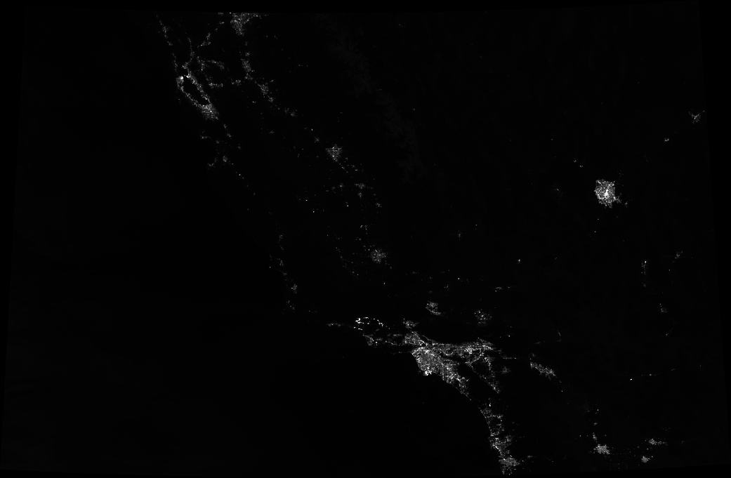
Fierce Santa Ana winds and unusually dry air made the fires particularly difficult to contain. In the image above, the Thomas fire is seen on Dec. 8. An animation from the NASA Earth Observatory shows the fire spreading quickly from Dec. 4 to Dec. 8.
The imagery was acquired with the “day night band” of the Suomi NPP satellite. NPP’s Visible Infrared Imaging Radiometer Suite (VIIRS) detects light in a range of wavelengths from green to near-infrared and uses filtering techniques to observe signals such as city lights, auroras, and wildfires. The image was captured around 2 a.m.
Additional information, references and animations: NASA Earth Observatory
Image Credit: NASA Earth Observatory image by Joshua Stevens using VIIRS day-night band data from the Suomi National Polar-orbiting Partnership
Caption: Adam Voiland