


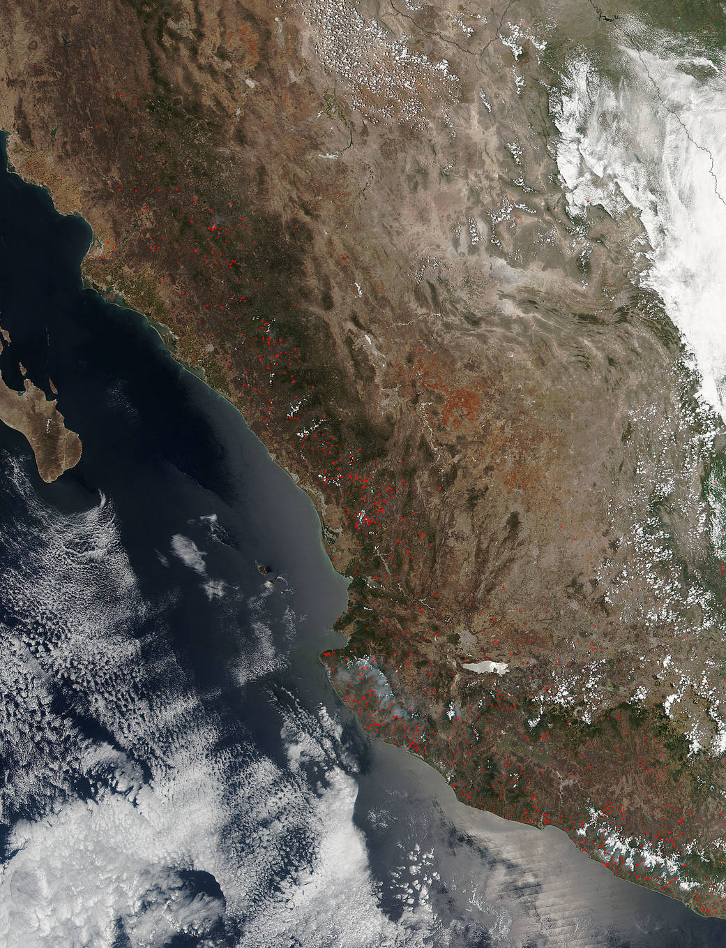
The Suomi NPP satellite’s Visible Infrared Imaging Radiometer Suite (VIIRS) instrument captured a look at multiple fires and smoke burning in western Mexico on May 20, 2016, at 20:00 UTC (4 p.m. EDT).
Actively burning areas, detected by VIIRS are outlined in red. The fires appear to stretch in a line from north to south from the Mexican states of Guanajuato and Jalisco south to Michoacan where Mexico City is located, and further south to Guerrero state.
May is the end of dry season in this part of the world, and these fires may be intentional agricultural fires set by people to prepare for the upcoming growing season, or they may be accidental forest fires.
The Suomi NPP satellite is a joint mission between NASA, NOAA and the U.S. Department of Defense.
NASA image courtesy Jeff Schmaltz, MODIS Rapid Response Team. Caption: NASA/Goddard, Rob Gutro