


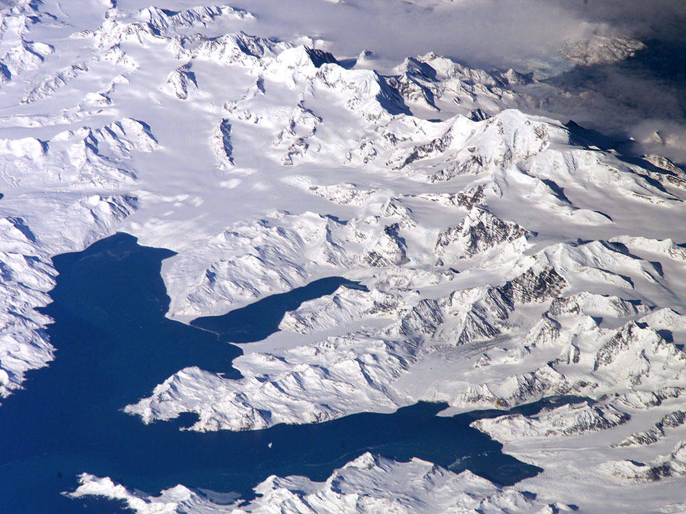
There is no permanent human base on South Georgia Island, a British territory in the South Atlantic Ocean that lies about 800 miles east of the Falkland Islands. The crew of the International Space Station captured the rugged and isolated landscape of the northern shore of the island in this August 2005 photo.
South Georgia Island is notable on several fronts. The first recorded explorer to land on the island was Captain James Cook aboard the HMS Resolution in 1775. He mapped part of the coastline, but was discouraged by the thick ice cover, lack of vegetation, and steep mountains. Mt. Paget, the highest peak, rises to 9,625 feet above sea level, and the island supports 161 glaciers. Cook named the southernmost point of the island “Cape Disappointment” when he realized he had not reached Antarctica.
The high mountains protect the north and eastern coast of the island from the prevailing gales coming from Antarctica and the west. The steep topography also makes deep bays along the coast, which provide habitat for wildlife and anchorages for whaling ships. The island supports major rookeries of penguins and albatrosses, and large seal populations. This view centers on Mt. Paget and Cumberland Bay. The former whaling station Grytviken is located within the bay. Today, the encampment supports the scientific base for the British Antarctic Survey and Bird Island Research Station.Image Credit: NASA