


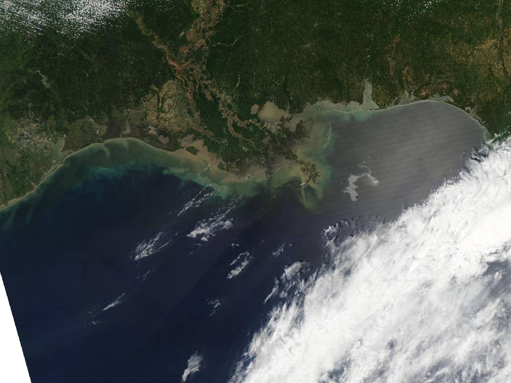
NASA’s Aqua satellite captured this image of the Gulf of Mexico on April 25, 2010 using its Moderate Resolution Imaging Spectroradiometer (MODIS) instrument. With the Mississippi Delta on the left, the silvery swirling oil slick from the April 20 explosion and subsequent sinking of the Deepwater Horizon drilling platform is highly visible. The rig was located roughly 50 miles southeast of the coast of Louisiana.
The oil slick may be particularly obvious because it is occurring in the sunglint area, where the mirror-like reflection of the Sun off the water gives the Gulf of Mexico a washed-out look. Oil slicks are notoriously difficult to spot in natural-color (photo-like) satellite imagery because a thin sheen of oil only slightly darkens the already dark blue background of the ocean. Under unique viewing conditions, oil slicks can become visible in photo-like images, but usually, radar imagery is needed to clearly see a spill from space.Image Credit: NASA/MODIS Rapid Response Team