


Severe storms swept through the Delmarva Peninsula Monday, Aug. 7, and the NASA S-Band Dual-Polarimetric Radar (NPOL) weather radar located in Newark, Md., captured these images during routine storm observations of the storm which swept through Salisbury, Md. early in the afternoon.
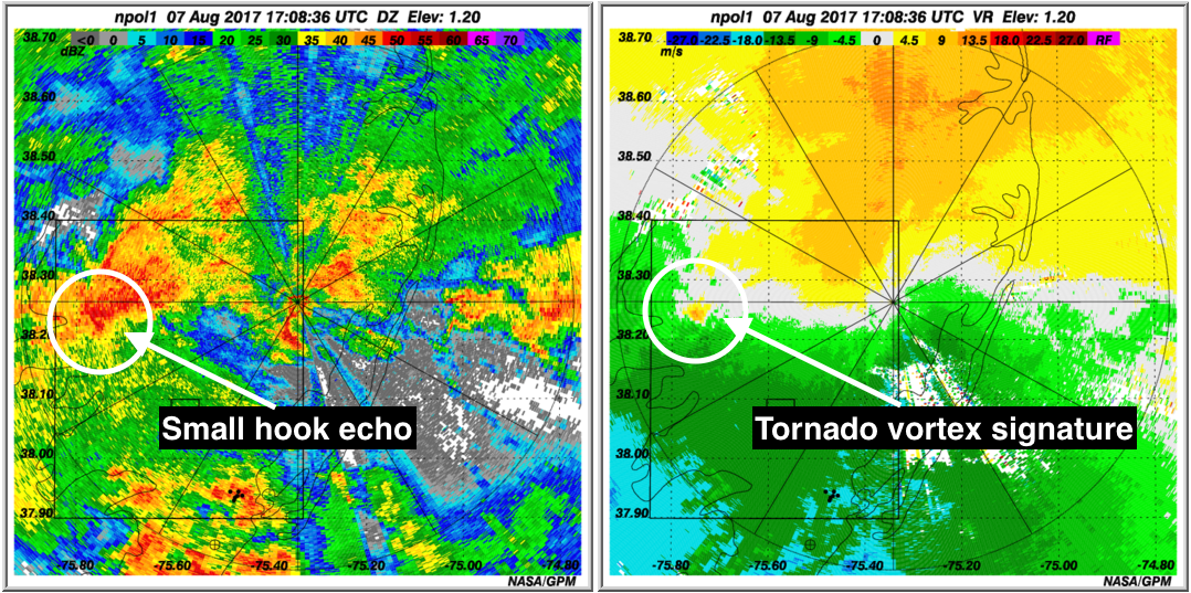
The first image shows the radar reflectivity at 1:08 p.m EDT, about 40 minutes prior to the Salisbury damage reports and before a warning was issued. There is evidence of slight hook echo in the highlighted area, indicative of cyclonic rotation. The second image shows the radial velocity. The green colors are moving towards the radar, while the yellows are moving away from the radar. The highlighted area shows a red (left)/green (right) couplet, again indicative again of cyclonic rotation, which is usually referred to as a Tornado Vortex signature.
The NPOL is a research radar operated by NASA-s Wallops Flight Facility in Virginia, as part of the ground validation activities associated with the NASA Global Precipitation Measurement Mission