


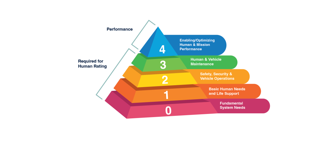


-Carolyn_Y._Ng.jpeg?w=1024)


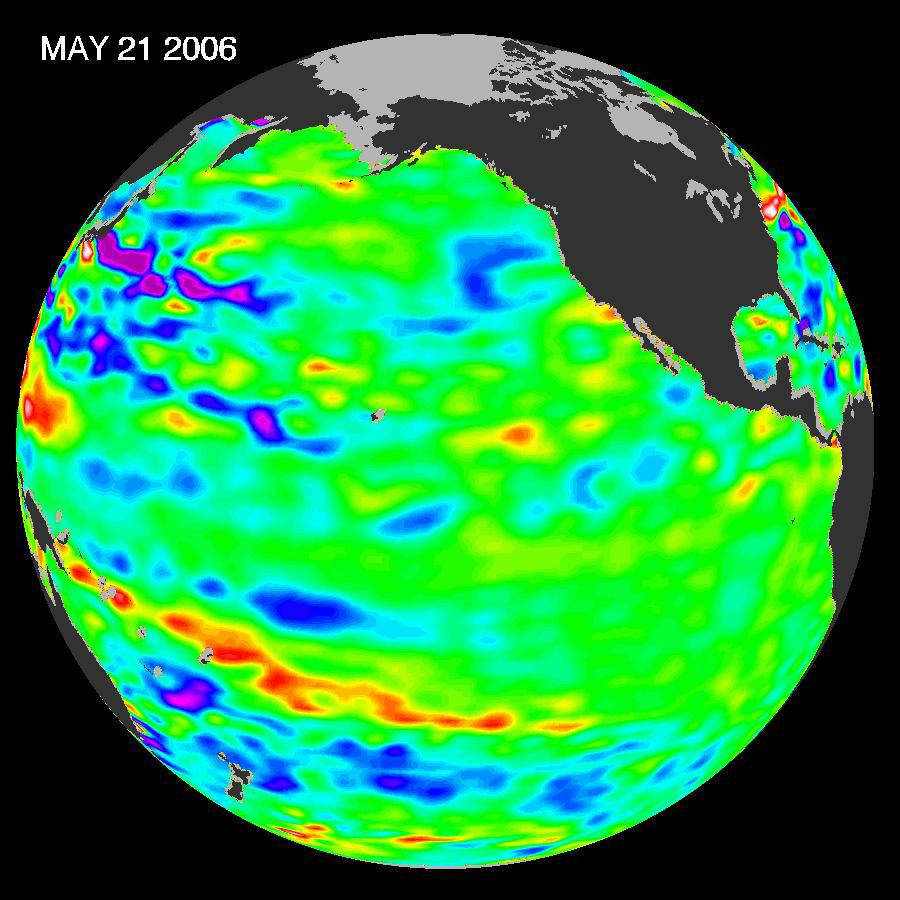
The latest remote sensing data from NASA’s Jason satellite show near normal conditions across the equatorial Pacific Ocean. As we enter the 2006 Atlantic Ocean hurricane season, there are currently no visible signs in sea surface height of either El Niño or La Niña.
The image represents data collected and composited over a 10-day period, centered on May 21, 2006. The height of the water relates to the temperature of the water, an indicator of the changing amount of heat stored in the ocean. As the ocean warms, its level rises; and as it cools, its level falls. Yellow and red areas indicate where the waters are relatively warmer and have expanded above normal sea level, green (dominating this image) indicates near normal sea level, and blue and purple areas show where the waters are relatively colder and the surface is lower than normal sea level.
The Jason satellite carries a dual-frequency radar altimeter, an instrument which determines the ocean’s height by beaming microwave pulses to Earth and measuring the time it takes for them to return. This measure, multiplied by the speed of light, gives the range from the satellite to the ocean surface.Image credit: NASA/JPL Ocean Surface Topography Team