


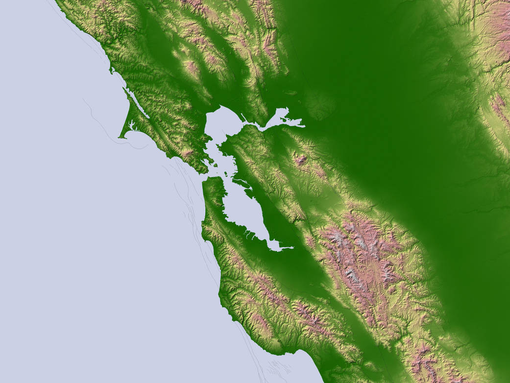
Along the coast of California, the tectonic plate underlying the Pacific Ocean and the plate harboring the North American landmass meet at the San Andreas Fault. Intense pressure builds up along the fault as the two plates grind past each other. On the morning of April 18, 1906, the pent-up pressure was released in a major earthquake that thundered across coastal California. The earthquake ruptured the ground for 296 miles (477 kilometers) along the northernmost section of the San Andreas Fault, and the ground surfaces on either side of the rupture slipped more than 20 feet away from each other in some places. The quake set off a catastrophic fire in San Francisco that devastated the city.
This image shows the topography of the region using data from NASA’s Shuttle Radar Topography Mission. Low elevations are green, with yellow, pink, and white representing progressively higher elevations. Major geologic faults are marked with white lines. The San Andreas Fault runs in a northwest-southeast line along the coast. The numbers on the fault line indicate how far the ground surface slipped at that location as a result of the 1906 earthquake. Also labeled in the image is the Hayward Fault on the eastern side of San Francisco Bay. The Hayward is one of the faults with a high likelihood of a major earthquake in coming decades. That fault runs through Oakland and Berkeley.Image Credit: NASA