


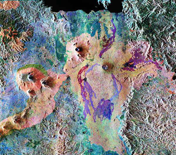
This false-color composite of Central Africa from 1994 shows the Virunga volcano chain along the borders of Rwanda, Democratic Republic of Congo and Uganda.
The dark area at the top of the image is Lake Kivu, which forms the border between Congo (to the right) and Rwanda (to the left). In the center of the image is the steep cone of Nyiragongo volcano, rising 3,465 meters (11,369 feet) high, with its central crater now occupied by a lava lake.
To the left are three volcanoes, Mount Karisimbi, rising 4,500 meters (14,800 feet) high; Mount Sabinyo, rising 3,600 meters (12,000 feet) high; and Mount Muhavura, rising 4,100 meters (13,500 feet) high. To their right is Nyamuragira volcano, which is 3,053 meters (10,017 feet) tall, with radiating lava flows dating from the 1950s to the late 1980s.Image Credit: NASA/JPL