


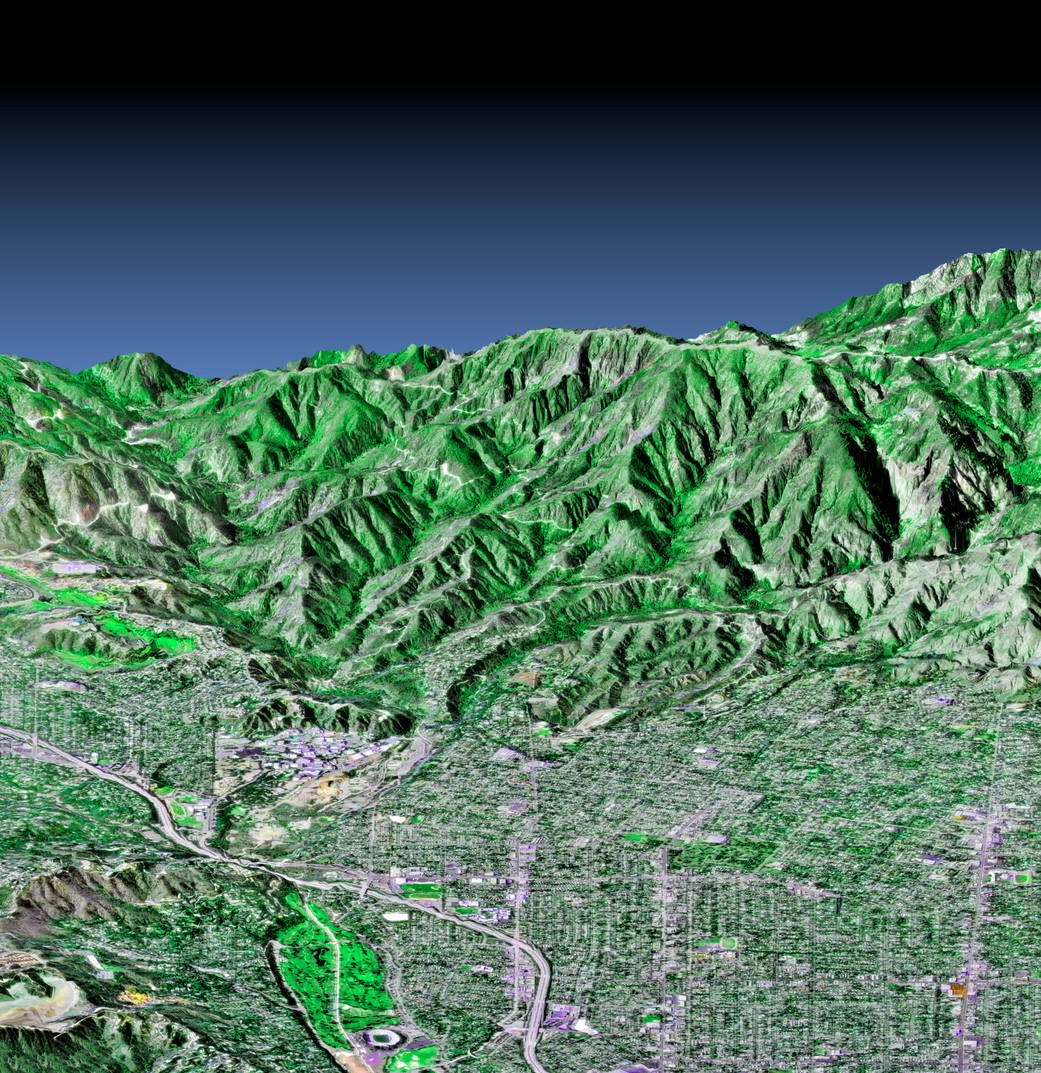
This image of the western part of the city of Pasadena, Calif. – home to NASA's Jet Propulsion Laboratory – was created from three sources. The Shuttle Radar Topography Mission supplied the elevation data; Landsat data from November 11, 1986 provided the land surface color and U.S. Geological Survey digital aerial photography provided detail.
This image of the western part of the city of Pasadena, Calif. – home to NASA’s Jet Propulsion Laboratory – was created from three sources. The Shuttle Radar Topography Mission supplied the elevation data; Landsat data from November 11, 1986 provided the land surface color (not the sky) and U.S. Geological Survey digital aerial photography provides the image detail. This image shows the power of combining data from different sources to create planning tools to study problems that affect large urban areas.Image Credit: NASA