


NASA and the U.S. Agency for International Development (USAID) announced a five-year project that will promote the use of satellite imagery to help Asia’s Lower Mekong region better predict and cope with floods and other natural disasters and increase resilience to the negative effects of climate change.
SERVIR Mekong, funded by USAID and NASA and implemented by the Asian Disaster Preparedness Center and its partners, will help governments and other key decision-makers in Burma, Cambodia, Laos, Thailand and Vietnam take advantage of publicly available satellite imagery, geospatial data and maps to make more informed decisions on issues such as water management, land use planning, disaster risk reduction, infrastructure development and natural resource management.
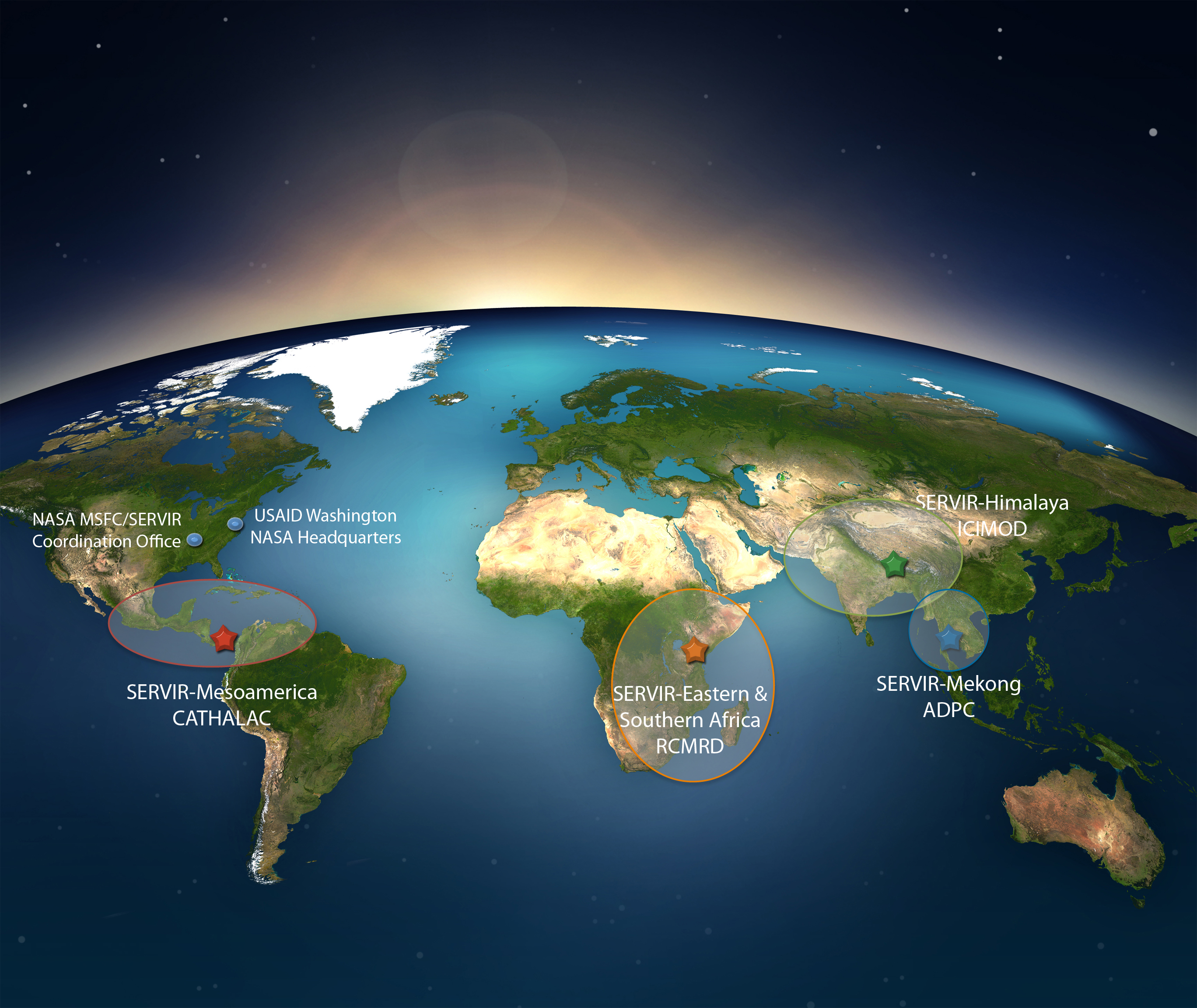
SERVIR Mekong is one of four SERVIR hubs currently operating across the developing world. SERVIR connects USAID’s development network in data-poor environments with NASA’s science, technology and extensive satellite data. Together with leading regional organizations in Africa, Asia and Latin America, SERVIR has developed 43 climate change adaptation and mitigation products to provide information, tools and training to more than 30 countries.
“With the addition of this new member of the SERVIR family, we continue to develop a network of regional hubs around the world,” said Dan Irwin, SERVIR program director at NASA’s Marshall Space Flight Center in Huntsville, Alabama. “SERVIR works to strengthen the capacity of governments to use satellite information and geospatial technologies for improved decision-making.”
Operating as a regional hub, SERVIR Mekong will promote collaboration between technical institutions in the region and develop analytical tools, services and products that are tailored to the needs of the Lower Mekong region’s decision-makers. These decision-makers include government officials and disaster management professionals as well as regional institutions, planning agencies and development partners.
“Use of the best available science and technology is essential to safeguarding this region’s vital ecosystems and the goods and services they provide to society,” said Michael Yates, director of USAID’s Regional Development Mission for Asia. “Under SERVIR Mekong, Asian scientists, NASA scientists and others will work hand-in-hand to develop tools to build resilience and address some of the region’s greatest challenges.”
SERVIR Mekong will bring tools to bear on the challenges of the Lower Mekong region, which are similar to those in other regions. In Bangladesh, for example, where climate change has altered rainfall patterns and disrupted formerly predictable flood cycles, a new satellite-based flood forecasting system developed by the SERVIR hub based in Nepal is helping communities and supporting agencies design measures to better protect lives, homes, crops and livestock.
More information on SERVIR is available at www.servirglobal.net.