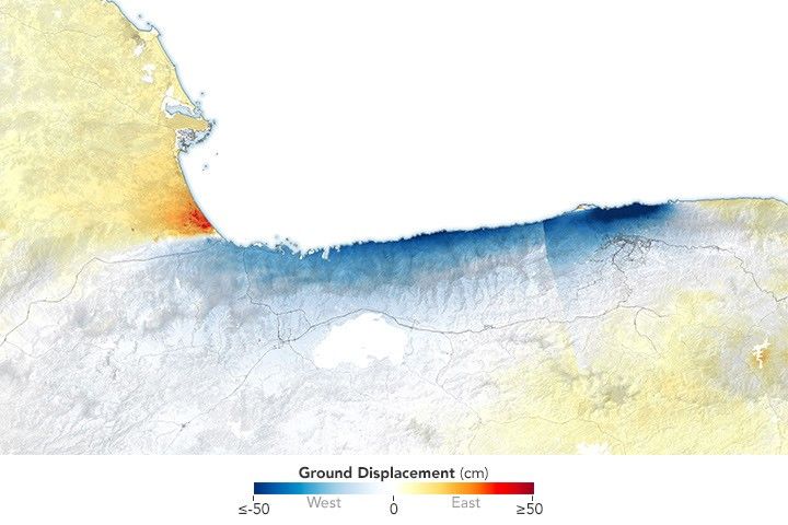
Since launching 16 months ago, the EMIT imaging spectrometer aboard the International Space Station has shown an ability to detect more than just surface minerals.
More than a year after first detecting methane plumes from its perch aboard the International Space Station, data from NASA’s EMIT instrument is now being used to identify point-source emissions of greenhouse gases with a proficiency that has surprised even its designers.
Short for Earth Surface Mineral Dust Source Investigation, EMIT was launched in July 2022 to map 10 key minerals on the surface of the world’s arid regions. Those mineral-related observations, which are already available to researchers and the public, will help improve understanding of how dust that gets lofted into the atmosphere affects climate.
Detecting methane was not part of EMIT’s primary mission, but the instrument’s designers did expect the imaging spectrometer to have the capability. Now, with more than 750 emissions sources identified since August 2022 – some small, others in remote locations, and others persistent in time – the instrument has more than delivered in that regard, according to a new study published in Science Advances.
“We were a little cautious at first about what we could do with the instrument,” said Andrew Thorpe, a research technologist on the EMIT science team at NASA’s Jet Propulsion Laboratory in Southern California and the paper’s lead author. “It has exceeded our expectations.”
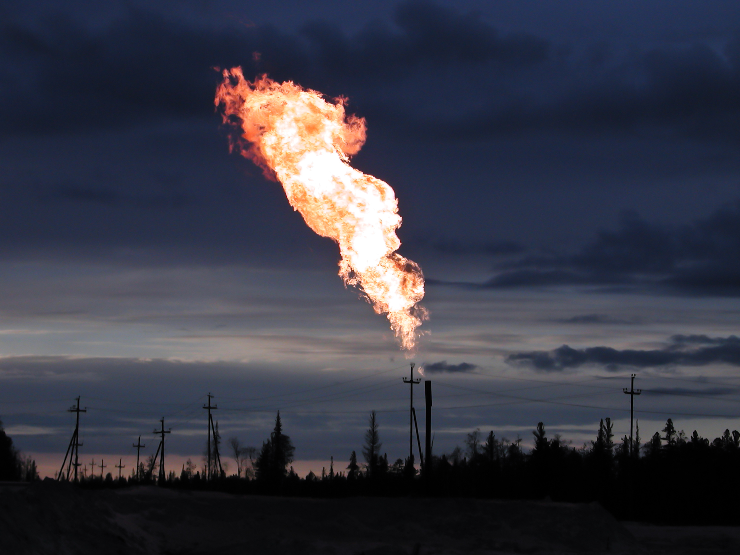
By knowing where methane emissions are coming from, operators of landfills, agriculture sites, oil and gas facilities, and other methane producers have an opportunity to address them. Tracking human-caused emissions of methane is key to limiting climate change because it offers a comparatively low-cost, rapid approach to reducing greenhouse gases. Methane lingers in the atmosphere for about a decade, but during this span, it’s up to 80 times more powerful at trapping heat than carbon dioxide, which remains for centuries.
Surprising Results
EMIT has proven effective at spotting emission sources both big (tens of thousands of pounds of methane per hour) and surprisingly small (down to the hundreds of pounds of methane per hour). This is important because it permits identification of a greater number of “super-emitters” – sources that produce disproportionate shares of total emissions.
The new study documents how EMIT, based on its first 30 days of greenhouse gas detection, can observe 60% to 85% of the methane plumes typically seen in airborne campaigns.
From several thousand feet above the ground, methane-detecting instruments on aircraft are more sensitive, but to warrant sending a plane, researchers need prior indication that they’ll detect methane. Many areas are not examined because they are considered too remote, too risky, or too costly. Additionally, the campaigns that do occur cover relatively limited areas for short periods.
On the other hand, from about 250 miles (400 kilometers) altitude on the space station, EMIT collects data over a large swath of the planet – specifically the arid regions that fall between 51.6 degrees north and south latitude. The imaging spectrometer captures 50-mile-by-50-mile (80-kilometer-by-80-kilometer) images of the surface – researchers call them “scenes” – including many regions that have been beyond the reach of airborne instruments.
“The number and scale of methane plumes measured by EMIT around our planet is stunning,” said Robert O. Green, a JPL senior research scientist and EMIT’s principal investigator.
Scene-by-Scene Detections
To support source identification, the EMIT science team creates maps of methane plumes and releases them on a website, with underlying data available at the joint NASA-United States Geological Survey Land Processes Distributed Active Archive Center (LP DAAC). The mission’s data is available for use by the public, scientists, and organizations.
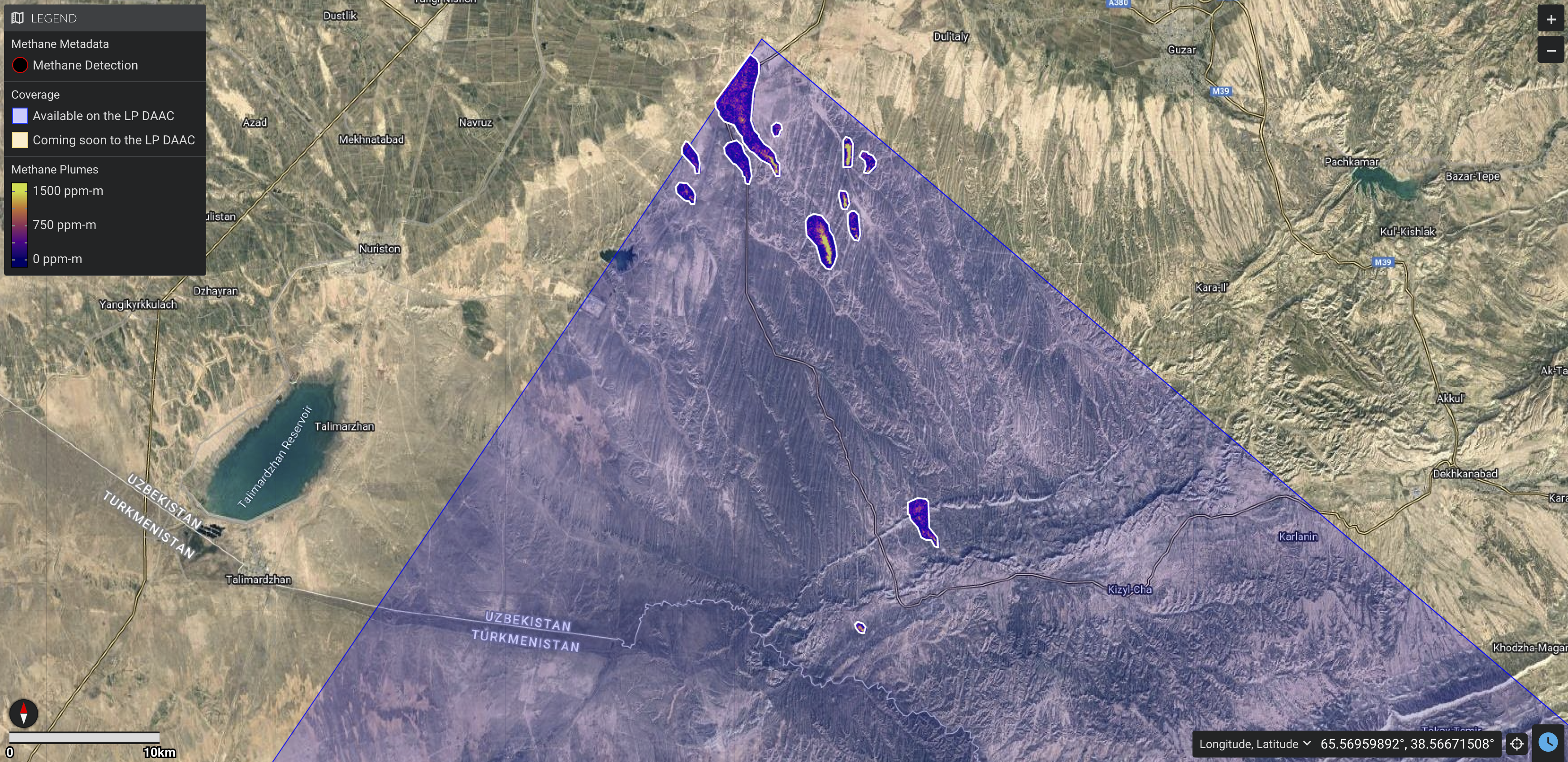
Since EMIT began collecting observations in August 2022, it has documented over 50,000 scenes. The instrument spotted a cluster of emissions sources in a rarely studied region of southern Uzbekistan on Sept. 1, 2022, detecting 12 methane plumes totaling about 49,734 pounds (22,559 kilograms) per hour.
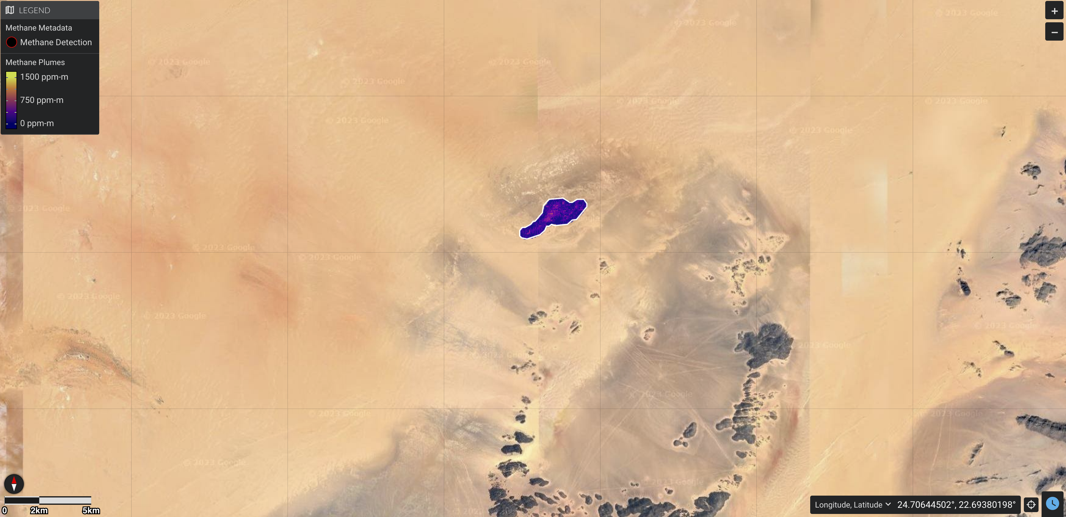
In addition, the instrument has spotted plumes far smaller than expected. Captured in a remote corner of southeastern Libya on Sept. 3, 2022, one of the smallest sources so far was emitting 979 pounds (444 kilograms) per hour, based on estimates of local wind speed.
More About the Mission
EMIT was selected from the Earth Venture Instrument-4 solicitation under the Earth Science Division of NASA’s Science Mission Directorate and was developed at NASA’s Jet Propulsion Laboratory, which is managed for the agency by Caltech in Pasadena, California. The instrument’s data is available at the NASA Land Processes Distributed Active Archive Center for use by other researchers and the public.
To learn more about the mission, visit:
https://earth.jpl.nasa.gov/emit/
News Media Contacts
Andrew Wang / Jane J. Lee
Jet Propulsion Laboratory, Pasadena, Calif.
626-379-6874 / 818-354-0307
andrew.wang@jpl.nasa.gov / jane.j.lee@jpl.nasa.gov
2023-172