![Request for Information – Potential [Placeholder for Prize]](https://assets.science.nasa.gov/dynamicimage/assets/science/psd/solar/2023/09/s/solarsystem_0.jpg?w=1024)


Satellites and the imagery they provide support many of our daily activities on Earth, from looking up a new restaurant to checking tomorrow’s weather. Remote sensing, or Earth observation science, uses satellites to examine our planet for a variety of applications that also affect our daily lives.
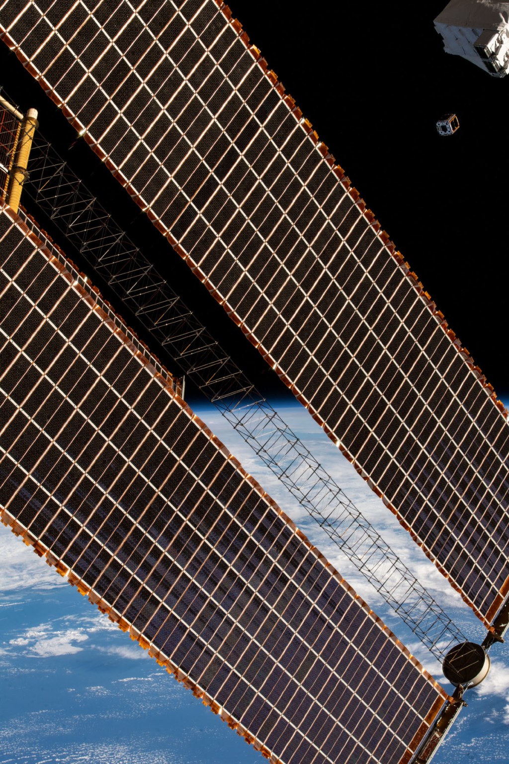
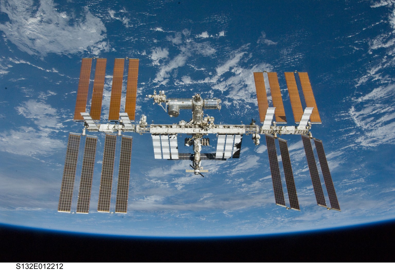
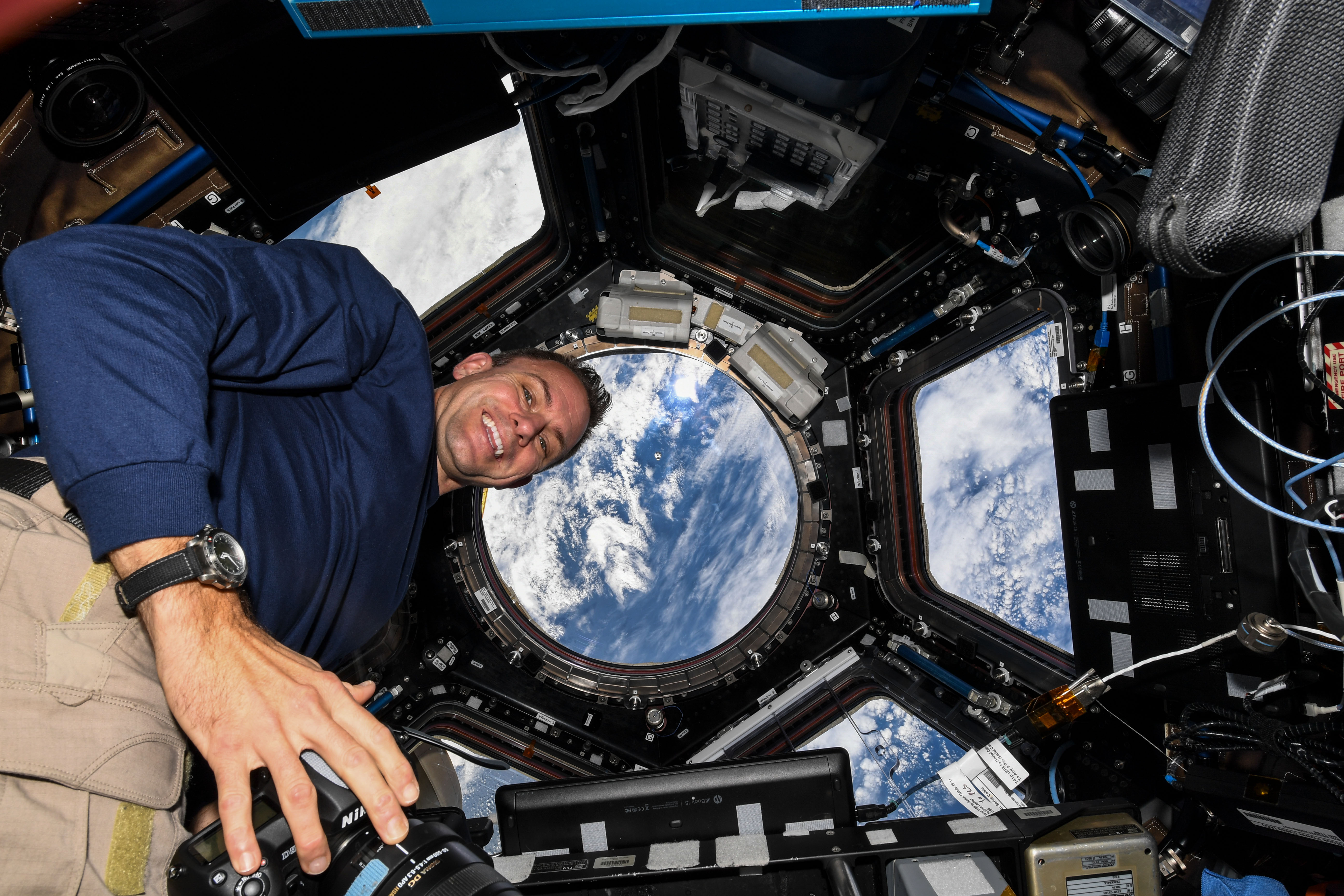
The International Space Station serves as a unique platform for observing Earth with both hands-on and automated equipment. Station crew members have produced hundreds of thousands of images, recording phenomena such as storms in real time, observing natural events such as volcanic eruptions as they happen, and providing input to ground personnel for programming automated Earth-sensing systems. Having a crew on board provides flexibility, a significant advantage over sensors on robotic spacecraft.
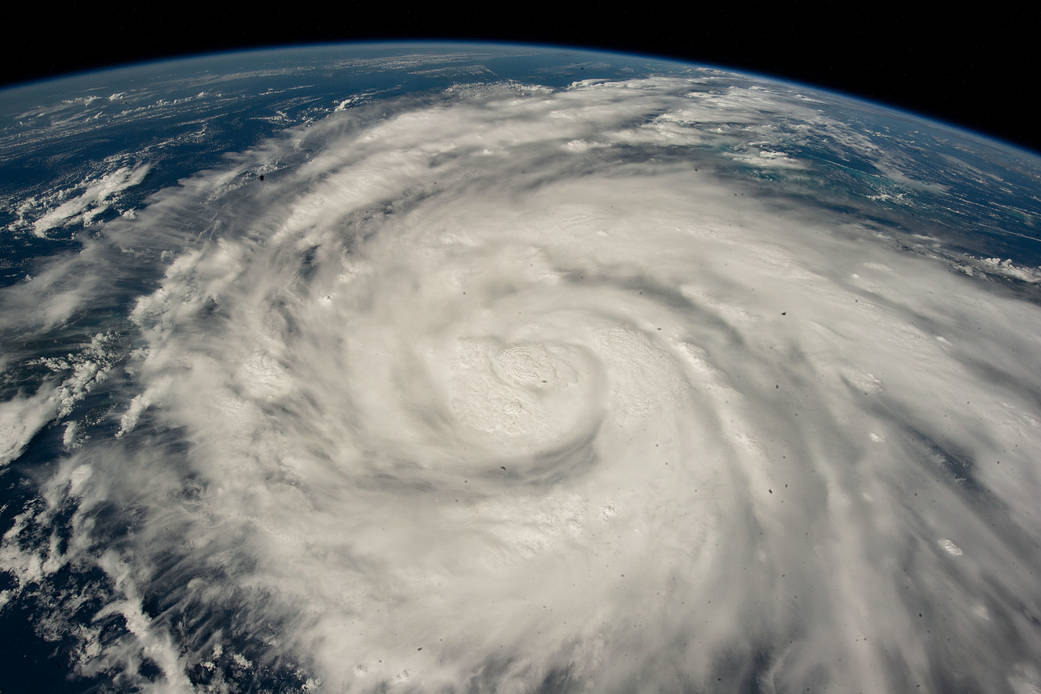
The station’s orbit provides another advantage: because its orbit is not synchronized with Earth, the station passes over places between latitudes 52 degrees north and 52 degrees south at different times of the day. This orbit makes it possible to capture images of a particular location from different angles and varying light conditions and even to photograph infrequent and short-term events. This capability proves particularly useful for studying natural disasters. The ISS SERVIR Environmental Research and Visualization System (ISERV) has provided data from many such events, supporting disaster response efforts and helping responders determine how to mitigate the effects of future events.
Images From Space
Astronauts take images using handheld digital cameras, usually through windows in the station’s cupola, for Crew Earth Observations (CEO). These images supported research showing that urban green areas, which contribute to human well-being, are rarely in close proximity to where people live1, and have been used to create population maps2 valuable for urban planning, resource allocation, and disaster prevention and response. Researchers use CEO images for monitoring glaciers and volcanos and for studying urban night lighting, atmospheric processes such as the frequency of lightning flashes, and ecology – the set of relationships between organisms and their environment. A collaborative project called Aviation Migration Aerial Surface Space (AMASS) used these images to track bird migration routes and the effects of climate change occurring along those routes.
CEO imagery is free and accessible through the Gateway to Astronaut Photography of Earth, which offers several ways to investigate existing data and accepts requests from researchers and educators for new imagery.
Astronaut photography also supports NASA Disaster Response, a program that works with various NASA centers to collect data before, during, and following a disaster.
These projects benefit the astronauts taking part in them as well, as studies have shown that taking pictures of their home planet has a positive impact on their mental health.
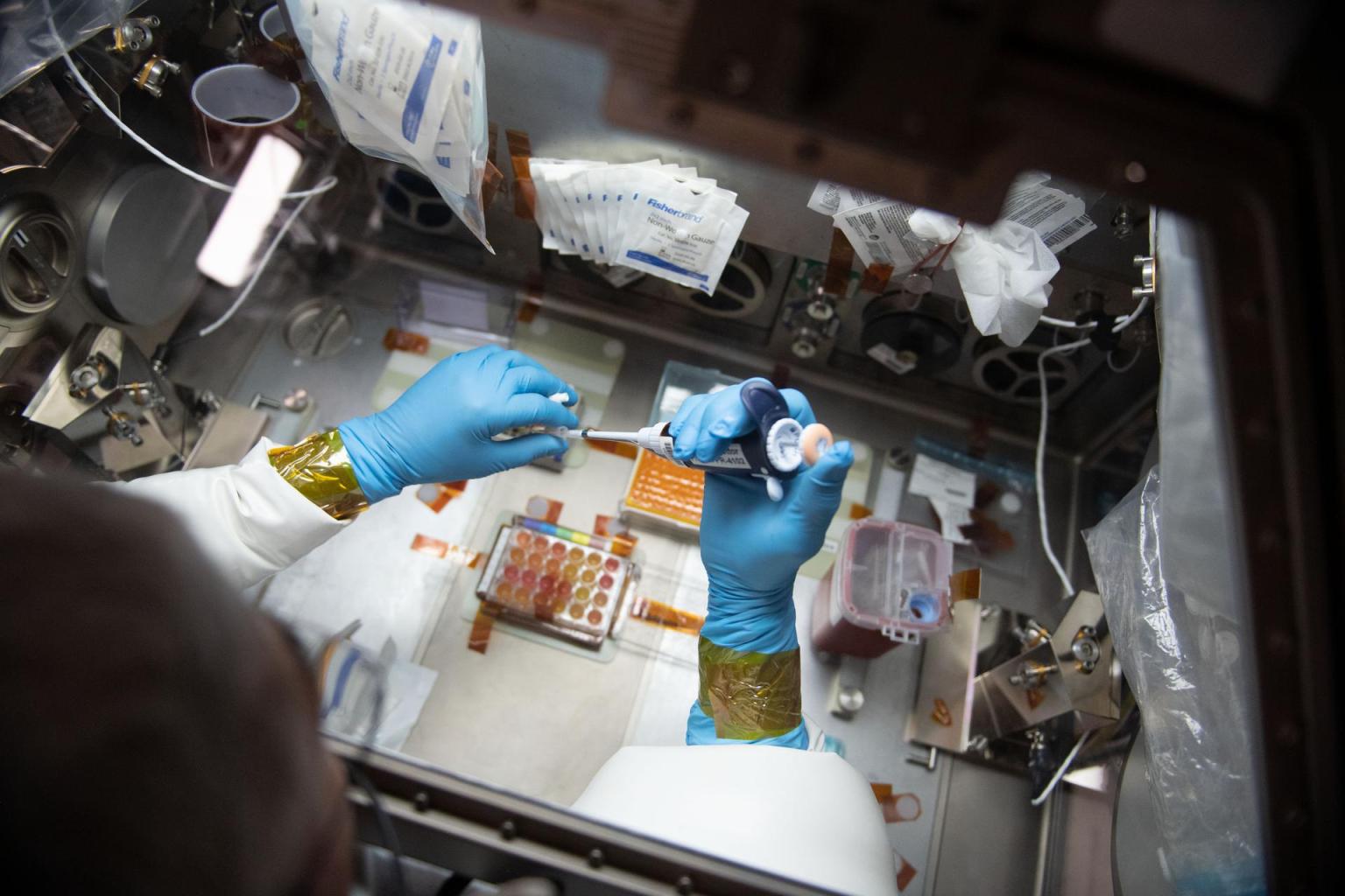
Exterior Instruments
Mineral dust carried into Earth’s atmosphere by high winds can affect local warming and cooling, air quality, rate of snow melt, and plankton in the oceans. These effects depend heavily on the type of mineral involved – dark-colored particles absorb sunlight and increase heat while light-colored particles have a cooling effect. Earth Surface Mineral Dust Source Investigation (EMIT) uses imaging spectrometer technology to determine the type and distribution of minerals in the dust of Earth’s arid regions. Results could clarify how mineral dust affects solar energy balance on the planet. The Jet Propulsion Laboratory Earth-Observing Mission Operations Center in California controls EMIT operations.
The space station also carries a variety of automated sensors and facilities, both internal and external. Several exterior instruments collect data about the global climate, environmental change, and natural hazards. These data are shared through existing international partnerships to benefit people around the world and promote international collaboration on other Earth-observation activities. After all, natural events know no borders.
ECOSTRESS takes high-resolution thermal infrared measurements of the temperature of the ground, which gets hotter during the day than the air does. These measurements show, for example, significant differences between the temperature of urban surfaces, especially pavement, and cooler suburban areas and identifies heat islands at regional scales. These are areas where night temperatures remain significantly higher than their surroundings. Extreme temperatures can be deadly, a risk compounded when temperatures do not drop sufficiently at night.
SAGE III-ISS measures gases and tiny particles in the atmosphere that play significant roles in atmospheric processes. A previous instrument, SAGE II, helped confirm human-driven changes to atmospheric ozone and contributed to a ban on certain harmful chemicals in 1987. SAGE II then recorded data showing that ozone stopped decreasing after the ban. SAGE III continues these measurements. It also tracked concentrated atmospheric particles and water vapor belched into the stratosphere by an eruption of the Hunga Tonga-Hunga Ha’apai volcano and discerned a new aerosol layer in the lower stratosphere after an eruption of the Fukutoku-Okanoba undersea volcano.
Data from another remote sensing project, Sally Ride EarthKAM, is available to the public. Students use this investigation’s digital camera to take photographs of coastlines, mountain ranges, and other interesting features and phenomena. The EarthKAM team posts the images on a searchable website.
Station-based remote sensing and Earth observation may happen high above the planet, but these tools provide important information for a wide variety of applications that benefit those of us on the ground.
Citations
1 Wicht M, Kuffer M. The continuous built-up area extracted from ISS night-time lights to compare the amount of urban green areas across European cities. European Journal of Remote Sensing. 2019 August 9; 5258-73. DOI: 10.1080/22797254.2019.1617642
2 Li K, Chen Y, Li Y. The Random Forest-Based Method of Fine-Resolution Population Spatialization by Using the International Space Station Nighttime Photography and Social Sensing Data. Remote Sensing Letters. 2018 October 17; 10(10): 1650. DOI: 10.3390/rs10101650.