


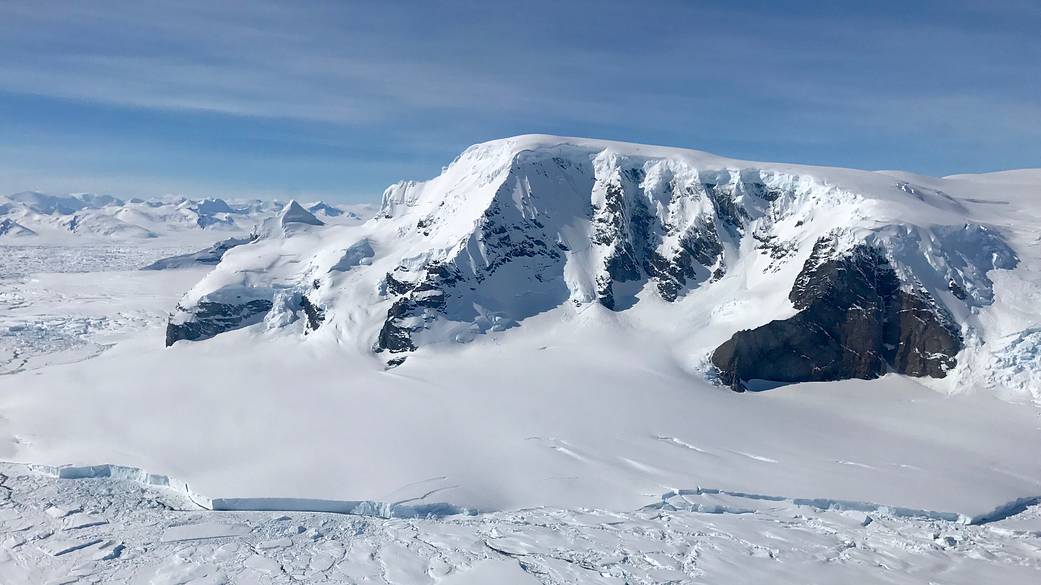
Antarctica’s Mt. Balfour splits the lower reaches of Fleming Glacier, with tidewater glacier terminus in foreground. This photograph was taken from a Nov. 14, 2016 flight by NASA’s IceBridge mission, an airborne survey of polar ice, which completed an eighth consecutive Antarctic deployment on Nov. 18.
Antarctica is heading into austral summer, a period of rapid sea ice melt in the Southern Ocean. But this year the sea ice loss has been particularly swift and the Antarctic sea ice extent is currently at the lowest level for this time of year ever recorded in the satellite record, which began in 1979. IceBridge expanded its reach this year, covering a vast swath of Antarctica – from the Ruppert Coast in West Antarctica to Recovery Glacier in the eastern half of the continent, plus the Weddell and Bellingshausen seas. Additionally, IceBridge flew twice over the South Pole, an area rarely measured since satellites don’t overfly it.
The mission of Operation IceBridge is to collect data on changing polar land and sea ice and maintain continuity of measurements between NASA’s Ice, Cloud and Land Elevation Satellite (ICESat) missions. The original ICESat mission ended in 2009, and its successor, ICESat-2, is scheduled for launch in 2018. Operation IceBridge, which began in 2009, is currently funded until 2019. The planned overlap with ICESat-2 will help scientists validate the satellite’s measurements.
Image Credit: NASA/Joe MacGregor