


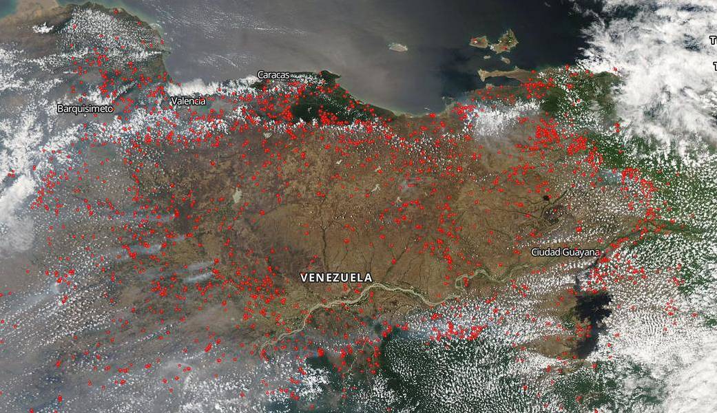
Hundreds of wildfires dot the Venezuelan landscape in this NOAA/NASA Suomi NPP satellite image from March 27, 2019. The cause of these fires is most likely environment related meaning the hot, dry weather coupled with lightning creates a powder keg effect and fires tend to erupt in this type of weather. Two Venezuelan engineers studied NASA imagery and found that three fires were burning near power transmission lines on March 7, 2019 according to AP News.
Interestingly, there were reports of a meteorite striking the country on February 09, 2019 causing fires to break out. There were nine separate persons who reported this to the American Meteor Society and there was one video of the event. https://fireball.amsmeteors.org/members/imo_view/event/2019/676
NASA’s Earth Observing System Data and Information System (EOSDIS) Worldview application provides the capability to interactively browse over 700 global, full-resolution satellite imagery layers and then download the underlying data. Many of the available imagery layers are updated within three hours of observation, essentially showing the entire Earth as it looks “right now.” Actively burning fires, detected by thermal bands, are shown as red points. Image Courtesy: NASA Worldview, Earth Observing System Data and Information System (EOSDIS). Caption: Lynn Jenner with information from AP News and the American Meteor Society.