


![Request for Information – Potential [Placeholder for Prize]](https://assets.science.nasa.gov/dynamicimage/assets/science/psd/solar/2023/09/s/solarsystem_0.jpg?w=1024)


Very hot, dry and unstable conditions in California and across the Pacific Northwest add to the challenges facing firefighters as they battle blazes around the region. Cal Fire is urging Californians to be extremely cautious, especially for the next few days, as the current conditions increase the dangers authorities face.
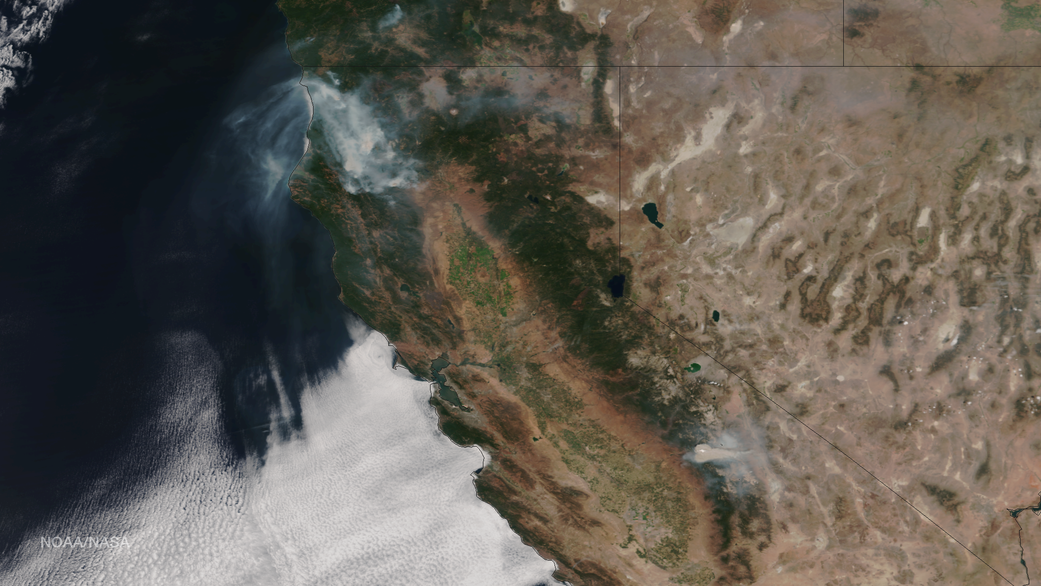
This image was taken by NASA-NOAA’s Suomi NPP satellite’s VIIRS instrument around 2145 UTC (5:45 p.m. EDT) on August 17, 2015. Northern California is seeing smoke from the River Complex, Route Complex, South Complex, Fork Complex and Mad River Complex fires combine over a large area of the Shasta-Trinity National Forest west of Redding, California, while the Rough Fire in Fresno County is spreading toward the Black Rock Reservoir, causing evacuations and road closures.
Fires across the Pacific Northwest aren’t limited to California. Please see the Suomi NPP VIIRS composites in NOAA View to see the growth and extent of fires over the past weeks.
Credit: NOAA