


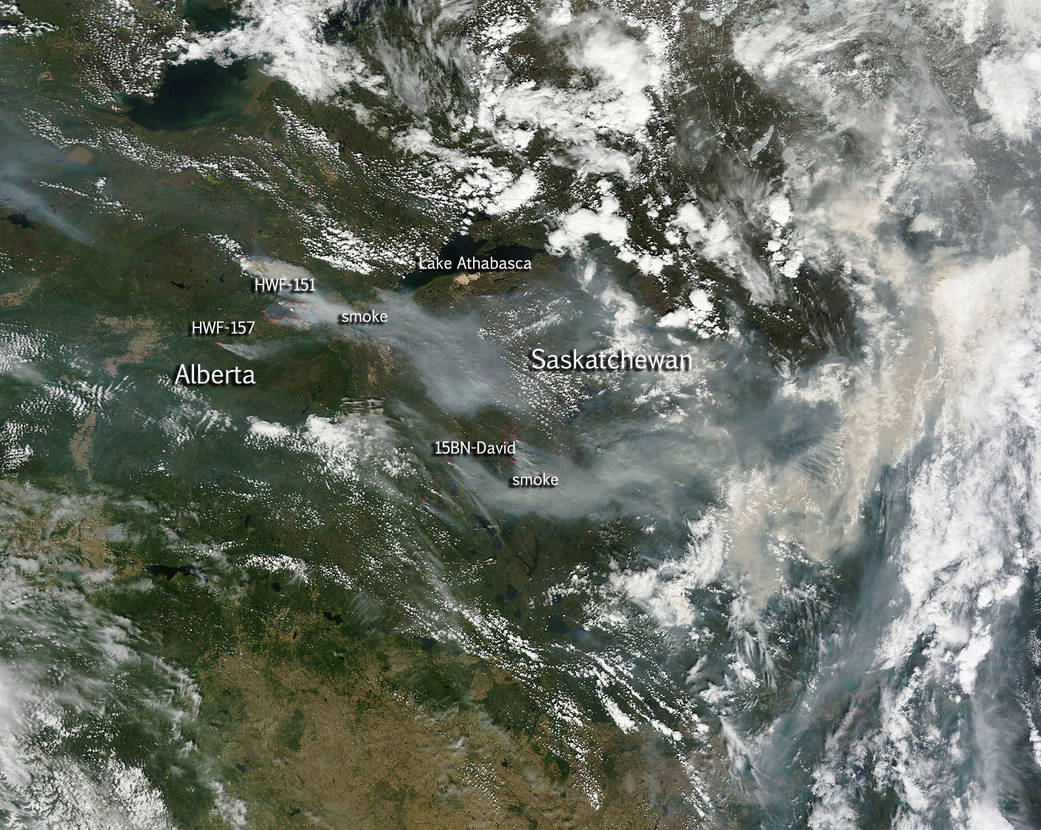
The Active Wildfire Mapping Program through the USDA Forest Service has pinpointed six active fires larger than 2500 hectares (6,177 acres) in the Alberta province of Canada. The Alberta wildfire status map shows even more wildfires in the province. Fire number-HWF151 is considered out of control at 10,000 hectares (24,710 acres) and is located approximately 12 kilometres west of the Wood Buffalo National Park border. Fire number-HWF157 is located 18km south east of the community of Fox Lake. This wildfire has grown to 2,600 hectares in size (6,424 acres) and is out of control. The winds are coming from the north west, pushing the wildfire to the east toward Wood Buffalo National Park. The wildfire has had very little growth towards the north, keeping its distance from Fox Lake at 18 kilometres. No human life is at risk at this time.
The fires in Saskatchewan are located in the Buffalo Narrows FPA. In the province there are currently 47 active wildfires with 15 active wildfires over 100 hectares. The most urgent fire in Saskatchewan has been designated 15BN-David. It is considered a priority fire for the area and is currently out of control having already consumed 4,678 hectares (11,559 acres) 149 personnel, 10 helicopters, and 12 pieces of heavy equipment have been dispatched to fight this fire.
This natural-color satellite image was collected by the Moderate Resolution Imaging Spectroradiometer (MODIS) aboard the Aqua satellite on June 07, 2015. Actively burning areas, detected by MODIS’s thermal bands, are outlined in red. NASA image courtesy Jeff Schmaltz, MODIS Rapid Response Team. Caption: NASA/Goddard, Lynn Jenner with information from various Canadian and U.S. government websites.