


![Request for Information – Potential [Placeholder for Prize]](https://assets.science.nasa.gov/dynamicimage/assets/science/missions/a-step/FFR_Earth_Background_20251120%20.png?w=1024)


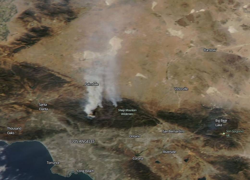
NASA’s Aqua satellite zeroed in on the Bobcat Fire in California, just outside of Los Angeles on Sept. 20, 2020. This growing fire began on Sep. 06, 2020 and its cause is still under investigation. As of Sep. 21, this fire has grown to 105,345 acres and is only 15 percent contained. According to Inciweb as of Sep. 21: “Fire will continue to spread from the foothills into communities of Juniper Hills, Valyermo and Big Pine. Wind-driven fire [will] spread downslope with spotting and rapid growth threatening structures. [The] Communities of Littlerock and Wrightwood will be impacted soon. On the east side, fire continues to threaten containment lines north of the Ranch 2 fire and threatens the Hwy 39 corridor. Very poor humidity recovery, especially in higher elevation, and warm overnight temperatures will allow the fire to burn actively through the night. Fire activity on the eastside of Mt. Wilson Observatory is threatening all of the values on that peak.”
This fire ranks as one of the largest that Los Angeles County has ever endured. Since Aug. 15, when California’s fire activity elevated amid dry and windy conditions and an unparalled number of lightning strikes, there have been 26 fatalities and over 6,100 structures destroyed according to CAL Fire as of Sep. 20, 2020. One of the most iconic structures destroyed by the Bobcat fire was the Devil’s Punchbowl Nature Center which is extremely popular and had drawn over 100,000 visitors a year. There have been over 7,900 wildfires that have burned over 3.5 million acres in California this year.
NASA’s satellite instruments are often the first to detect wildfires burning in remote regions, and the locations of new fires are sent directly to land managers worldwide within hours of the satellite overpass. Together, NASA instruments detect actively burning fires, track the transport of smoke from fires, provide information for fire management, and map the extent of changes to ecosystems, based on the extent and severity of burn scars. For more information visit: https://www.nasa.gov/mission_pages/fires/main/missions/index.html
NASA’s Earth Observing System Data and Information System (EOSDIS) Worldview application provides the capability to interactively browse over 700 global, full-resolution satellite imagery layers and then download the underlying data. Many of the available imagery layers are updated within three hours of observation, essentially showing the entire Earth as it looks “right now.” Actively burning fires, detected by thermal bands, are shown as red points. Image Courtesy: NASA Worldview, Earth Observing System Data and Information System (EOSDIS). Caption: Lynn Jenner with information from Inciweb and CAL Fire.