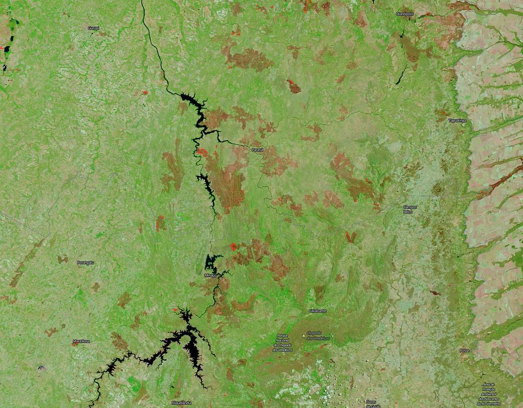
NASA’s Terra satellite captured this infrared image of an area in Brazil affected by the recent spate of fires on Sep. 24, 2019. This image was developed using the reflective bands (7-2-1) on the Terra satellite to highlight different areas of the landscape so that each area is easier to distinguish than it would be in a natural color image.
The combination of these bands is most useful for distinguishing burn scars from naturally low vegetation or bare soil and enhancing floods. Even the smallest hint of vegetation appears bright green in the image. Naturally bare soil, like a desert, is reflective in all bands used in this image, but more so in the shortwave infrared (Band 7, red) and so soils will often have a pinkish tinge.
The burned areas or fire-affected areas are characterized by deposits of charcoal and ash, removal of vegetation and/or the alteration of vegetation structure. When assigned to red in the image, Band 7 will show burn scars as deep or bright red or reddish brown, depending on the type of vegetation burned, the amount of residue, or the completeness of the burn. As such the large swaths of the deep reddish brown color in this image highlight the areas that have been burned in Brazil over the past few weeks. The red pixels dotting the landscape show areas that are still burning.
NASA’s Earth Observing System Data and Information System (EOSDIS) Worldview application provides the capability to interactively browse over 700 global, full-resolution satellite imagery layers and then download the underlying data. Many of the available imagery layers are updated within three hours of observation, essentially showing the entire Earth as it looks “right now.” Actively burning fires, detected by thermal bands, are shown as red points. Image Courtesy: NASA Worldview, Earth Observing System Data and Information System (EOSDIS). Caption: Lynn Jenner with information from Worldview.

