


The Whiting Knoll fire burning in east central Arizona is generating enough smoke to be seen from space.
The U.S. Forest Service’s Apache-Sitgreaves National Forest in Springerville, Arizona, reported that lightning ignited the Whiting Knoll Fire. The fire was discovered on Sunday, June 30, 2019 at approximately 10:00 a.m. MDT. The fire is burning adjacent to Whiting Knoll, north of Greens Peak midway between U.S. Highway 60 and Arizona State Highway 260 on the Springerville Ranger District. The fire is located east of Vernon, Arizona and north of Mount Baldy.
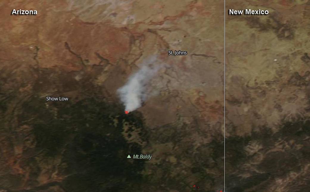
On July 4, the Visible Infrared Imaging Radiometer Suite (VIIRS) instrument aboard Suomi NPP provided a visible image of the forest. The VIIRS image showed a large thick plume of light brown colored smoke blowing to the northeast. VIIRS also detected heat signatures of the fire and that appears in a red color on the image.
On July 4, Inciweb, an interagency all-risk incident information management reported that the Whiting Knoll Fire is approximately 1,546 acres. At 11 p.m. MDT, the fire was only 5 percent contained. Mixed Conifer, Ponderosa Pine and grass are fueling the fire.
Text: Rob Gutro, NASA’s Goddard Space Flight Center with additional text from the USDA and Inciweb.
Image Credit: NASA Worldview, Earth Observing System Data and Information System (EOSDIS)/NOAA