


The Hirz Fire which started on August 9, 2018 has reached 36,083 acres and is 39% contained. The fire was human caused. Officials have ruled out a lightning strike so they have determined the fire was human-caused, however, law enforcement is still investigating whether the fire was accidentally or intentionally set.
The fire is burning in mixed conifer on the upper slopes where there is no recorded fire history, and oak woodland/brush on the lower slopes, closer to Shasta Lake and the McCloud River. Plantations and some areas of untreated slash are present on private timber lands. The fire behavior includes running, backing, and creeping. Burning operations continued today under favorable conditions. Interior islands of fire continue to burn in the remainder of the fire perimeter.
Weather concerns for this fire include noticeable warmer and drier conditions are expected to develop Saturday and Sunday and poor to fair humidity recoveries are expected Saturday night and Sunday night which allow for a longer burning period.
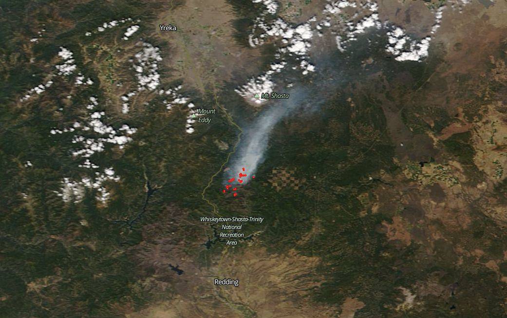
NASA’s Earth Observing System Data and Information System (EOSDIS) Worldview application provides the capability to interactively browse over 700 global, full-resolution satellite imagery layers and then download the underlying data. Many of the available imagery layers are updated within three hours of observation, essentially showing the entire Earth as it looks “right now. This satellite image was collected on August 30, 2018. Actively burning fires, detected by thermal bands, are shown as red points. Image Courtesy: NASA Worldview, Earth Observing System Data and Information System (EOSDIS). Caption: Lynn Jenner with information from Inciweb.